
Avian field data collection for the Second Atlas required a herculean effort via two simultaneous projects of unparallelled size. The first relied almost entirely on volunteer Atlasers, with the help of a few paid ‘blockbusters’ (see Atlas Methods), to collect data upon which we based the majority of the Atlas products featured in the Species Accounts. The second collected data through point counts across the entire state via paid field technicians, an unprecedented effort for this type of survey in Virginia. Here, we provide summaries of each.
Volunteer-collected Atlas Data
Avian Data
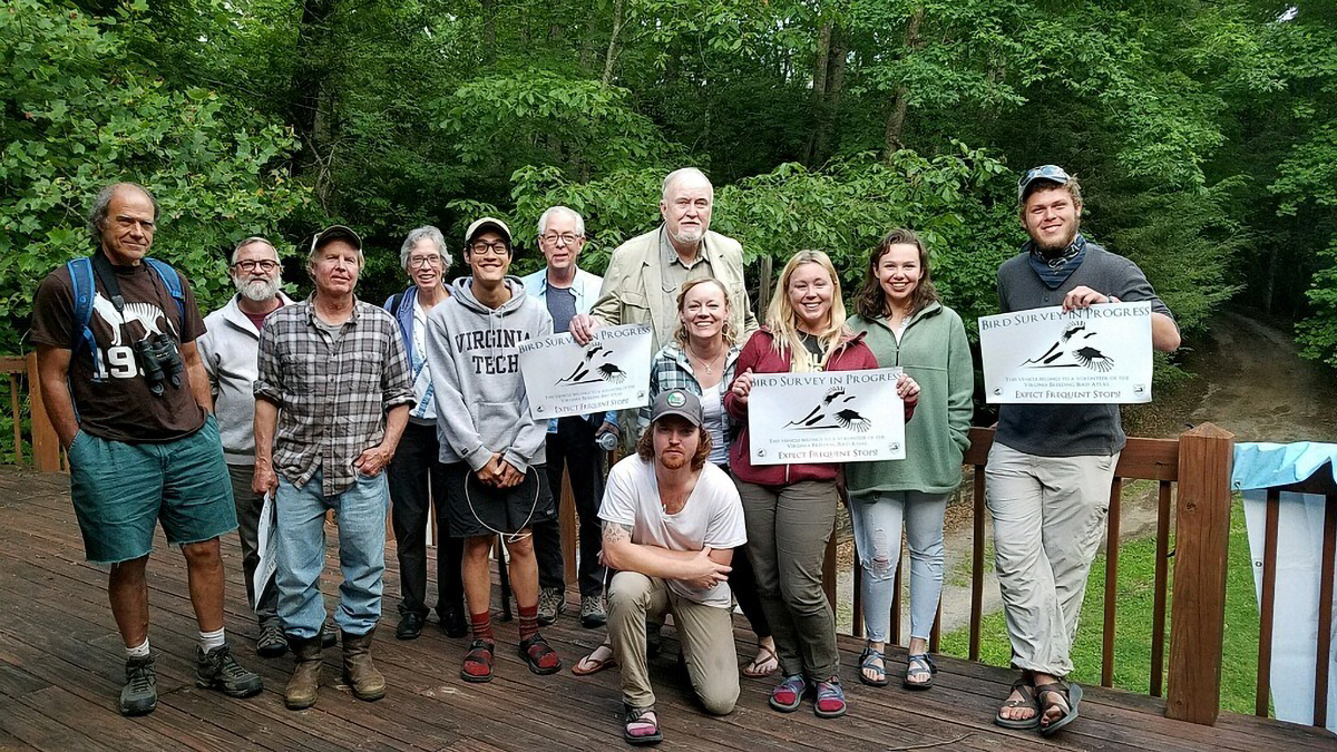
Over 1,450 individuals, including birders working independently or through bird clubs, natural resource professionals, students and academics, volunteered their time to collect avian data within individual Atlas blocks across the state.
Volunteers submitted over 113,000 eBird checklists through the Atlas eBird portal. An additional 13,000 checklists were harvested from the main eBird portal. These checklists collectively tallied six million individual birds.
Through the data review process, the checklists were converted to records. A record is defined as the observation of a species at a particular location on a given date and time and may include more than one individual of that species. Over 1.5 million records were generated through this process.
- Nearly 710,000 records of these 1.5 million records were of birds with breeding evidence. Together with almost 10,900 additional records compiled from breeding bird surveys unrelated to the Atlas effort (see ‘Supplementary Data’ section of Atlas Methods), they were the foundation upon which most of the Atlas models and maps are based.
- Of the records used to produce the Atlas models and maps, 70% represented possible breeding, 17% probable breeding and 13% confirmed breeding.
- The remaining records were not included in Atlas models and maps.
- Nearly 820,000 records were of birds lacking sufficient breeding evidence based on Atlas standards.
- Over 13,000 additional records were not incorporated into Atlas products because they were associated with traveling checklists that covered over 6 mi (9.7 km). Their removal prevented associating species with the wrong block, as checklists that cover longer distances have a higher probability of crossing block boundaries.
Block Summary Data: Survey Effort
We estimate that the total volunteer field survey effort, as reported through the Atlas eBird portal across five years, topped 72,000 hours. This estimate does not include all of the additional time spent planning field visits, traveling to field sites, and entering data into the Atlas eBird portal.
The COVID-19 pandemic struck in the early months of 2020, the last year of Atlas field data collection. Those guiding the Atlas effort devoted April and much of May to assessing how the project might move forward in the face of a rising human global death toll; still-developing guidance by public health agencies relating to mask wearing, sanitizing and social distancing; and much uncertainty around transmissibility of the virus and what activities carried a risk of contracting it. As a result, the pandemic doubtlessly had an impact on survey effort. However, Atlas volunteers readily adapted to conducting surveys in a more solitary fashion by targeting more rural areas, driving their own cars, and avoiding close group outings and travel requiring hotel stays. As a result, the project managed to reach all areas targeted for surveys in its final year.
Although data were collected in the majority (91%) of Virginia’s 4,421 blocks, the underlying survey effort was not evenly distributed (Figure 1). As expected, blocks with greater survey effort tended to be found in and around more populated areas (e.g., urban centers) or in areas that typically receive high visitation from birders and outdoor recreationists, such as public lands.
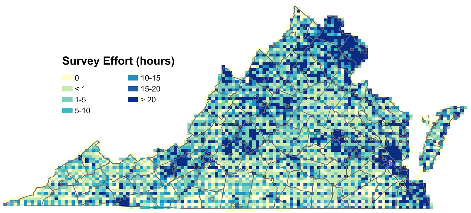
Figure 1. Distribution of cumulative Atlas survey effort (2016-2020) by block.
Some of these blocks received well over the 20 threshold hours necessary to categorize a block as completed (see Atlas Methods); 129 blocks were each surveyed for over 100 hours. Nearly 50% of the 4,421 blocks covering Virginia were surveyed for less than 5 hours, with an additional 13% of blocks not having been surveyed at all (Figure 2). The blocks that were not surveyed are concentrated in areas of southwestern Virginia, the southern Piedmont, and the southern Coastal Plain (Figure 1).
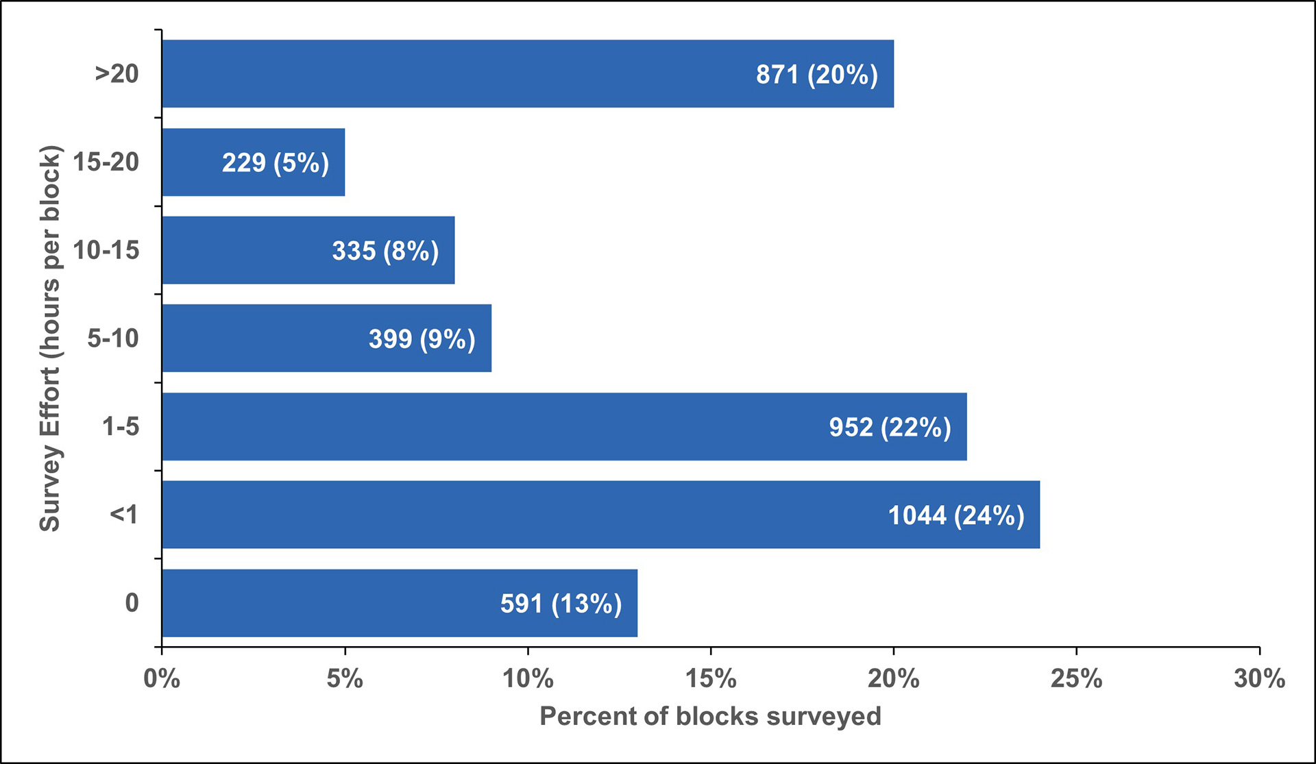
Figure 2. Proportion of Atlas blocks categorized by survey effort expended per block. Data labels include total number of blocks and proportion of blocks.
Block Summary Data: Block Completion
The high proportion of blocks with low survey effort is at least partially a result of priority blocks having been given precedence during Atlas data collection. Volunteers were encouraged to survey a priority block until that block was categorized as completed based on various criteria (see Atlas Methods). Of the 786 priority blocks, 657 (84%) were completed (Figure 3). An additional 43 blocks would have been categorized as completed were it not for insufficient nocturnal survey effort. Blockbusting (see Atlas Methods) contributed to completing blocks with otherwise little to no survey effort, especially those in geographically remote areas.
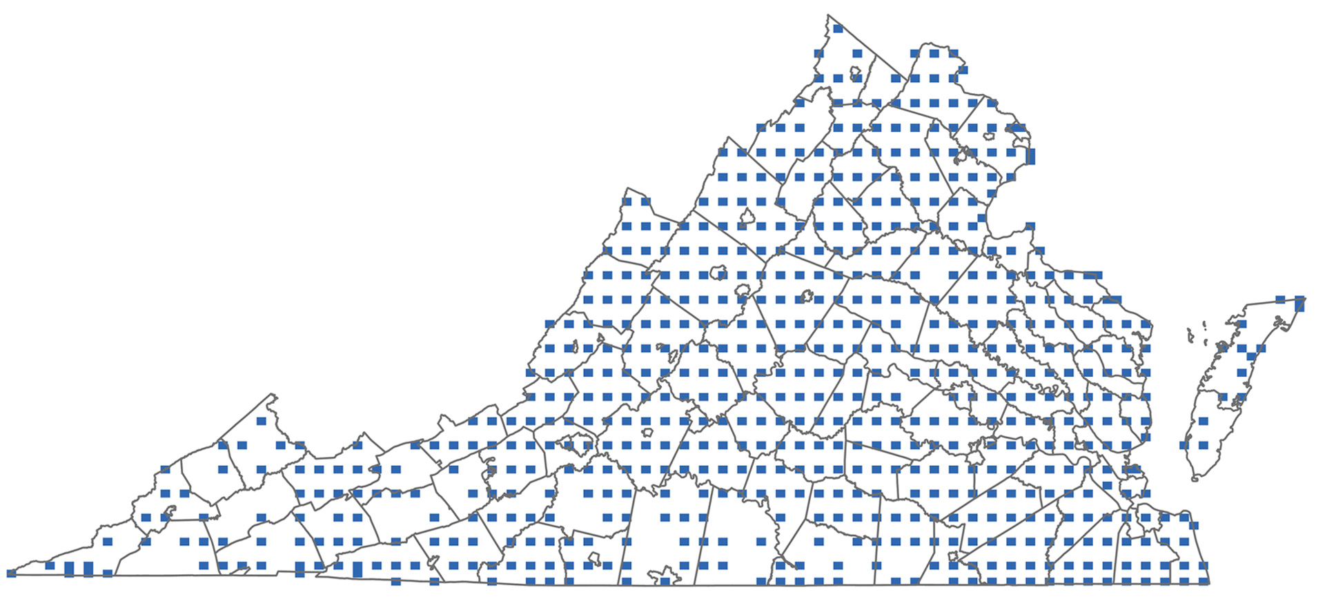
Figure 3. Distribution of priority blocks categorized as completed during the Second Atlas.
Atlas Point Counts
Thirty-two field technicians surveyed a total of 15,764 individual points between 2017 and 2020. The points were distributed in 2,078 blocks across the entire state, representing nearly one half of the Atlas blocks covering Virginia.
A total of 201 species were detected, of which 180 are documented as breeders in Virginia. The remaining species are birds with a protracted winter stay in Virginia (e.g., White-throated Sparrow [Zonotrichia albicollis]) or are migrants that only pass through the Commonwealth (e.g., Blackpoll Warbler [Setophaga striata]). Almost 202,000 individual birds were counted. Given the nature of the methodology, the point counts were biased toward landbirds, habitats occurring near roads, and more abundant and detectable (e.g., vocal) species.
The Atlas point count dataset is the largest of its kind in the Commonwealth’s history based on its sheer geographic scope and breadth. It represents a benchmark against which future point count data collected at various geographic scales can be compared.