Written By: Sergio Harding and Lisa Koerner Perry
The Need for Bird Conservation
Birds face serious threats across the Commonwealth, just as they do around the globe. Since the 1970s, the United States and Canada have lost about 30% of their total population (nearly 3 billion birds; Rosenberg et al. 2019). Beyond rare species and habitat specialists, even more common birds have seen declines in the past half-century. Unfortunately these bird populations are declining due to multiple causes, which interact to create a complex, multi-faceted milieu with no simple one-size-fits-all solution.
Many bird species are threatened by large-scale habitat loss and degradation, through land use changes like deforestation, wetland conversion, and loss of grasslands. However, more gradual habitat changes over time can also be a stressor on bird populations – for example, increases in invasive plant species can disrupt food webs and alter physical environmental conditions in a way that negatively impacts native species. Even natural succession of native species can become a stressor for some species that rely on early successional habitat for some part of their life cycle.
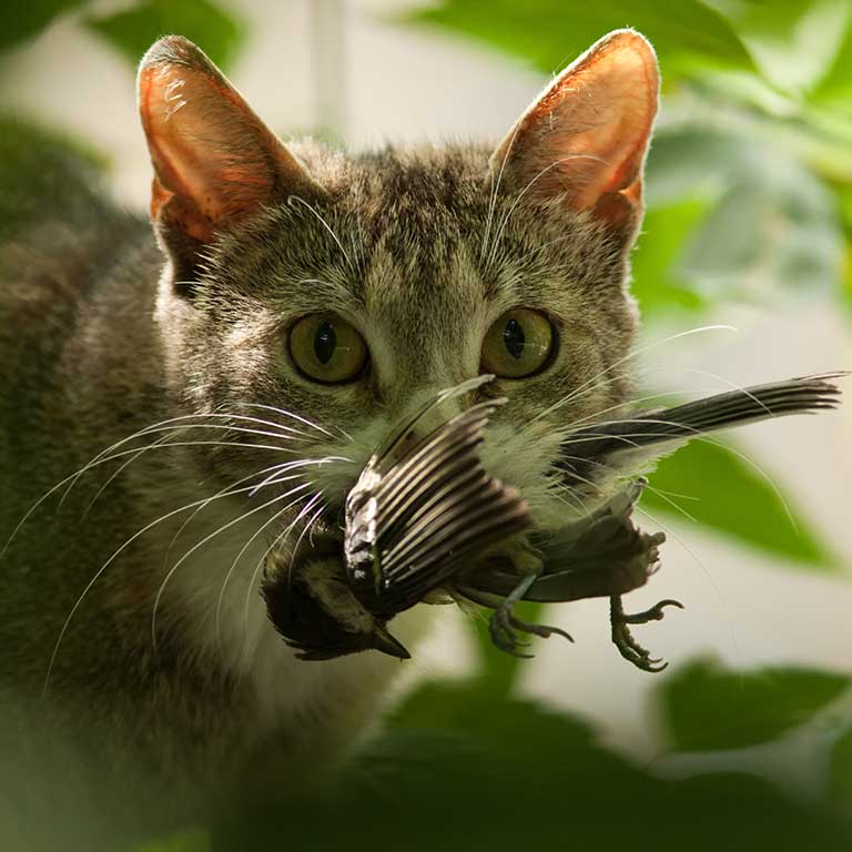
Predation by feral and domestic cats is a top cause of direct bird mortality. Additionally, many birds die each year due to collisions with buildings, vehicles, or other structures, such as communication towers and wind turbines. Birds also face direct and indirect threats from the use of herbicides and pesticides, and scavenging birds are particularly vulnerable to exposure to toxic lead from hunting ammunition. Diseases such as Highly Pathogenic Avian Influenza and West Nile Virus can cause deadly outbreaks among bird populations.
Although a few species may benefit from shifting environmental conditions, many species are likely to face significant and varied challenges due to climate change. For example, the increased strength and frequency of storms such as hurricanes due to climate change can severely impact birds during migration, causing more birds to die during their voyage. Shifting weather patterns can also cause a “trophic mismatch”, wherein food sources that are important for birds during migration may not be available at the time when they are needed. For example, earlier spring temperatures may cause insects to emerge earlier than they have historically. These insects may be less abundant later, when hungry migrating birds pass through an area in need of refueling or when breeding species are attempting to provide for their young.
Threats impacting our breeding birds are not encountered exclusively on the Virginia landscape. Many birds that breed in Virginia are migratory, spending portions of their life cycles hundreds to thousands of miles away. These species are exposed to threats along their migratory routes and on their wintering grounds. It is important to consider a species’ entire life cycle and geography when planning for conservation – all of our best efforts in Virginia may not be adequate if the birds lack favorable conditions for their migratory journeys and supporting habitat on their wintering grounds.
The threats listed above are wide-reaching and impact almost all birds to varying degrees, but some species also have very specific threats based on their ecology and life cycle. In Virginia, only a fraction of our breeding birds has been studied thoroughly enough to identify both threats and/or conservation actions that would be impactful at the species level. A few species have been studied extensively enough to identify actions (of varying degrees of feasibility) that could be used to bolster and support healthy populations, if resources can be allocated accordingly. This information can be found in the Conservation section of individual Species Accounts.
As human populations continue to cause significant impacts to the natural world, it is increasingly important to plan and implement conservation strategies that protect our diverse avian fauna.
The Virginia Bird Conservation Landscape
Birds are admired and celebrated by human societies around the globe. Our collective understanding of the vital role birds play in ecosystems and in our daily lives, along with increasing awareness of their declining populations, has inspired efforts to protect and conserve bird species.
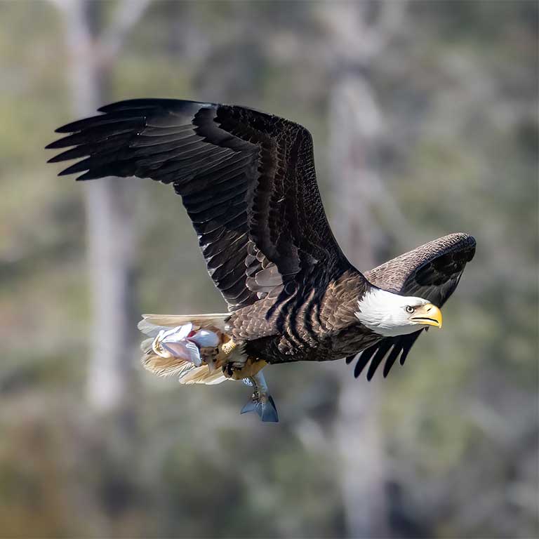
Virginia has a long, rich history of bird conservation. The Eastern Shore was the site of some of the first efforts by fledgling Audubon societies to protect vulnerable seabird colonies from overharvest through the hiring of game wardens at the turn of the twentieth century (Johnston 2003). Along with other eastern states, Virginia participated in the reintroduction of the then-extirpated Peregrine Falcon, starting in 1978, as well as of game species such as Wild Turkey. The Chesapeake Bay’s Bald Eagle and Osprey populations have rebounded from their DDT-induced lows thanks to the efforts of many Virginia conservation partners. These are but some examples of the avian conservation success stories that have played out within the Commonwealth.
It is important to note that while these examples highlight conservation actions that explicitly target birds, other initiatives can indirectly benefit avian populations. Examples include general land protection efforts, conservation and management of specific habitat types (e.g., spruce forest and wetland restoration, or programs to promote private land management for wildlife resources), and land practices to improve air and water quality and soil health.
Like virtually all other states, Virginia now finds itself at the confluence of avian conservation efforts by international, national, regional, statewide, and local organizations and partnerships, some of which have been operating for decades or more. While too numerous to list, they include federal natural resource agencies such as the U.S. Fish and Wildlife Service, U.S. Forest Service, National Park Service, and Natural Resources Conservation Service, as well as state entities such as the Virginia Department of Wildlife Resources (VDWR) and the Virginia Department of Conservation and Recreation. Non-governmental organizations (NGO) include national organizations like the American Bird Conservancy and The Nature Conservancy and Virginia-based entities Smithsonian Conservation Biology Institute and the Virginia Society of Ornithology. Local NGOs include groups such as the Northern Virginia Bird Alliance, Richmond Audubon Society, and the Clifton Institute. Regional partnerships like the Appalachian Mountains Migratory Bird Joint Venture are also active in Virginia, as are state-based programs such as Virginia Master Naturalists. Research entities such as the Center for Conservation Biology at the College of William and Mary and various academics at Virginia universities also make significant contributions to bird conservation in the Commonwealth.
Virginia also operates within international avian initiatives like Partners in Flight and Road to Recovery, and participates in various single-species Working Groups such as the Golden-winged Warbler Working Group and Loggerhead Shrike Working Group.
Collectively, these organizations, partnerships and initiatives all contribute to moving the conservation needle forward for birds and a variety of other wildlife with which birds share habitat.
The Atlas as a Conservation Tool
The Atlas is poised to help inform the efforts of the Commonwealth’s many bird conservation partners through its suite of data products and through the raw data collected by volunteers and field technicians. It can be added to the toolbox of existing decision support tools and data-driven products available for Virginia, including eBird Status and Trends, Coastal Gems, the Virginia Wildlife Action Plan, the Virginia Natural Heritage Data Explorer, and others.
The decision to publish the Atlas online, rather than as a traditional coffee-table style book typical of many state Atlases, allows increased accessibility to and use of Atlas information by a variety of audiences. As a website the Atlas can also continue to be updated and improved with new information and features such as taxonomic updates, expansion of existing content within Species Accounts, and publication of new content elsewhere on the site.
The raw Atlas data are important in providing a baseline against which future Atlases can be compared to assess changes in the status of Virginia’s breeding birds. The point count data collected by field technicians will also allow for comparisons to be made to data collected via other projects at statewide or smaller regional levels. Novel analyses of the Atlas data sets by researchers would unlock their additional unrealized potential to further support and guide conservation planning decisions (see Research).
The Atlas has the potential to serve as an incredibly powerful tool to support bird conservation across multiple scales. Below we explore different aspects of conservation and how the Atlas can help to inform them.
Conservation Planning
Planning is one of the cornerstones of conservation delivery, as it is necessary before actions can be implemented on the ground. It can range from identifying knowledge gaps that need to be filled, to selecting land parcels on which habitat management should take place, to identifying priority species, among many other things. In each of these instances the Atlas can play an important role, ultimately informing planning efforts for the benefit of birds. Spatial files of existing Atlas data products can be made available to entities and institutions for conservation planning purposes (see Research).
Species Prioritization
Prioritizing species is important when identifying which species should receive conservation attention, considering limited funding, time, and capacity of most conservation entities. As an example, Atlas breeding evidence maps and population estimates were used to help in the selection of avian Species of Greatest Conservation Need (SGCN) for the 2025 Virginia Wildlife Action Plan. The value added from these products cannot be overstated, considering these SGCN rankings are the primary focus of VDWR’s conservation efforts over the 10-year lifespan of the Plan.
Identifying Focal Areas for Conservation Action
Once target species are selected through a prioritization process, specific actions can be identified to benefit those species. This could include formulating research questions (see Surveys and Research), planning for habitat management or land acquisition, or designing an education or awareness campaign. Atlas products can help identify geographic focal areas where implementing these actions may be most successful.
Typically, areas ripe for conservation action are those that support high levels of species-specific occurrences (number of documented records in an area), high species abundances (number of individuals of a species in an area), or high species richness (number of species in an area). The full suite of Atlas maps (breeding evidence, distribution, and abundance) can be used to identify such focal areas. In addition, overlaying maps for priority species or for groups of species that are associated with similar habitats (e.g., grassland birds) can reveal where they co-occur. This can effectively identify areas of conservation value based on species richness.
Additional Conservation Planning
Beyond the examples above, there are many other ways that Atlas data and products can aid with conservation planning, such as:
- Abundance, distribution, and breeding evidence maps can be used to evaluate the degree of protection of species and their habitats within the Commonwealth relative to their occurrence on public and protected lands, including private properties under conservation easement. This can in turn help to formulate conservation strategies for individual species or suites of species.
- Maps of distribution change between Atlases can be used to identify geographic areas of significant contractions in the predicted distribution of one or more species of interest. This would be an initial step toward evaluating the feasibility of restoring species to areas where they were formerly found. These maps can also help inform where conservation actions can be targeted to help prevent future losses.
- Abundance maps and population estimates can be used to develop habitat and population goals on a species-specific basis. Such goals would help inform conservation strategies and provide a yardstick against which to measure progress.
- Atlas raw data can be used to further evaluate landscape-level and local habitat relationships, which can help to guide management and conservation actions and help inform management practices.
The Atlas and the Virginia Wildlife Action Plan
The Atlas and the 2025 Virginia Wildlife Action Plan (WAP) are in many ways complementary to one another. Although the Atlas is more narrowly focused on breeding birds than the WAP, both are tools intended to guide and inform wildlife conservation. The two share a link through the designation of avian SGCN: Atlas data were used in the SGCN selection process (see Species Prioritization), and SGCN feature prominently on the Atlas website (see Species of Greatest Conservation Need).
Atlas products can play a key role in WAP implementation. In many cases, the Conservation section of Species Accounts for Species of Greatest Conservation Need provides additional information on the threats and actions identified by the WAP. Furthermore, Atlas products can be used to direct the implementation of conservation actions identified in the WAP to geographic areas where those actions would be most impactful to priority species.
Surveys and Research
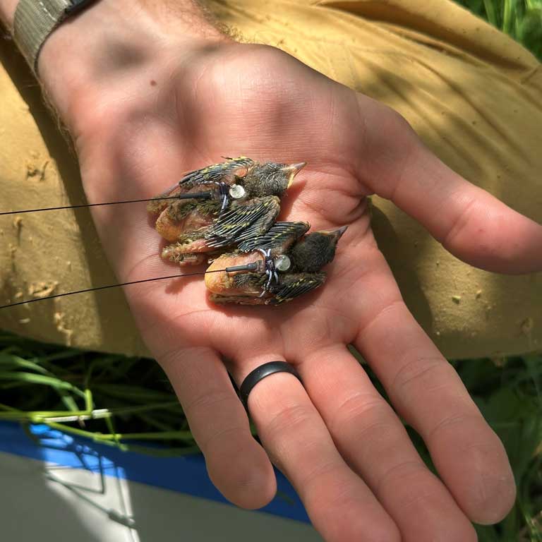
Although the Second Atlas generated an enormous amount of data, certain species are less represented in those data sets. For example, some species may simply be less common, while others may be less easily detected. Detection of some species may require specialized equipment (e.g., boats for marsh bird surveys), off-road access to private lands (e.g., for Golden-winged Warbler surveys), or targeted survey techniques (e.g., playback or area searches) that were not available to Atlas volunteers. Breeding evidence maps can inform where to direct surveys for such species by identifying areas where specialized surveys have not been conducted (i.e. the species have not been documented). Breeding distribution maps can further refine this by guiding surveys toward areas where a species that has not yet been documented is predicted to be very likely to occur.
Atlas products can also help identify geographic areas that are suitable for more intensive surveys based on previously documented observations. Species like Loggerhead Shrike and Golden-winged Warblers tend to cluster on the landscape. Knowledge of the presence of a species at a particular location (through breeding evidence and distribution maps) can therefore serve as a starting point for surveys in the surrounding area. In the same vein, abundance maps can inform selection of study sites to answer research questions based on the abundance levels of one of more target species; these are best used to select a broader geographic area of interest (e.g., regional vs. local), within which individual sites can then be explored.
A phenology table derived from Atlas data displays species-specific date ranges and median dates for the timing of different stages of the nesting cycle, from nest building through fledged young. Although dates are not included for pre-nesting breeding behaviors (e.g. singing males), these data can be useful in planning the timing of field surveys for individual species of interest.
Finally, raw Atlas data are being made available for analysis to further benefit Virginia’s breeding birds (see Research).
Habitat Management
Decisions about how to manage habitat are ultimately shaped by what management is feasible at a site, including both current and past habitat conditions and available resources. However, goals and objectives pertaining to soil and water quality, ecosystem services (e.g., flood and erosion control), land use (e.g., recreation, preservation), and wildlife are equally important in deciding the direction that habitat management should take.
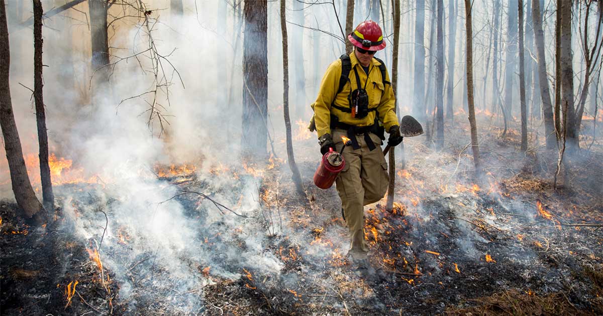
Deciding how to manage a property can be informed by whether a desired species occurs, or once occurred, on or in proximity to the property, and whether targeting habitat management to benefit that species is possible. This approach has been taken by VDWR in managing habitat for Golden-winged Warblers on Highland Wildlife Management Area (WMA) in Highland County, for Red-cockaded Woodpeckers on Big Woods WMA in Sussex County, and for Cerulean Warblers on Gathright WMA in Bath County.
Although the full suite of Atlas maps can be used to identify where species occur, knowledge of verified occurrences (breeding evidence maps, raw Atlas data) may be necessary when deciding to move forward with management actions. At a minimum, the distribution and abundance maps can be used to direct surveys to areas where a species is predicted to occur, such that its occurrence can be verified.
Atlas products can be used to inform habitat management on both public and private lands by a variety of entities and institutions, including government agencies and non-governmental organizations, as well as by private landowners.
Education and Outreach
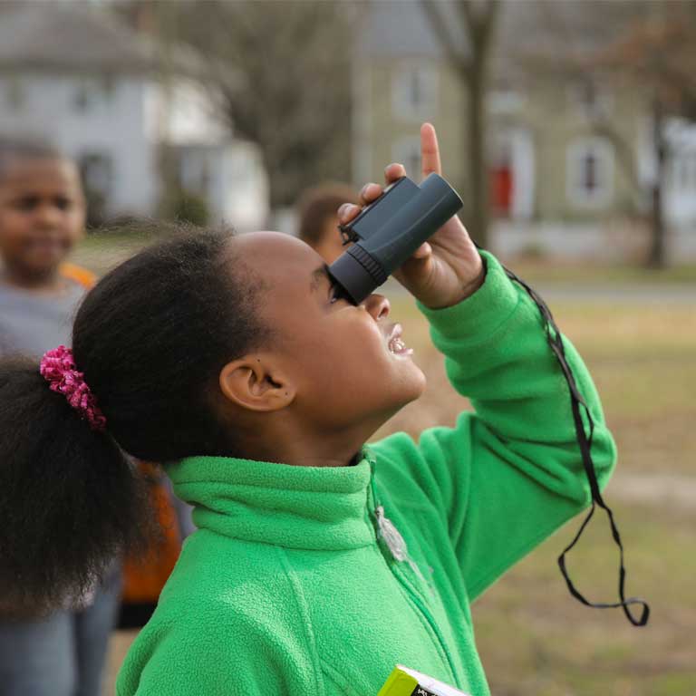
This broad category encompasses communications with people to help build awareness of and support for bird conservation. The Atlas website itself is both an education and outreach tool. It provides information about the status of Virginia’s breeding bird species based on their distribution, abundance, and population trends. It also raises awareness about the decline of many breeding bird populations, the threats they face, and the actions people can take to help protect these species (see How You Can Support Birds). We hope to see the information presented on the website used by K-12 educators and university and college instructors to create lesson plans, or as the basis of classroom assignments or projects (see Education). Conservation outreach campaigns can also incorporate Atlas content in their messaging or reference the Atlas website as a resource.
Land Acquisition and Conservation Easements
Land conservation organizations include non-governmental organizations, government agencies and private-public partnerships whose mission is to facilitate land conservation through land acquisition, conservation easements, or other types of legal agreements.
A conservation easement is a binding agreement with a land trust which requires that a certain property be maintained to specific standards. Different conditions can be written into each easement agreement, but many conservation easements are written with the intention of supporting high ecological function of the subject property. Because these easements are often executed in perpetuity, extensive study is undertaken prior to placing an easement on a property. Considerations include existing habitat and ecological function, potential species richness, and proximity to other preserved or ecologically important lands and corridors. Tools such as the Virginia Department of Conservation and Recreation’s Natural Heritage Data Explorer help aggregate ecological values into one source. The Atlas products, including distribution, abundance, and breeding evidence maps are a valuable resource for evaluation of land and its merits for conservation. They can also inform language and conditions in easement agreements in relation to avian communities on or in the vicinity of the property. Atlas products can help identify areas for acquisition that support priority species or avian communities. They can also support acquisition efforts for parcels that are already targeted for purchase. Entities involved in conservation-based land purchases often rely on external funding, including grants, to complete their acquisitions. Grant proposals are more competitive when they identify priority species likely to benefit from the purchase and protection of a land parcel. Distribution, abundance, and breeding evidence maps can provide information on the occurrence of such species in the landscape surrounding the target property.
Policy Making
Environmental regulation as well as conservation incentive programs are ultimately approved by our elected officials. These officials decide priorities such as which programs to fund and what activities require review by natural resource stewardship agencies. Publicly available, scientifically vetted data such as the Atlas provides a foundation for informed decision-making.
Within the Atlas website, policy makers can find information about changes in species composition across the landscape within Virginia (see Results), land use changes and Virginia habitats, and more information on this page about threats to bird populations (see The Need for Bird Conservation above). Atlas data, in conjunction with resources such as VDWR’s Wildlife Action Plan, which include the Species of Greatest Conservation Need rankings, provide additional justification for allocating resources and setting priorities.
Environmental Review
Atlas data are one of the many data sources consulted to inform VDWR’s environmental review process. As Virginia’s state wildlife agency, VDWR has regulatory authority for the management and protection of the Commonwealth’s wildlife, including threatened and endangered wildlife, but excluding listed insects. VDWR reviews projects that propose to alter the natural landscape, with a focus on protection of listed species. Proximity to species records (documented via Atlas or other data) will prompt VDWR to assess whether the project has the potential to negatively affect the species and/or its habitat. VDWR recommends appropriate measures to avoid, minimize, or compensate for those impacts.
Land Use Planning

Local government officials carry much of the authority when it comes to land use and land development decisions in Virginia, as they are charged with zoning and permitting for various land uses and developments. Planning commissions, county boards, and city councils make thousands of land use decisions each year. In the Commonwealth, localities (counties and independent cities) are required to create and adopt a Comprehensive Land Use Plan, which must be reviewed every five years and are often completely reworked on a 20-year cycle, with some localities opting to update more frequently. These long-range plans are meant to serve as a guide for where and how land is developed or preserved within a locality. Extensive research goes into each round of plan updates, in order to get an accurate inventory of land, infrastructure, and resources in each planning locality. It is critical to have good information to guide these planning decisions.
In the future, the Atlas website may incorporate a centralized interactive map with tools to more easily allow people to aggregate data based on geographic locations, such as Atlas blocks or counties.
Building a Volunteer Workforce Through the Atlas
Nearly 1,500 individual volunteers contributed data to the Atlas, a testament to the interest that this project generated among community scientists. For some volunteers, the Atlas was an entry point into more serious birding and helped sharpen their bird identification skills. For others, it provided motivation to use their already honed skill sets to directly contribute to the conservation of Virginia’s breeding birds.
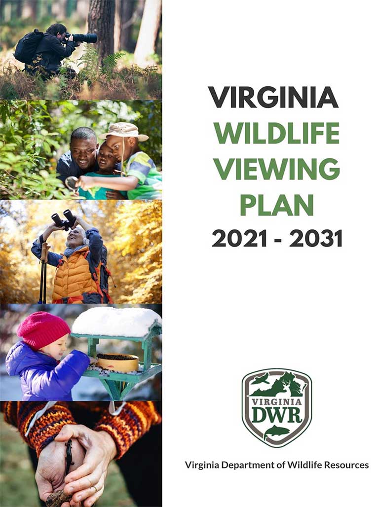
The importance of this level of engagement was not only in the amount of data collected for the Atlas, but in effectively helping to build an engaged volunteer ‘workforce’ to continue contributing to bird conservation beyond the Atlas. The Virginia Wildlife Viewing Plan in fact documents a desire by people to engage with VDWR through volunteer-based experiences.
Continued engagement by VDWR with Atlas volunteers in the years following Atlas data collection has been fruitful. A primary example has been the recruitment of former Atlas volunteers to run routes for the North American Breeding Bird Survey (BBS) in Virginia. Providing this opportunity for volunteers has led to much greater success in filling annual route vacancies than through other channels in previous years.
The above hints at the great potential for continued engagement with former Atlas volunteers to collect avian data for other needed projects. Tapping into this great pool of volunteers for future data collection efforts can make use of their talents to help further shape the future of bird conservation in Virginia through these community scientists.
Literature Cited
Johnston, D. W. (2003). The History of Ornithology in Virginia. University of Virginia Press, Charlottesville, Virginia.
Rosenberg K. V., A. M. Dokter, P. J. Blancher, J. R. Sauer, A. C. Smith, P. A. Smith, J. C. Stanton, A. Panjabi, L. Helft, M. Parr and P. P. Marra (2019). Decline of the North American avifauna. Science. https://doi.org/10.1126/science.aaw1313.