Introduction
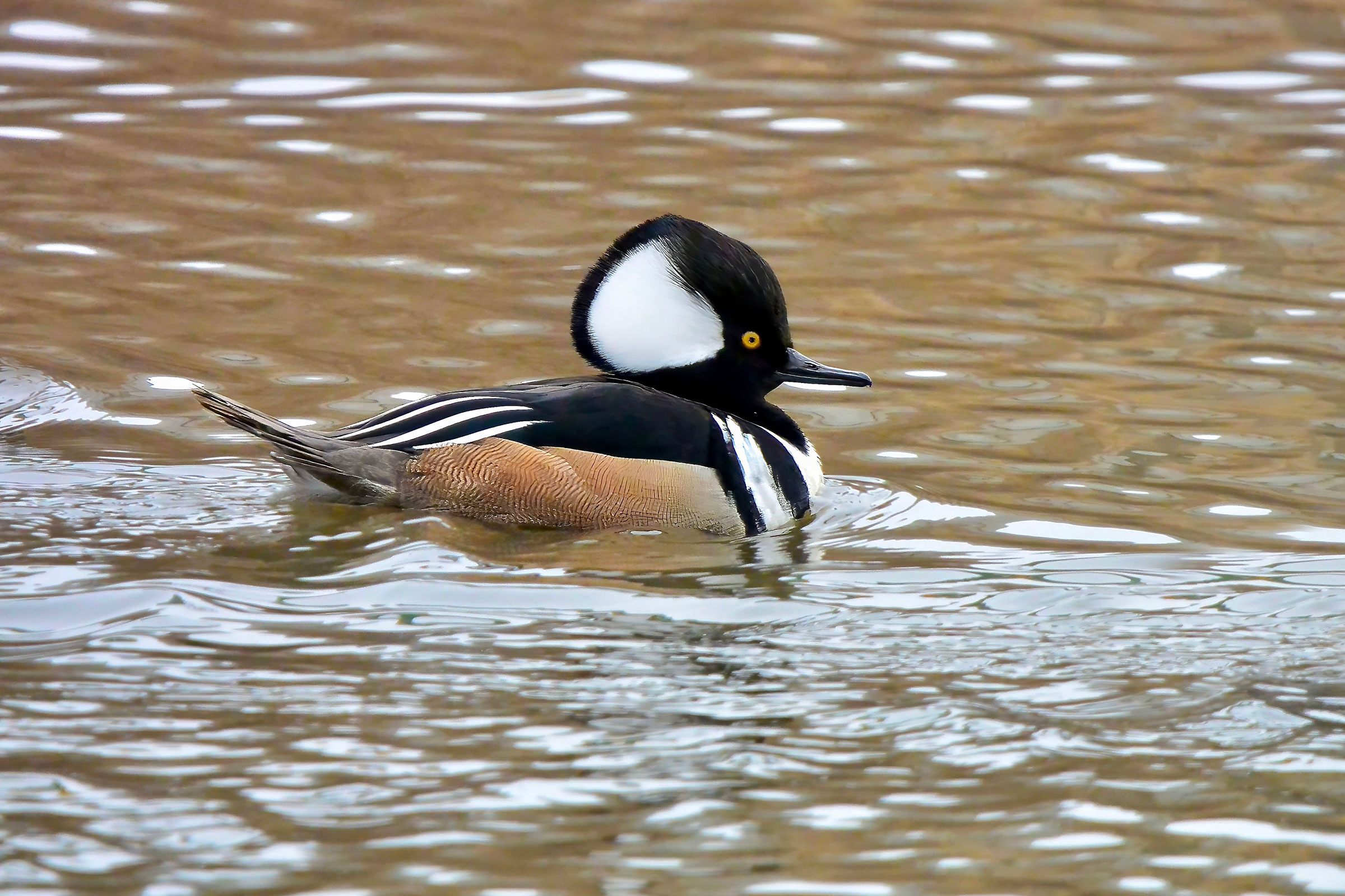
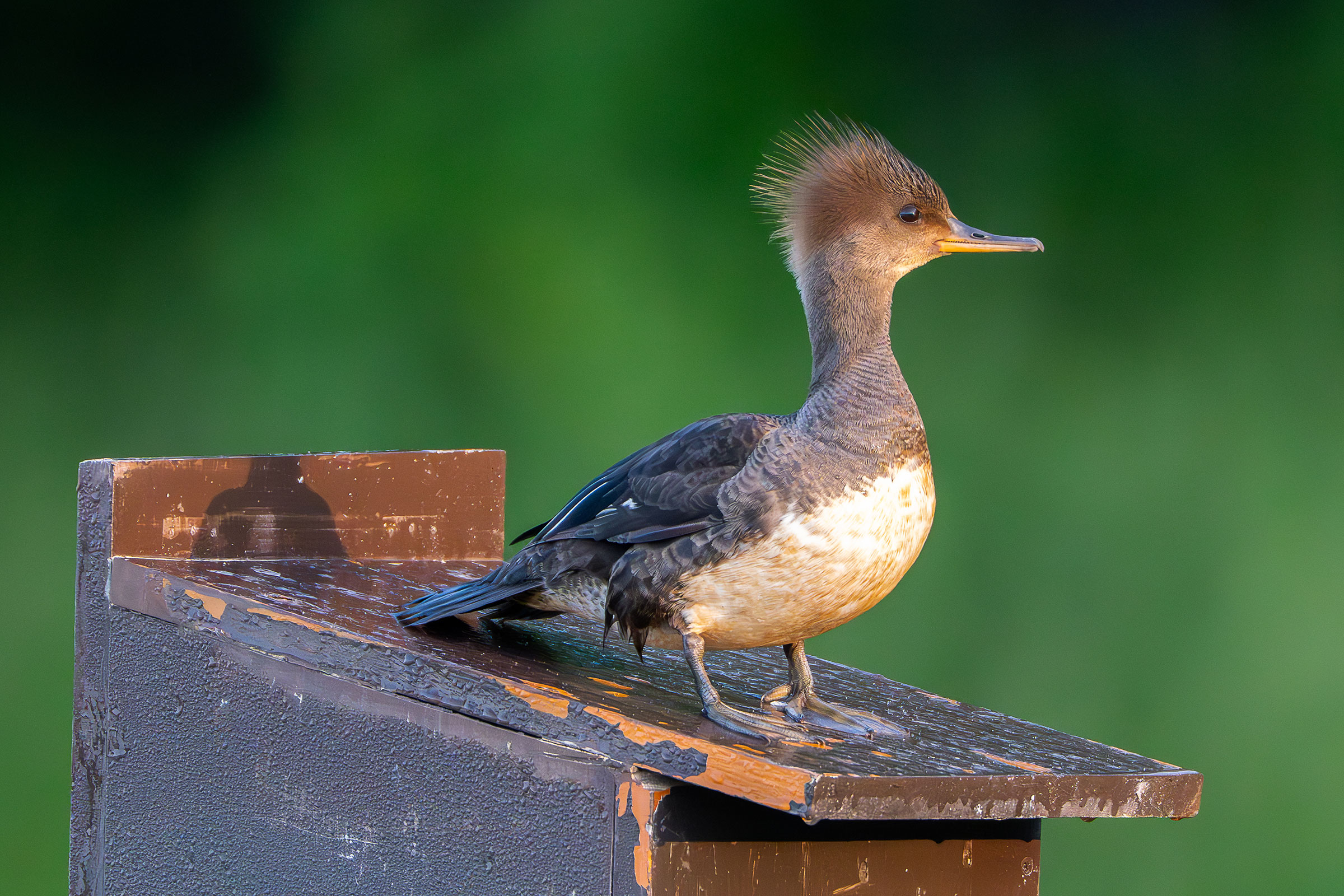
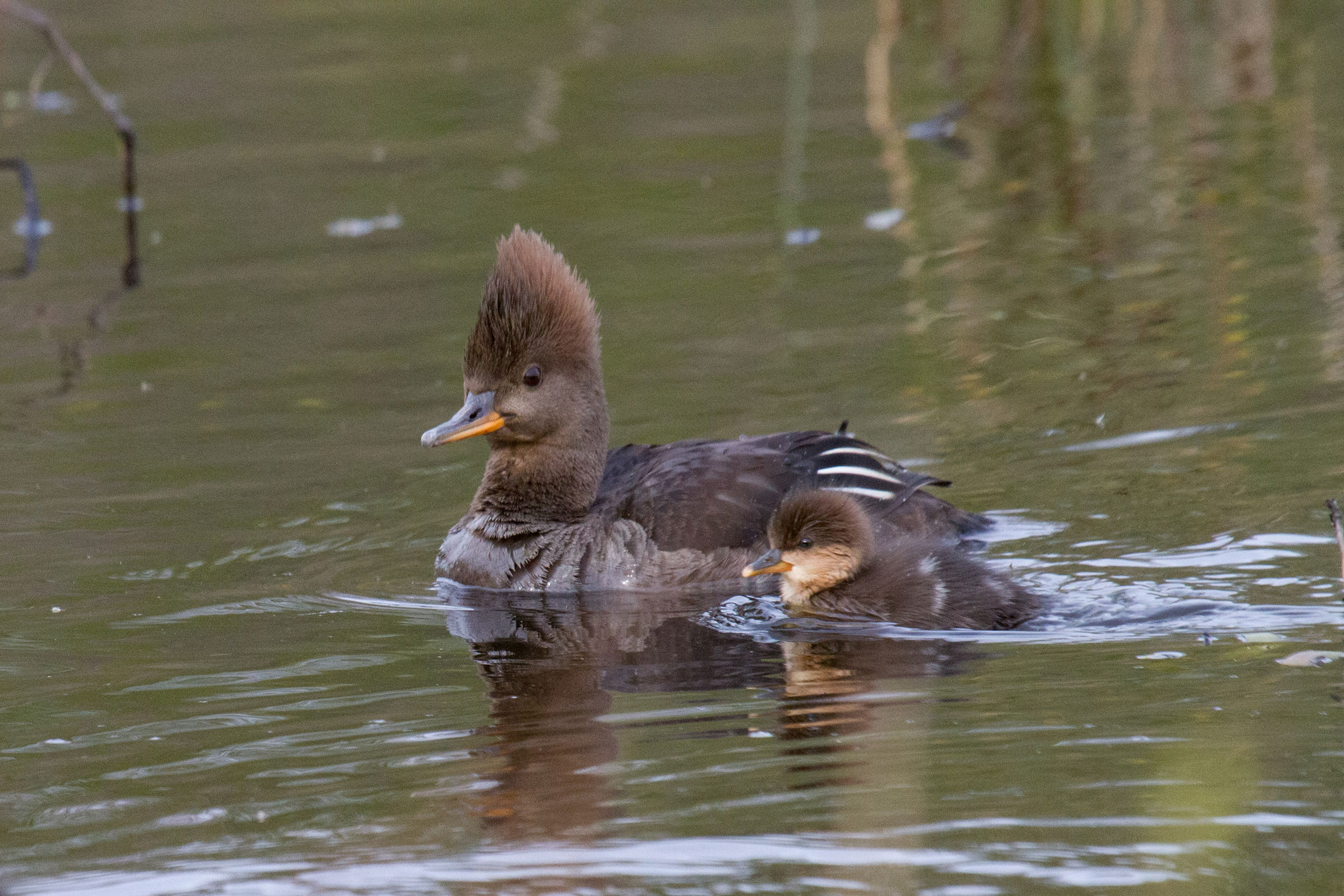
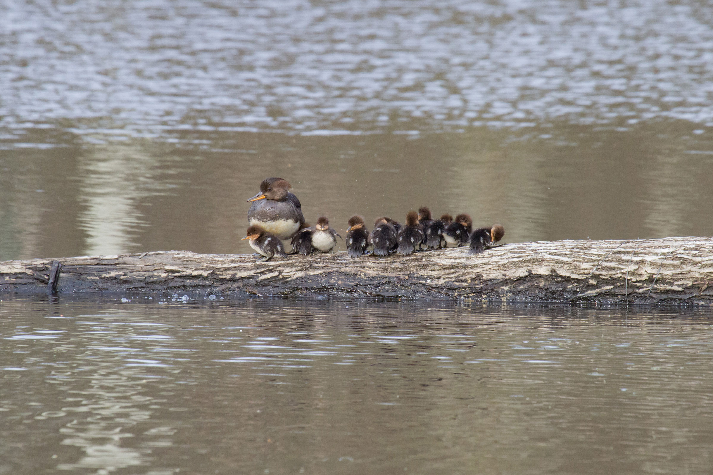
With spectacular black and white crests and reddish-brown flanks, male Hooded Mergansers are perhaps the most stunning ducks to grace Virginia’s waters. Females are beautiful as well, with their cinnamon (almost pink) crests and slender bills splashed with orange. Hooded Mergansers are small ducks, often seen diving well below the water’s surface where they capture crayfish, invertebrates, and small fish with their thin, serrated bills (Dugger et al. 2020).
Hooded Mergansers nest near creeks, rivers, ponds, and lakes within forested landscapes. They rely on large trees with existing cavities for nesting. In Virginia, these conditions are mostly met in more forested areas of the Mountains and Valleys region, yet they will also nest in man-made structures such as wood duck boxes and will sometimes lay eggs in existing wood duck clutches.
Breeding Distribution
During the Second Breeding Bird Atlas, there were too few breeding observations to develop distribution models for the Hooded Merganser. Please see the Breeding Evidence section for more information on breeding distribution.
Breeding Evidence
Hooded Mergansers were confirmed breeders in 26 blocks and 13 counties and probable breeders in two additional counties (Figure 1). Although they were confirmed throughout the state, the greatest number of observations were recorded in the Mountains and Valleys region and the northern reaches of the Piedmont region. More specifically, most breeding birds were documented in Fairfax and Loudoun Counties, with 11 confirmed nests in each county. During the First Atlas, only one breeding confirmation, which was in Halifax County, was recorded (Figure 2).
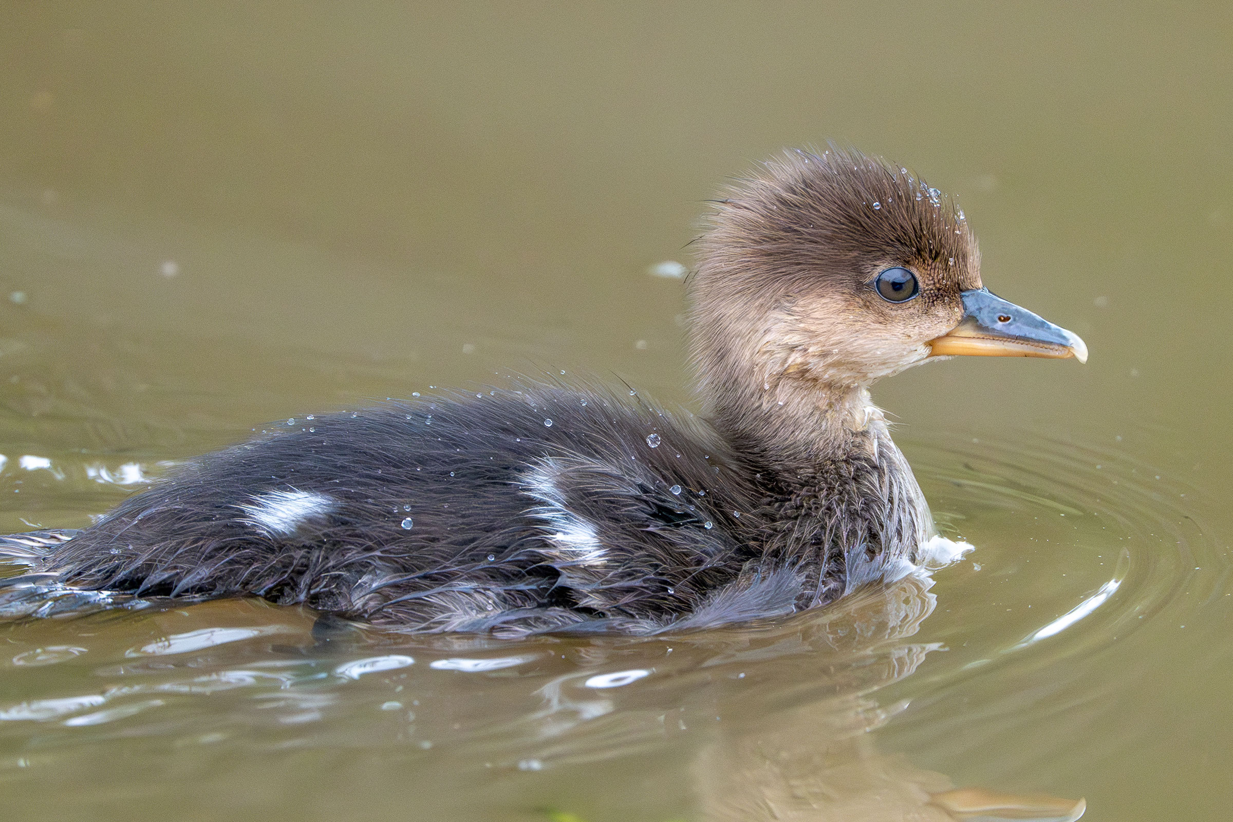
Breeding was primarily confirmed through observations of recently fledged young from early April through late July (Figure 3). However, nests with eggs, nests with young, and feeding young were also recorded. For more general information on the breeding habits of this species, please refer to All About Birds.
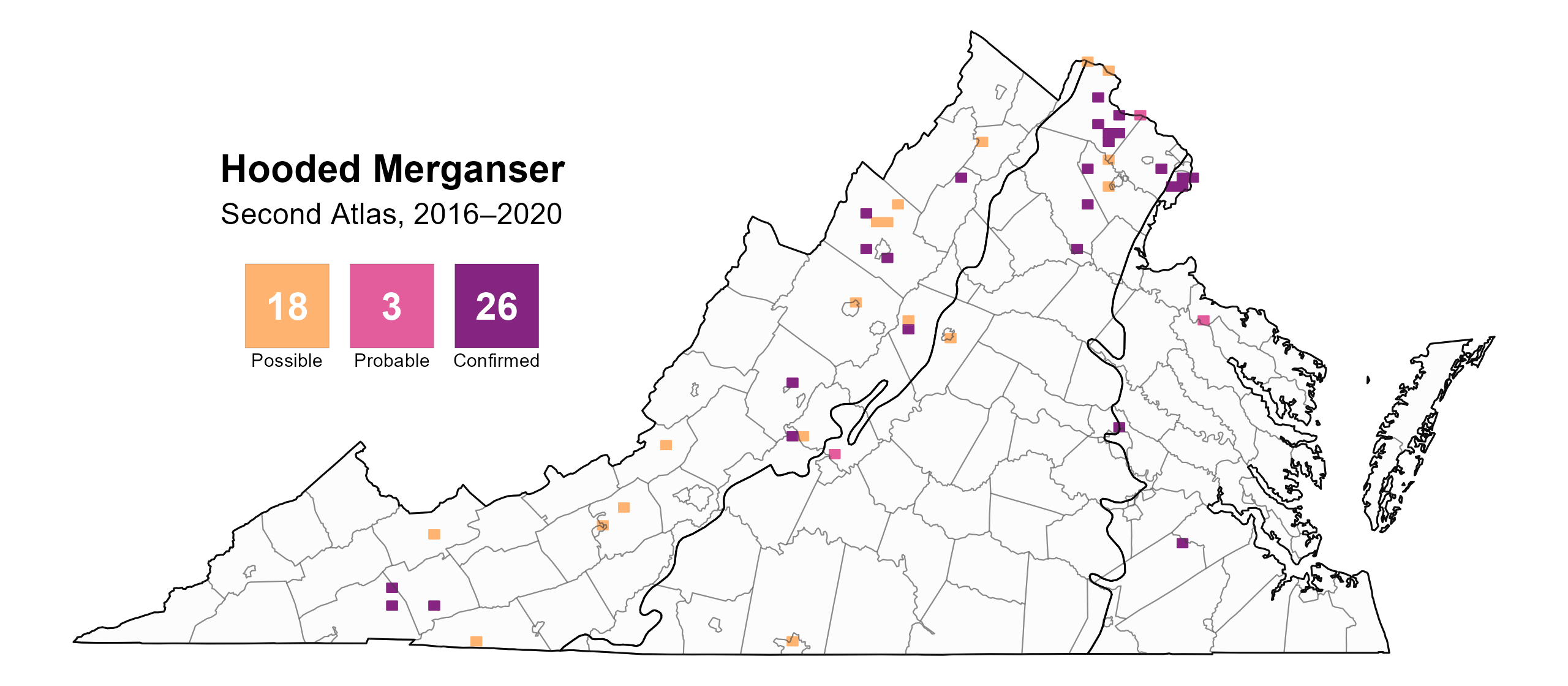
Figure 1: Hooded Merganser breeding observations from the Second Atlas (2016–2020). The colored boxes illustrate Atlas blocks (approximately 10 mi2 [26 km2] survey units) where the species was detected. The colors show the highest breeding category recorded in a block. The numbers within the colors in the legend correspond to the number of blocks with that breeding evidence category..
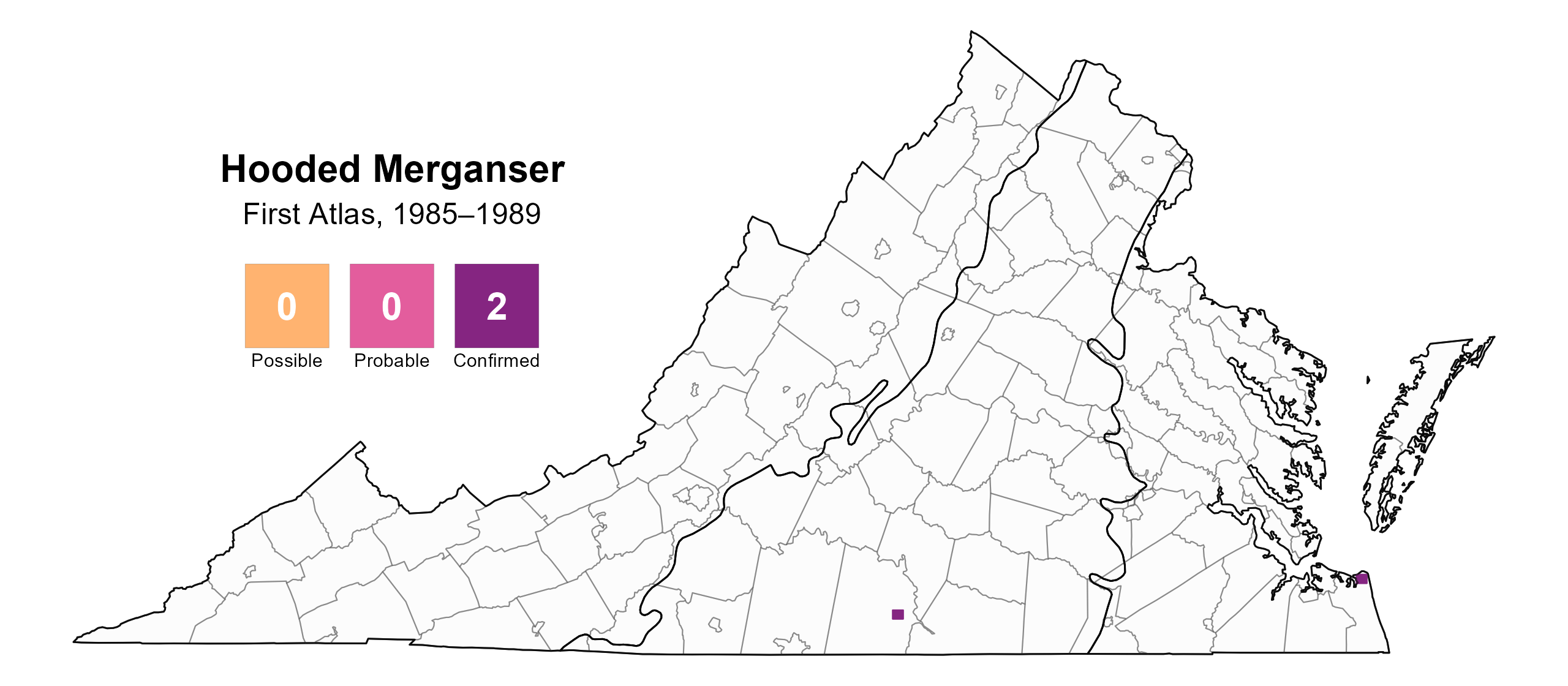
Figure 2: Hooded Merganser breeding observations from the First Atlas (1985–1989). The colored boxes illustrate Atlas blocks (approximately 10 mi2 [26 km2] survey units) where the species was detected. The colors show the highest breeding category recorded in a block. The numbers within the colors in the legend correspond to the number of blocks with that breeding evidence category.
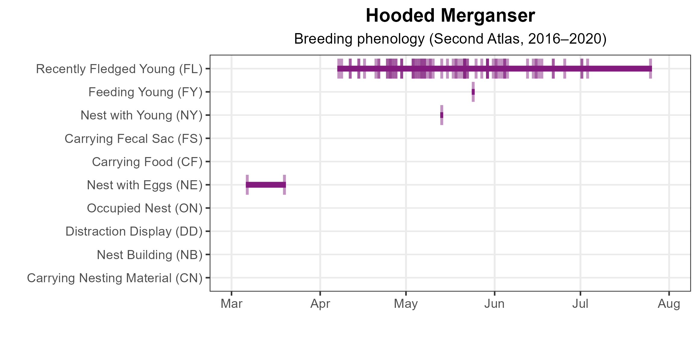
Figure 3: Hooded Merganser phenology: confirmed breeding codes. This graph shows a timeline of confirmed breeding behaviors. Tick marks represent individual observations of the behavior.
Population Status
A lack of detections during point count surveys prevented the development of an abundance model for Hooded Mergansers. Similarly, this species is not readily detected by the North American Breeding Bird Survey, which relies on roadside counts, so no estimates of population trends are available.
Conservation
No species-specific conservation efforts are being implemented in Virginia for the Hooded Merganser; however, nesting boxes placed near bodies of water can be used to coax Hooded Mergansers into more open habitats.
Interactive Map
The interactive map contains up to six Atlas layers (probability of occurrence for the First and Second Atlases, change in probability of occurrence between Atlases, breeding evidence for the First and Second Atlases, and abundance for the Second Atlas) that can be viewed one at a time. To view an Atlas map layer, mouse over the layer box in the upper left. County lines and physiographic regional boundaries (Mountains and Valleys, Piedmont, and Coastal Plain) can be turned on and off by checking or unchecking the box below the layer box. Within the map window, users can hover on a block to see its value for each layer and pan and zoom to see roads, towns, and other features of interest that are visible beneath a selected layer.
View Interactive Map in Full Screen
References
Dugger, B. D., K. M. Dugger, and L. H. Fredrickson (2020). Hooded Merganser (Lophodytes cucullatus), version 1.0. In Birds of the World (A. F. Poole, Editor). Cornell Lab of Ornithology, Ithaca, NY, USA. https://doi.org/10.2173/bow.hoomer.01.