Virginia Bird Atlas
Orchard Oriole
Environmental Associations
These graphs illustrate the probability that a species will occur within a block based on the values of significant environmental variables for that block in the Second Atlas species’ distribution models.
View Species Account
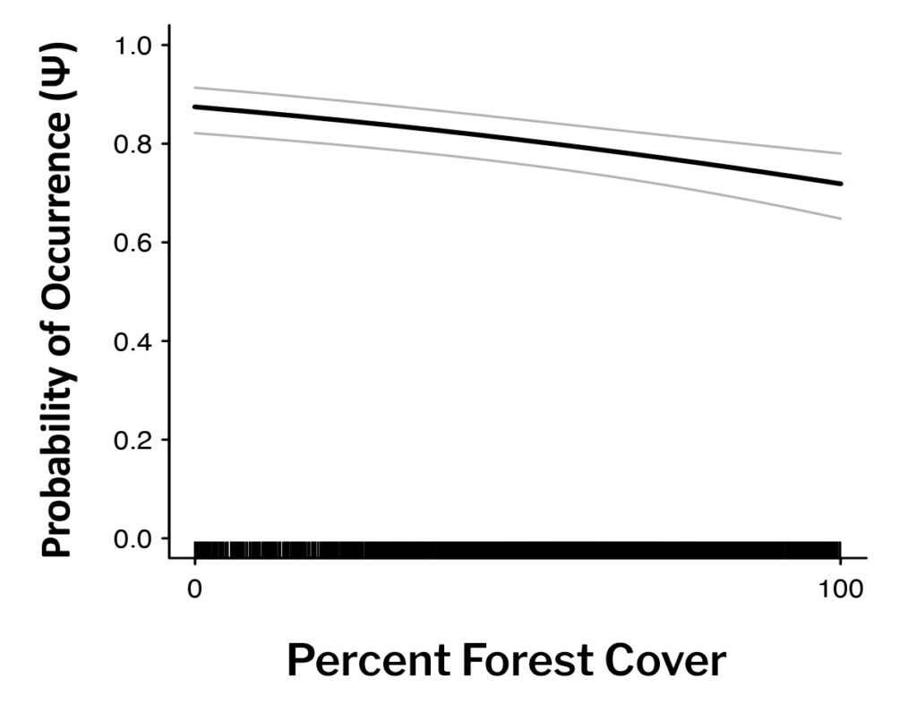

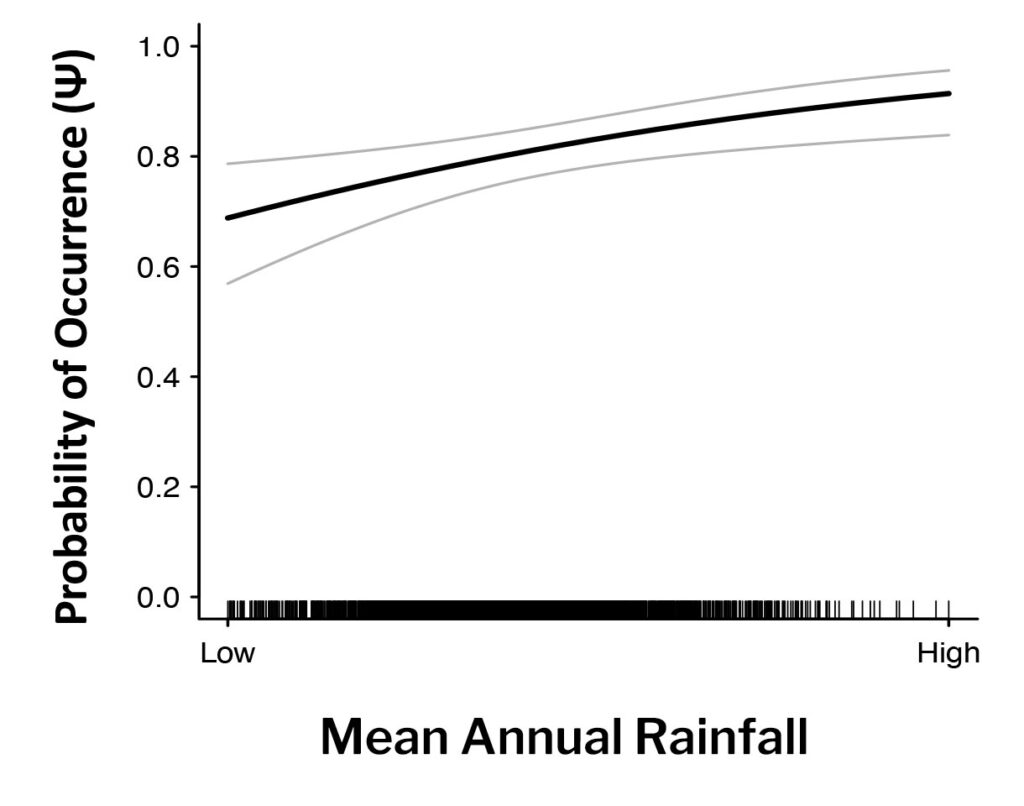
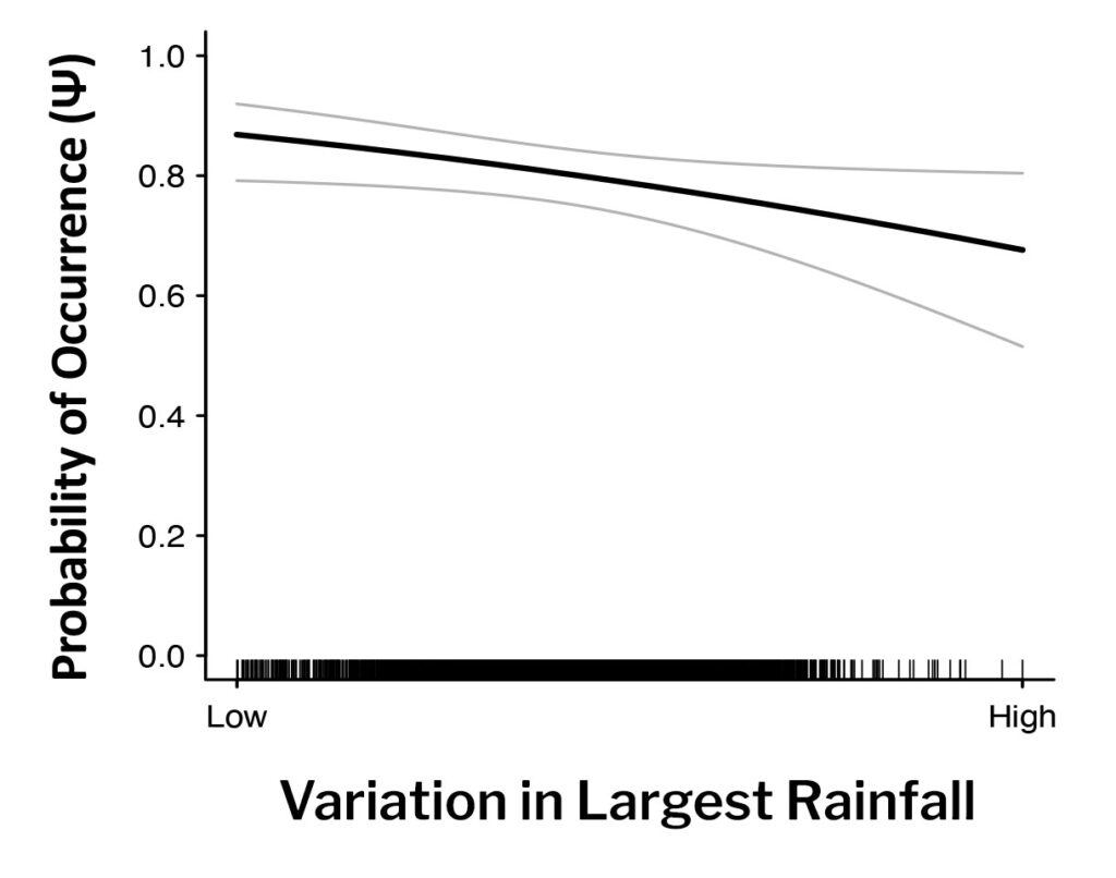
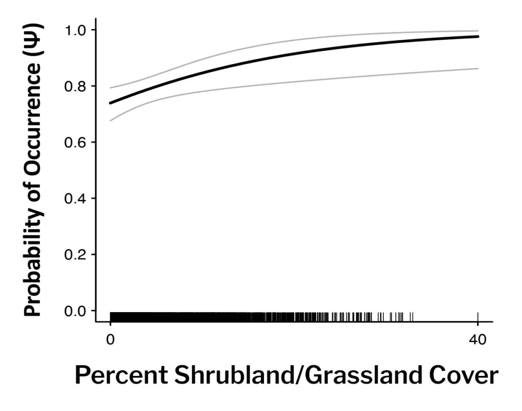
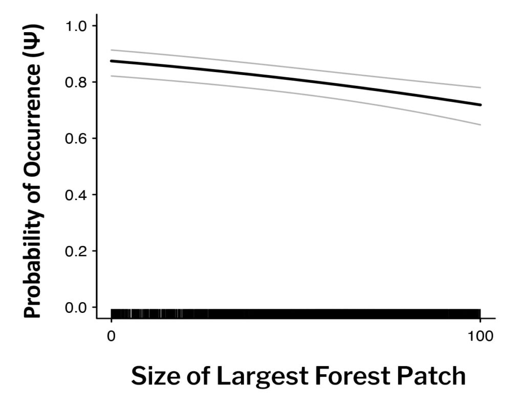
The graphs presented on this page illustrate the probability that a species will occur within a block based on the values of significant environmental variables for that block in the Second Atlas species’ distribution models. Probability of occurrence ranges from 0 to 1 (vertical axis). Depending on the graph, the horizontal axis depicts 1) the percentage of a block covered by a habitat type (e.g., grassland and shrubland) or 2) a value from low to high for climate variables (e.g., mean annual rainfall) and landscape-level features (e.g., diversity of habitat types) within a block. The dark line indicates the relationship between occurrence and the variable. There is a 95% probability (confidence interval) that this relationship falls between the gray lines. The black tick marks at the bottom of the graph show where individual blocks fall on the horizontal axis, to demonstrate the spread of values for the blocks in the model.