Introduction
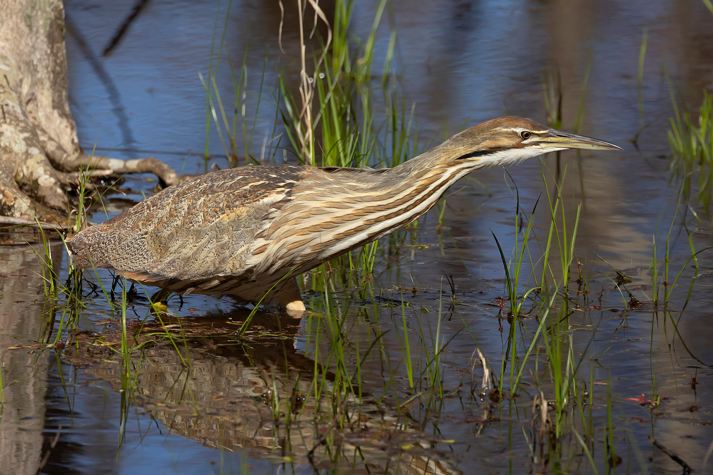
The streaked gold-and-rust plumage of the American Bittern allows it to blend seamlessly into the tall reedy marshes where it makes its home. Its plunger-like call resonates across long distances and has earned it nicknames including “thunder pumper,” “stake driver,” and “pumper lunker”. Virginia is one of the few regions where the species occurs year-round (Lowther et al. 2020), although it has never been known to breed in abundance in the state (Bryan Watts, personal communication). The Chesapeake Bay region is also the southernmost extent of this species’ breeding range.
Breeding Distribution
Because the American Bittern is rare, its occurrence could not be modeled. For information on where the species occurs in Virginia, see the Breeding Evidence section.
Breeding Evidence
American Bitterns were rare in Virginia during both Atlas periods. Breeding was not confirmed during the Second Atlas, but the species was a possible breeder in several locations based on lone individuals seen in appropriate habitat. In the Piedmont, observations were recorded along Dulles Toll Road wetlands (Fairfax County) and Bles Park (Loudoun County) (Figure 1). In the southeastern Coastal Plain region, American Bitterns were seen at Great Dismal Swamp National Wildlife Refuge (NWR) (Suffolk County) and Back Bay NWR (Virginia Beach).
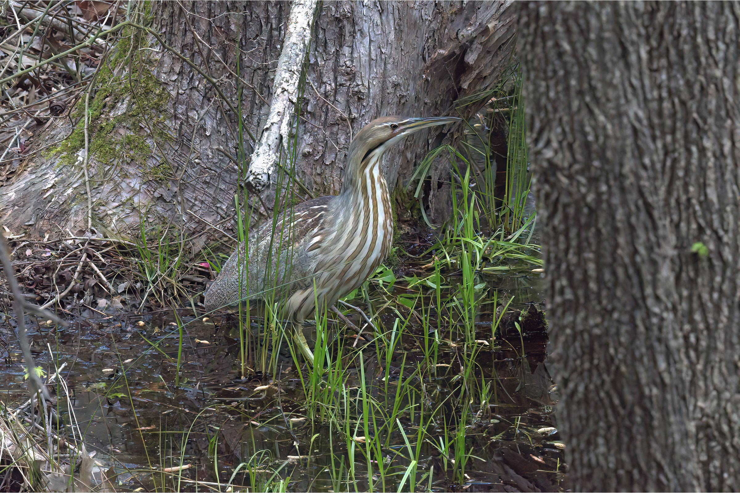
During the First Atlas, American Bitterns were only confirmed in one block in Huntley Meadows Park (Fairfax County), where the species reliably occurred for several years (Figure 2).
Because breeding was not confirmed, the species’ nesting phenology cannot be described. For more general information on the breeding habits of the American Bittern, please refer to All About Birds.

Figure 1: American Bittern breeding observations from the Second Atlas (2016–2020). The colored boxes illustrate Atlas blocks (approximately 10 mi2 [26 km2] survey units) where the species was detected. The colors show the highest breeding category recorded in a block. The numbers within the colors in the legend correspond to the number of blocks with that breeding evidence category.
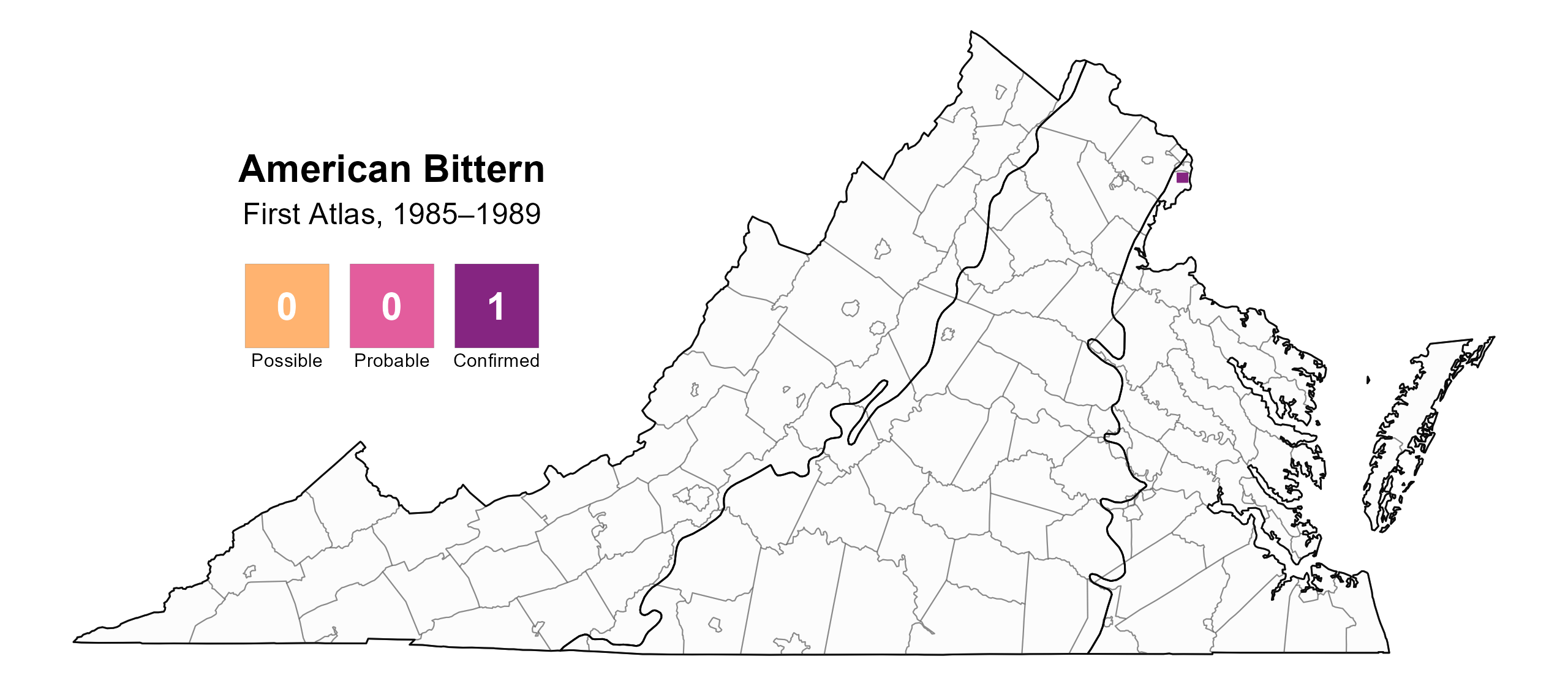
Figure 2: American Bittern breeding observations from the First Atlas (1985–1989). The colored boxes illustrate Atlas blocks (approximately 10 mi2 [26 km2] survey units) where the species was detected. The colors show the highest breeding category recorded in a block. The numbers within the colors in the legend correspond to the number of blocks with that breeding evidence category.
Population Status
Abundance could not be modeled because the species is so rare that only one detection occurred in the point count data. American Bitterns do breed in marshes on the Chesapeake Bay side of Accomack County, but they have never bred in abundance in Virginia (Bryan Watts, personal communication).
Conservation
Like many marsh birds, American Bitterns are threatened by loss of marsh habitat to sedimentation, excess nutrient input, sea-level rise, pollution, and development. Much of Virginia’s marshland has been lost or heavily degraded, particularly along the Potomac River (Litwin et al. 2011). The preservation of large freshwater marshes is therefore critical. Management of protected wetlands within state lands and NWRs can provide important habitat (Lowther et al. 2020). Even in good habitat, however, bitterns may go undetected. Conservation of this species requires a better understanding of where it occurs; thus, targeted surveys for American Bitterns may reveal more of their secrets.
Interactive Map
The interactive map contains up to six Atlas layers (probability of occurrence for the First and Second Atlases, change in probability of occurrence between Atlases, breeding evidence for the First and Second Atlases, and abundance for the Second Atlas) that can be viewed one at a time. To view an Atlas map layer, mouse over the layer box in the upper left. County lines and physiographic regional boundaries (Mountains and Valleys, Piedmont, and Coastal Plain) can be turned on and off by checking or unchecking the box below the layer box. Within the map window, users can hover on a block to see its value for each layer and pan and zoom to see roads, towns, and other features of interest that are visible beneath a selected layer.
View Interactive Map in Full Screen
References
Litwin, R. J., J. P. Smoot, M. J. Pavich, H. W. Markewich, E. O., B. Helwig, B. Steury, et al. (2011). Analysis of the deconstruction of Dyke Marsh, George Washington Memorial Parkway, Virginia-progression, geologic and manmade causes, and effective restoration scenarios. Open-File Report 2010-1269. U.S. Geological Survey. https://doi.org/10.3133/ofr20101269.
Lowther, P. E., A. F. Poole, J. P. Gibbs, S. M. Melvin, and F. A. Reid (2020). American Bittern (Botaurus lentiginosus), version 1.0. In Birds of the World (A. F. Poole, Editor). Cornell Lab of Ornithology, Ithaca, NY, USA. https://doi.org/10.2173/bow.amebit.01.