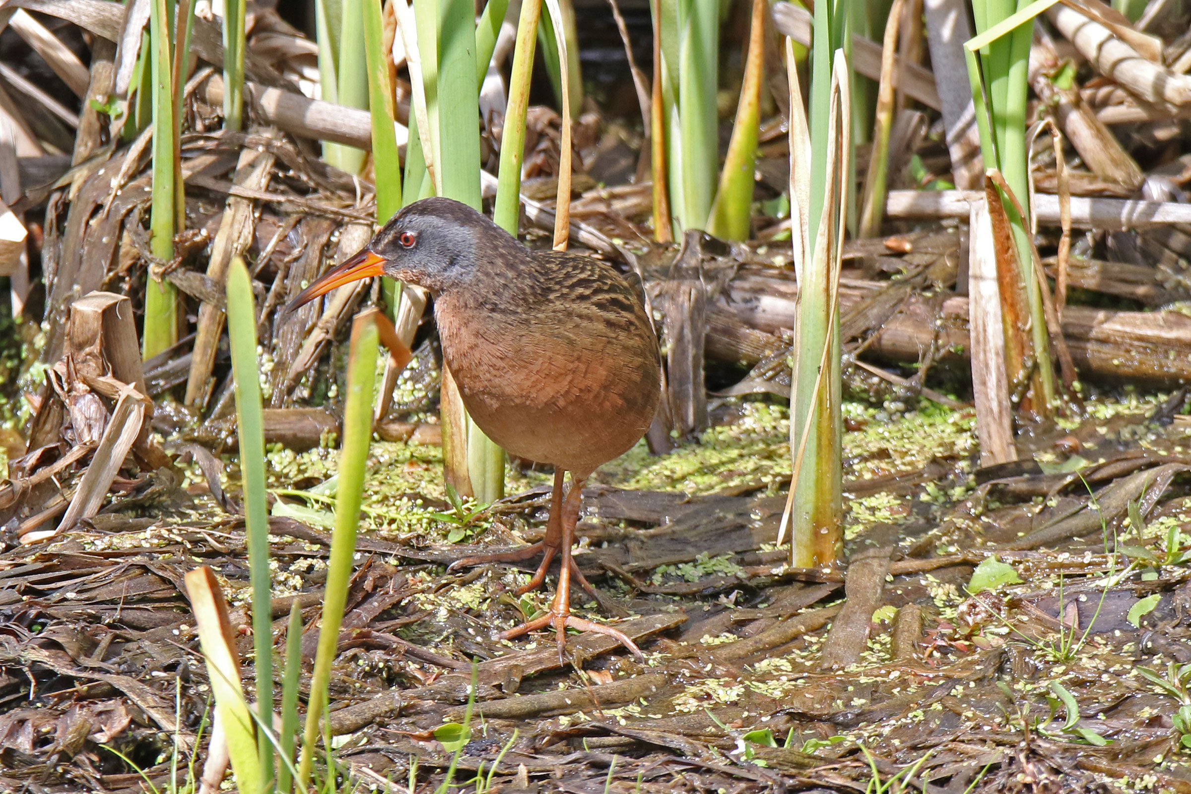
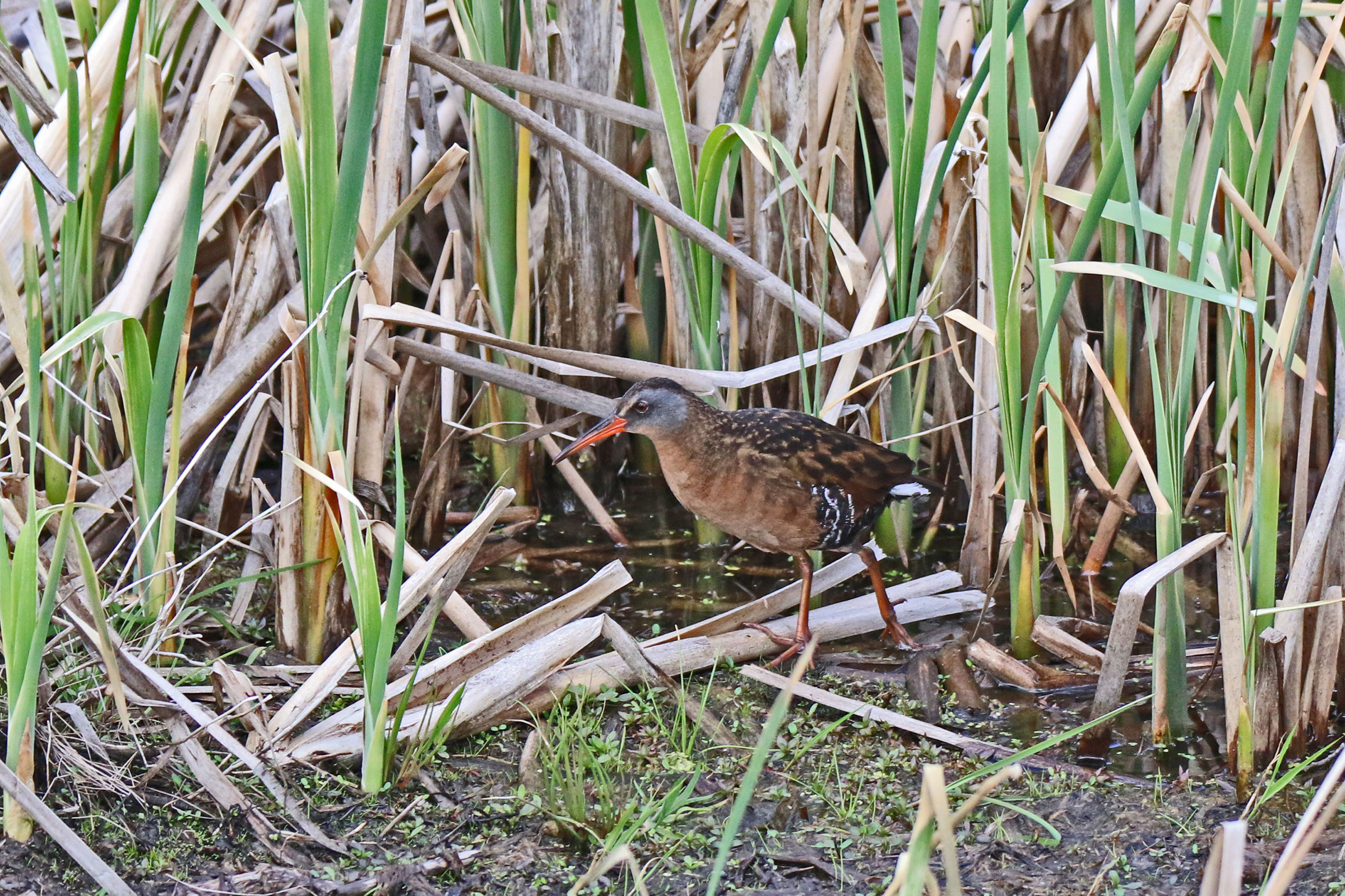
Introduction
The Virginia Rail was originally named by John James Audubon, who included the species in his groundbreaking book “Birds of America” in 1838. As with most rails, the Virginia Rail is highly secretive and often heard emitting a loud grunting sound before it is seen. Throughout their range and in Virginia, Virginia Rails nest in freshwater marshes where they build their nests atop floating mats of vegetation. They prefer shallow water where they can prey on snails, small fish, slugs, crayfish, and even frogs (Conway 2020).
Breeding Distribution
During the Second Breeding Bird Atlas, there were too few breeding observations to develop distribution models for the Virginia Rail. Please see the Breeding Evidence section for more information on its distribution.
Breeding Evidence
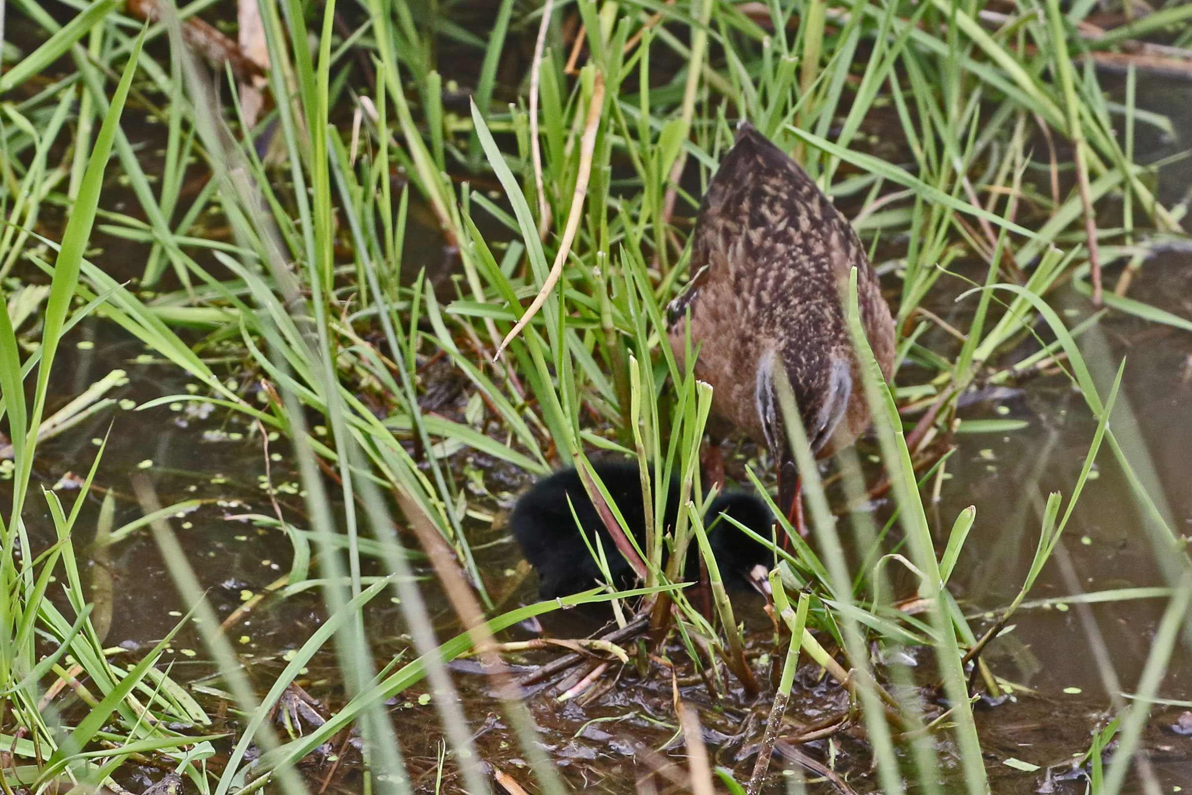
Virginia Rails were confirmed breeders in six blocks and six counties in the Mountains and Valleys region (Figure 1). These included Augusta, Bland, Lee, Rockbridge, Rockingham, and Washington Counties. In addition, probable breeders occurred in the Piedmont region (Prince William and Richmond Counties) and on Chincoteague Island in the Coastal Plain (Accomack County). During the First Atlas, most breeding observations were in the Coastal Plain region with one in the Piedmont region and two in the Mountains and Valleys region (Figure 3).
Breeding was primarily confirmed through observations of recently fledged young from June 22 to July 21 (Figure 3).
For more general information on the breeding habits of this species, please refer to All About Birds.
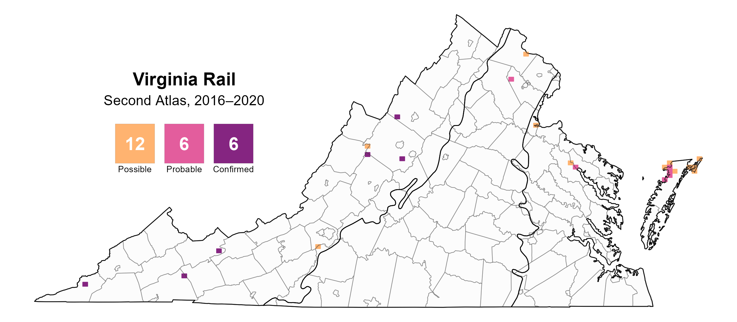
Figure 1: Virginia Rail breeding observations from the Second Atlas (2016–2020). The colored boxes illustrate Atlas blocks (approximately 10 mi2 [26 km2] survey units) where the species was detected. The colors show the highest breeding category recorded in a block. The numbers within the colors in the legend correspond to the number of blocks with that breeding evidence category.

Figure 2: Virginia Rail breeding observations from the First Atlas (1985–1989). The colored boxes illustrate Atlas blocks (approximately 10 mi2 [26 km2] survey units) where the species was detected. The colors show the highest breeding category recorded in a block. The numbers within the colors in the legend correspond to the number of blocks with that breeding evidence category.

Figure 3: Virginia Rail phenology: confirmed breeding codes. This graph shows a timeline of confirmed breeding behaviors. Tick marks represent individual observations of the behavior.
Population Status
A lack of detections during the point count surveys prevented the development of an abundance model for Virginia Rail. Similarly, this species is not readily detected by the North American Breeding Bird Survey (BBS), which relies on roadside counts, so no estimates of BBS population trends are available. However, biologists in Virginia have noted that this species has experienced a decline of over 97% on the Western Shore between 1992 and 2021, from an average of 1.95 to 0.05 individuals per survey point (Watts 2025). The population on Eastern Shore is still fairly strong based on recent point counts (Bryan Watts, personal communication).
Conservation
Given the decline that Virginia Rail is experiencing in Virginia, the 2025 Wildlife Action Plan includes it as a Tier III Species of Greatest Conservation Need (High Conservation Need), indicating it is of high conservation concern and management actions are needed (VDWR 2025). Conservation efforts related to preserving freshwater wetland habitat, especially ensuring adequate water levels and emergent vegetation could benefit this species.
Interactive Map
The interactive map contains up to six Atlas layers (probability of occurrence for the First and Second Atlases, change in probability of occurrence between Atlases, breeding evidence for the First and Second Atlases, and abundance for the Second Atlas) that can be viewed one at a time. To view an Atlas map layer, mouse over the layer box in the upper left. County lines and physiographic regional boundaries (Mountains and Valleys, Piedmont, and Coastal Plain) can be turned on and off by checking or unchecking the box below the layer box. Within the map window, users can hover on a block to see its value for each layer and pan and zoom to see roads, towns, and other features of interest that are visible beneath a selected layer.
View Interactive Map in Full Screen
References
Conway, C. J. (2020). Virginia Rail (Rallus limicola), version 1.0. In Birds of the World (A. F. Poole and F. B. Gill, Editors). Cornell Lab of Ornithology, Ithaca, NY, USA. https://doi.org/10.2173/bow.virrai.01.
Virginia Department of Wildlife Resources (VDWR). 2025. Virginia wildlife action plan. Virginia Department of Wildlife Resources, Henrico, VA, USA. 506 pp.
Watts, B. D. (2025) Decline of salt marsh-nesting birds within the lower Chesapeake Bay (1992–2021). PLoS One 20:e0323254.