Introduction
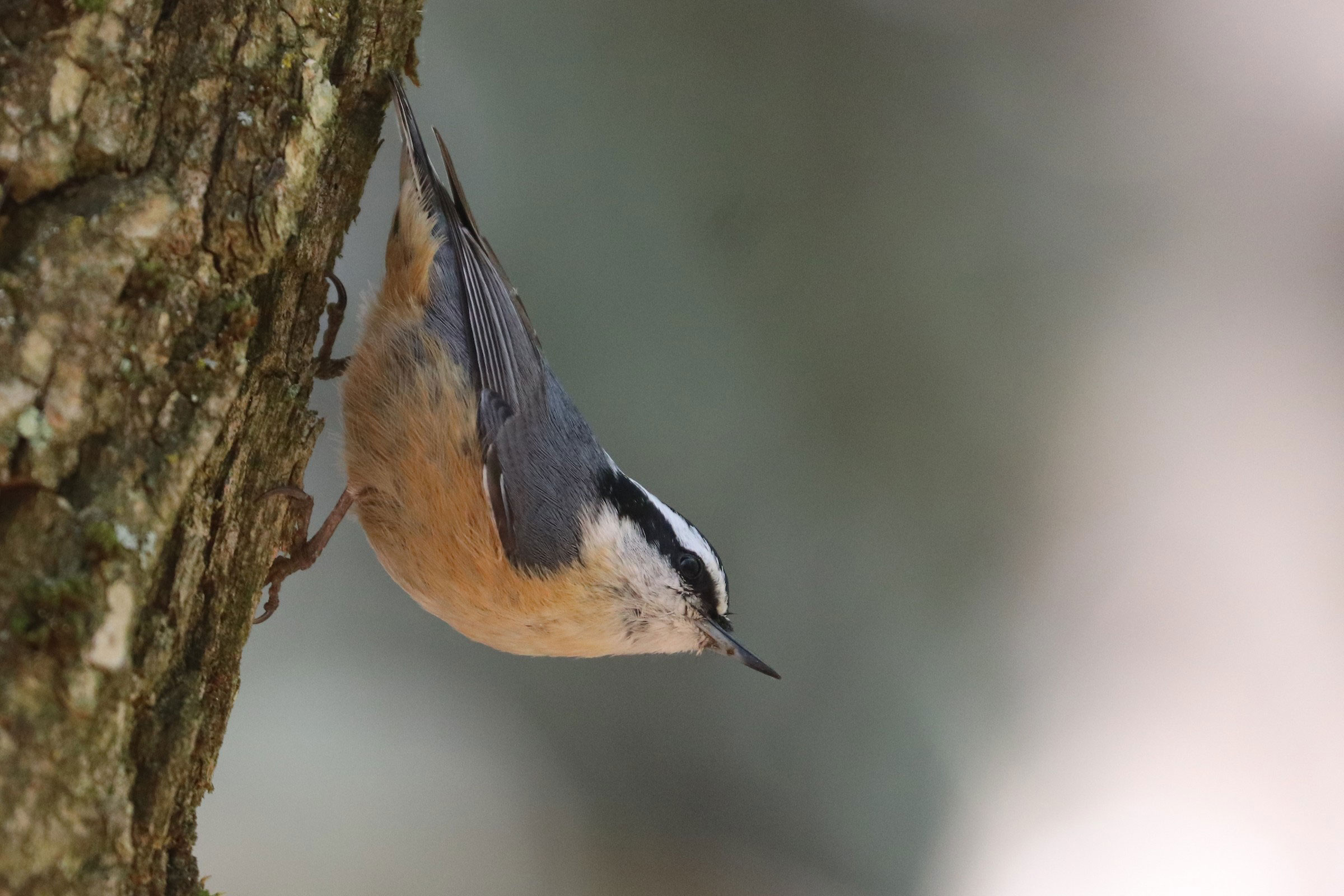
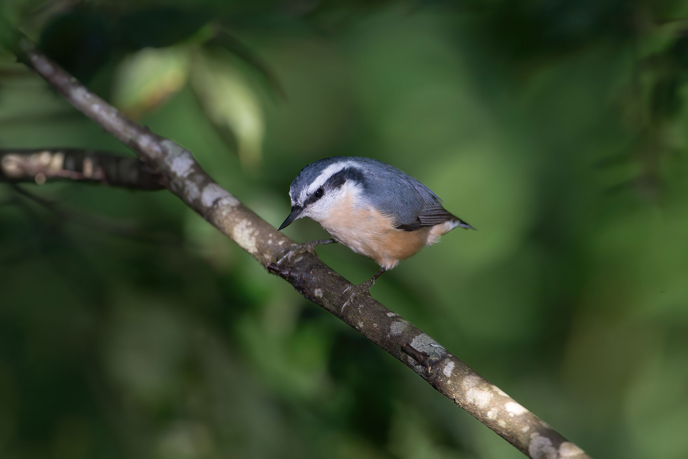
The Red-breasted Nuthatch is a plucky bird of northern spruce forests whose tinny, excitable honking characterizes backyard feeders and montane wilderness alike. In contrast to its sedentary relatives, the Red-breasted Nuthatch is migratory. Its irruptive movements after poor cone crops make it an exciting potential find throughout the state starting in winter, most recently in 2018 and 2020 (Gochfeld and Johnson 2020). Its breeding, however, is restricted to scattered high-elevation sites in the Mountains and Valleys region, where it favors boreal forest with red spruce (Picea rubens) and Fraser fir (Abies fraseri), characteristic of the “Canadian zone” in the vicinity of Mount Rogers and Whitetop Mountain. Additionally, in the southern Blue Ridge Mountains, they breed in stands of eastern hemlock (Tsuga canadensis) and white pine (Pinus strobus) (Simpson 1976).
Breeding Distribution
The Red-breasted Nuthatch is primarily a northern species, and its presence in Virginia represents a southern range extension along the Appalachian Mountains. During irruption years, it may winter in any county in the state. Breeding occurs only in the Mountains and Valleys region, typically above 3,000 ft (914 m) in elevation (Figure 1). The species is most likely to be found along the ridgeline at the West Virginia border in Highland and Rockingham Counties, as well as on Mount Rogers. Its likelihood of occurring in a block increases dramatically with elevation and slightly with large forest patches, though coniferous forest was not modeled separately. This strong correlation illustrates the importance of elevation in restricting their distribution.
Because of limited breeding data, its distribution during the First Atlas and its change between the two Atlas periods could not be modeled (please see the Breeding Evidence section for more information about its distribution during the First Atlas).
View Environmental Associations

Figure 1: Red-breasted Nuthatch breeding distribution based on probability of occurrence (Second Atlas, 2016–2020). This map indicates the probability that this species will occur in an Atlas block (an approximately 10 mi2 [26 km2] survey unit) based on environmental (including habitat) factors and after adjusting for the probability of detection (variation in survey effort among blocks). Blocks in gray are outside the species’ core range and were not modeled.
Breeding Evidence
Red-breasted Nuthatches were confirmed breeders in nine blocks and six counties (Figure 2). These locations included Grayson Highlands State Park near Mount Rogers (Grayson County), Whitetop Mountain (Grayson and Smyth Counties), Sugar Grove (Smyth County), Huckleberry Knob (Wythe County), Poor Mountain (Roanoke County), Laurel Fork Wilderness (Highland County), and multiple locations near Reddish Knob (Rockingham County). Probable and possible breeding was observed at several other high-elevation sites. Despite scattered sightings in the Piedmont region during the Second Atlas, there were no probable or confirmed breeding records there during either Atlas period, and the species was restricted to the Mountains and Valleys region (Figures 2 and 3).
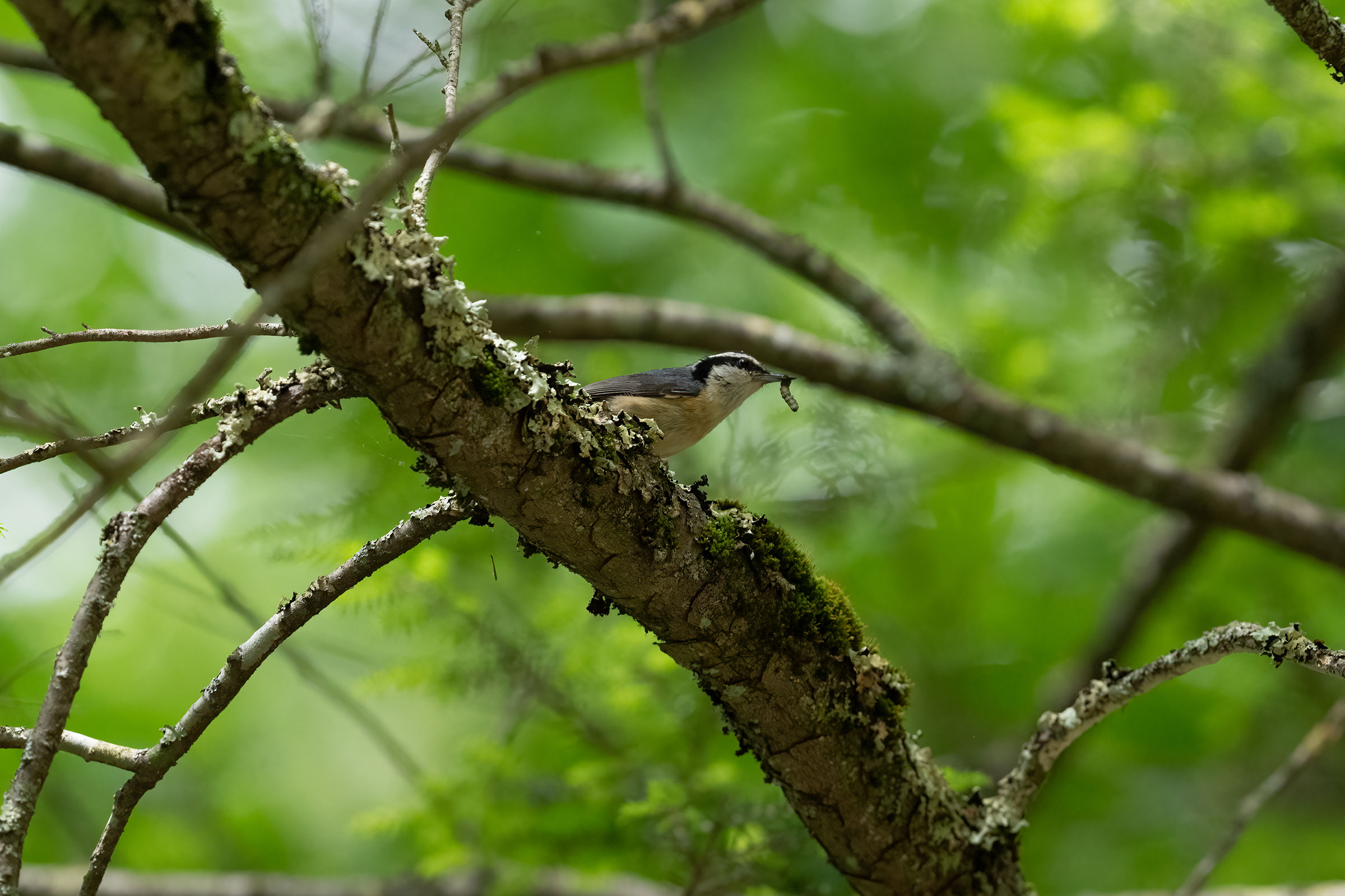
Nearly all confirmations were from adults carrying food or observations of recently fledged young. Red-breasted Nuthatches breed in unobtrusive cavities that may be excavated prior to the breeding season. They apply resin to the outside of the nest cavity and dive straight in rather than lingering on the tree (Ghalambor and Martin 2020), a behavior that may make nests hard to locate.
Red-breasted Nuthatches were documented breeding from May 28 (adults carrying food) through July 17 (recently fledged young) (Figure 4). For more general information on the breeding habits of this species, please refer to All About Birds.
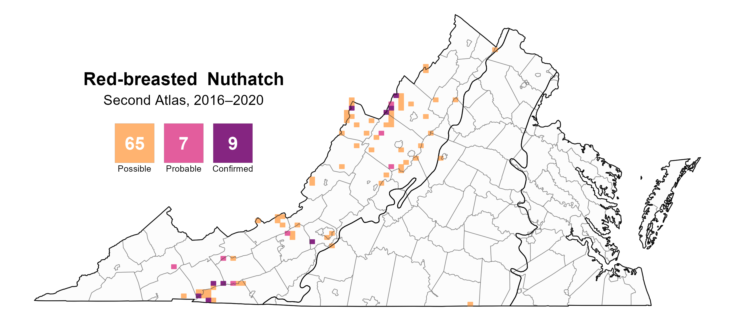
Figure 2: Red-breasted Nuthatch breeding observations from the Second Atlas (2016–2020). The colored boxes illustrate Atlas blocks (approximately 10 mi2 [26 km2] survey units) where the species was detected. The colors show the highest breeding category recorded in a block. The numbers within the colors in the legend correspond to the number of blocks with that breeding evidence category.
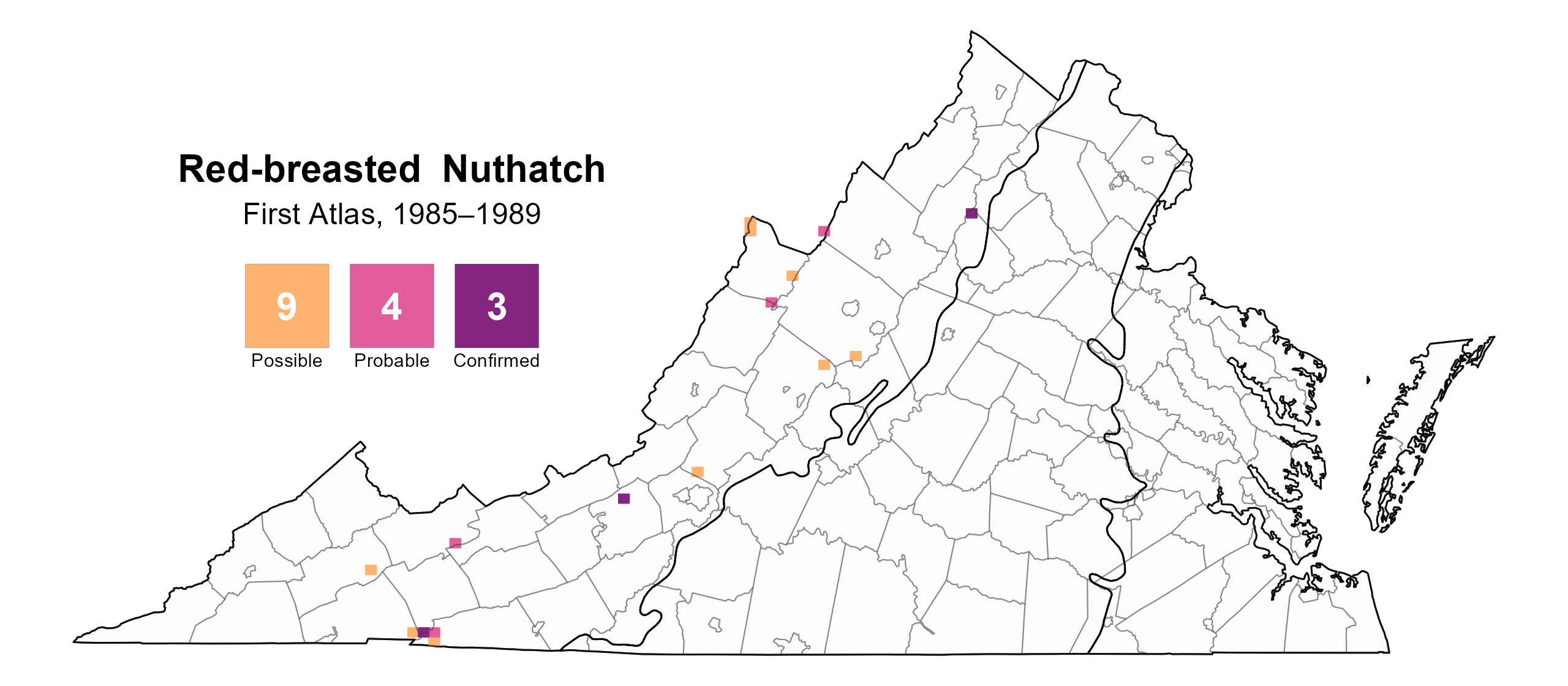
Figure 3: Red-breasted Nuthatch breeding observations from the First Atlas (1985–1989). The colored boxes illustrate Atlas blocks (approximately 10 mi2 [26 km2] survey units) where the species was detected. The colors show the highest breeding category recorded in a block. The numbers within the colors in the legend correspond to the number of blocks with that breeding evidence category.

Figure 4: Red-breasted Nuthatch phenology: confirmed breeding codes. This graph shows a timeline of confirmed breeding behaviors. Tick marks represent individual observations of the behavior.
Population Status
Due to a lack of detections during point count surveys, an abundance model could not be run for this species. The North American Breeding Bird Survey (BBS) coverage in Virginia is limited. At the Atlantic Flyway scale, BBS data show that the species experienced a significant increase of 2.23% per year from 1966–2022 (Hostetler et al. 2023; Figure 5). Between Atlas periods (1987–2018), they experienced a significant increase of 4.35% per year from 1987–2018 across the Atlantic Flyway.
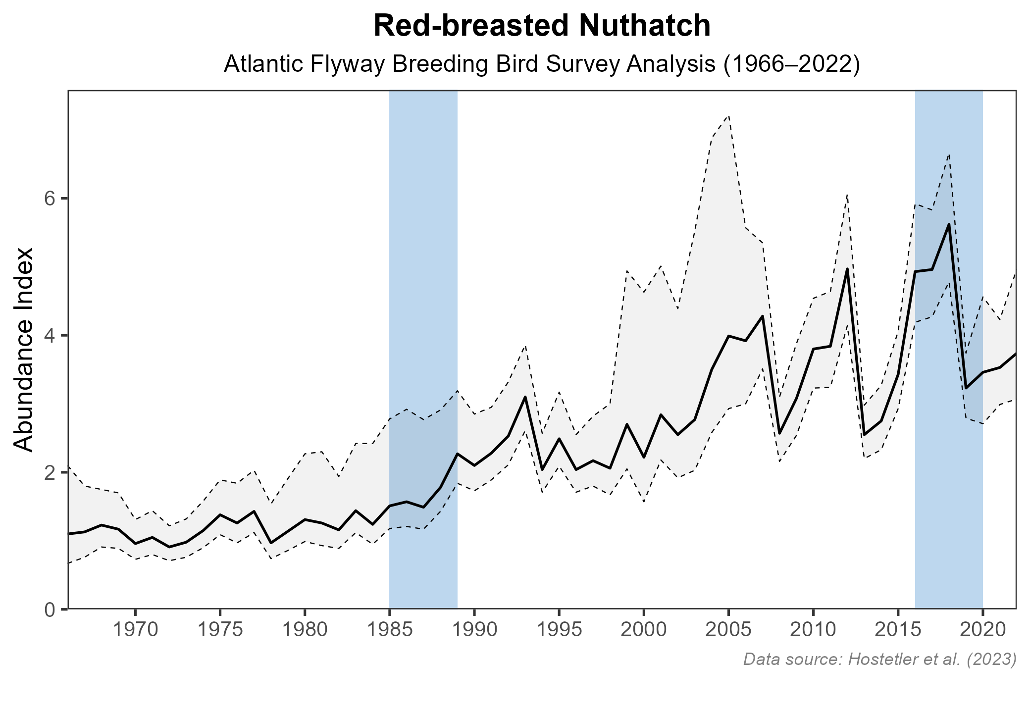
Figure 5: Red-breasted Nuthatch population trend for the Atlantic Flyway as estimated by the North American Breeding Bird Survey. The vertical axis shows species abundance; the horizontal axis shows the year. The solid line indicates the estimated population trend; there is a 97.5% probability that the true population trend falls between the dashed lines. The shaded bars indicate the First and Second Atlas periods.
Conservation
The Red-breasted Nuthatch is not currently a species of concern in Virginia. However, Red-breasted Nuthatches are strongly associated with Fraser fir and red spruce forests, a rare community type threatened by air pollution and the invasive balsam woolly adelgid (Adelges piceae) (VDCR 2021). To date, changes to their high-elevation habitats do not seem to have negatively affected the species in Virginia.
Interactive Map
The interactive map contains up to six Atlas layers (probability of occurrence for the First and Second Atlases, change in probability of occurrence between Atlases, breeding evidence for the First and Second Atlases, and abundance for the Second Atlas) that can be viewed one at a time. To view an Atlas map layer, mouse over the layer box in the upper left. County lines and physiographic regional boundaries (Mountains and Valleys, Piedmont, and Coastal Plain) can be turned on and off by checking or unchecking the box below the layer box. Within the map window, users can hover on a block to see its value for each layer and pan and zoom to see roads, towns, and other features of interest that are visible beneath a selected layer.
View Interactive Map in Full Screen
References
Ghalambor, C. K. and T. E. Martin (2020). Red-breasted Nuthatch (Sitta canadensis), version 1.0. In Birds of the World (A. F. Poole and F. B. Gill, Editors). Cornell Lab of Ornithology, Ithaca, NY, USA. https://doi.org/10.2173/bow.rebnut.01.
Gochfeld, D., and T. Johnson (2020). Migration alert: Red-breasted Nuthatch. BirdCast. https://birdcast.info/news/migration-alert-red-breasted-nuthatch/.
Hostetler, J. A., J. R. Sauer, J. E. Hines, D. Ziolkowski, and M. Lutmerding (2023). The North American breeding bird survey, analysis results 1966–2022. U.S. Geological Survey, Laurel, MD, USA. https://doi.org/10.5066/P9SC7T11.
Rottenborn, S. C., and E. S. Brinkley (Editors) (2007). Virginia’s birdlife: An annotated checklist. 4th edition. Virginia Society of Ornithology.
Simpson, M. B., Jr. (1976). Breeding season habitat and distribution of the Red-breasted Nuthatch in the Southern Blue Ridge Mountain Province. The Chat:23–24.
Virginia Department of Conservation and Recreation (VDCR) (2021). Spruce and fir forests. In The Natural Communities of Virginia Classification of Ecological Groups and Community Types, Third Approximation (version 3.3). https://www.dcr.virginia.gov/natural-heritage/natural-communities/ncta1.