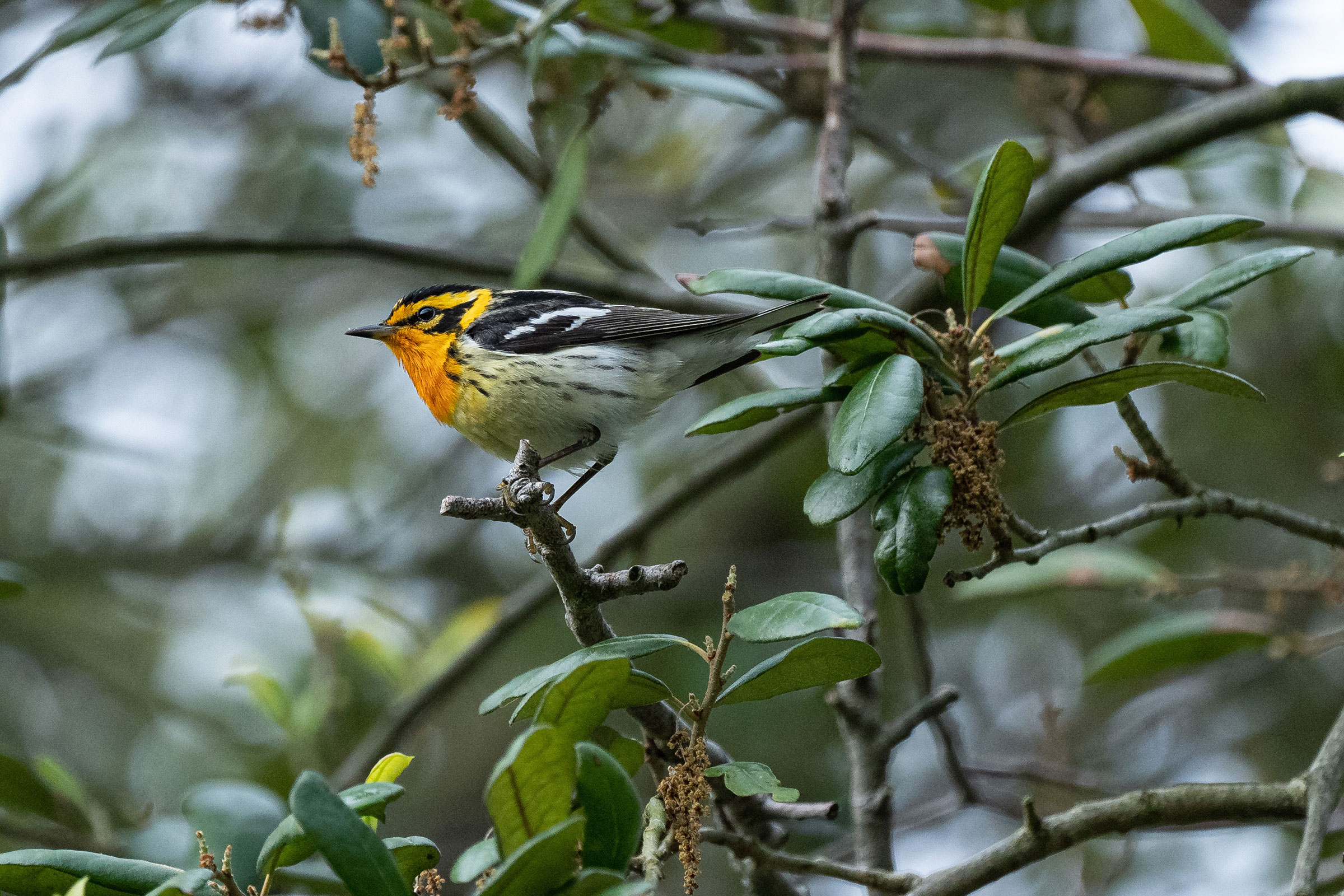
Introduction
The wash of bright orange across the throat and face of the male Blackburnian Warbler stands in contrast to its less conspicuous, high-pitched song. In Virginia, it is most frequently encountered as a migrant, though it is uncommon to fairly rare across the state (Rottenborn and Brinkley 2007). Its core breeding range lies in the northern boreal zone, but its distribution extends into the Appalachian Mountains as far south as Tennessee (Morse 2020). Blackburnian Warblers primarily nest in mature coniferous and mixed coniferous-deciduous forests. In the southern portion of their range, including Virginia, they are often associated with deciduous forests that have no coniferous component (Morse 2020).
Breeding Distribution
Blackburnian Warblers are found only in the Mountains and Valleys region. Within most of this region, Blackburnian Warblers are absent or not very likely to occur, except for isolated areas where there is high-elevation forest habitat in mountainous areas bordering West Virginia and the Blue Ridge Mountains (Figure 1). Accordingly, the likelihood of Blackburnian Warblers occurring in a block is strongly positively associated with elevation. They are also slightly more likely to occur in blocks with a high percentage of forest cover.
Due to data and model limitations, no distribution model was developed for the First Atlas nor was a change model produced (see Interpreting Species Accounts). For more information on its distribution during the First Atlas, please see the Breeding Evidence section.
View Environmental Associations
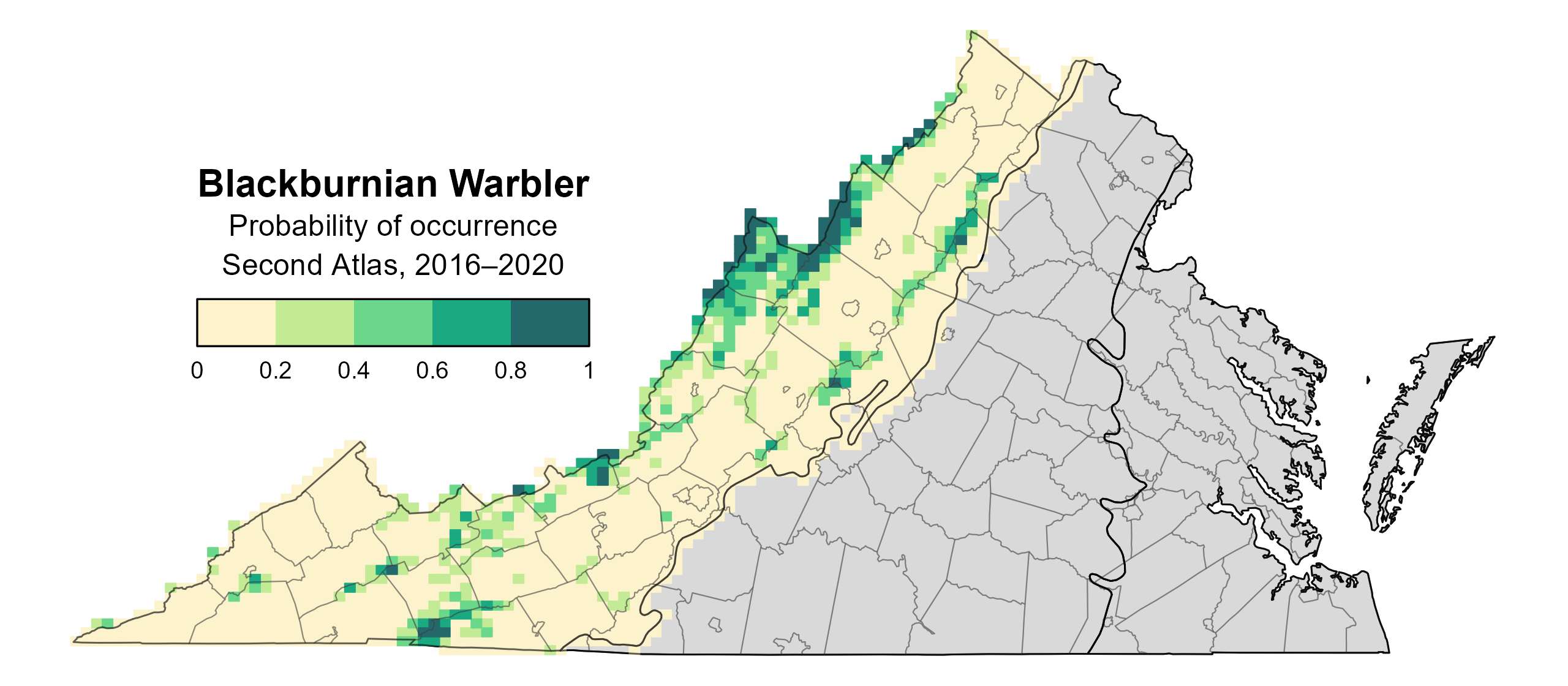
Figure 1: Blackburnian Warbler breeding distribution based on probability of occurrence (Second Atlas, 2016–2020). This map indicates the probability that this species will occur in an Atlas block (an approximately 10 mi2 [26 km2] survey unit) based on environmental (including habitat) factors and after adjusting for the probability of detection (variation in survey effort among blocks). Blocks in gray are outside the species’ core range and were not modeled.
Breeding Evidence
Blackburnian Warblers were confirmed breeders in 22 blocks and 12 counties (Amherst, Augusta, Bedford, Bland, Frederick, Giles, Highland, Madison, Rockbridge, Rockingham, Smyth, and Wise) and found to be probable breeders in five additional counties (Figure 2). Breeding observations were sparsely distributed throughout the Mountains and Valleys region during the First Atlas (Figure 3).
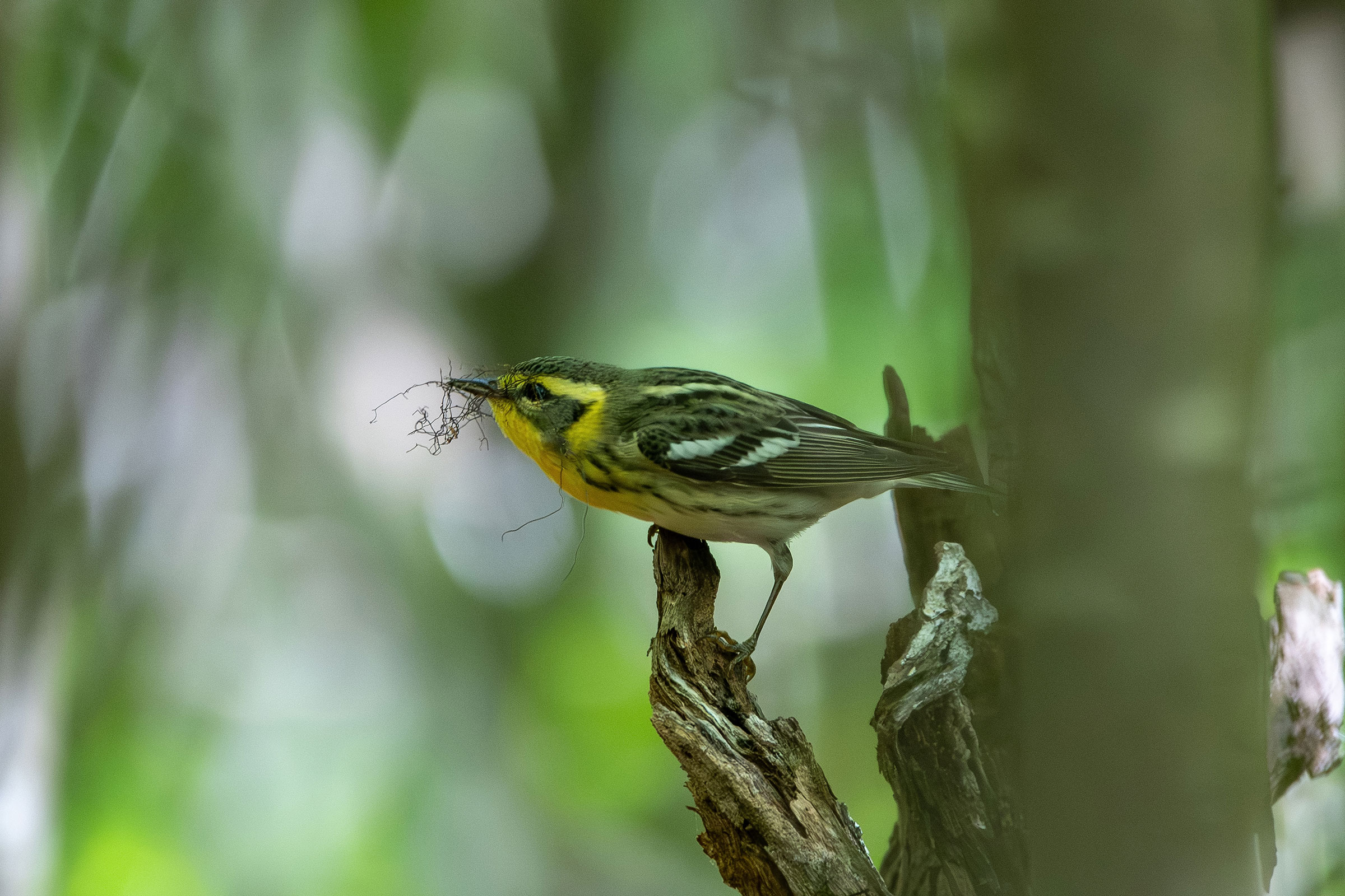
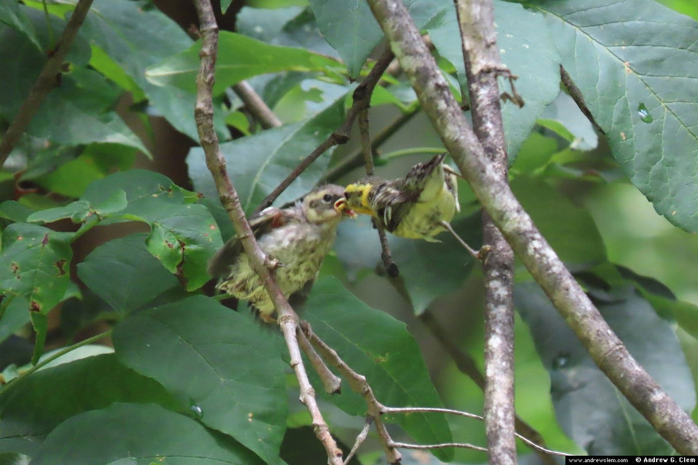
An observation of adults carrying nesting material was the earliest breeding behavior recorded by volunteers in early May followed by observations of an occupied nest (Figure 4). Breeding was primarily confirmed through observations of adults carrying food (June 3 – July 10), recently fledged young (June 18 – July 28), and adults feeding young (June 11 – July 9) (Figure 4).
For more general information on the breeding habits of this species, please refer to All About Birds.
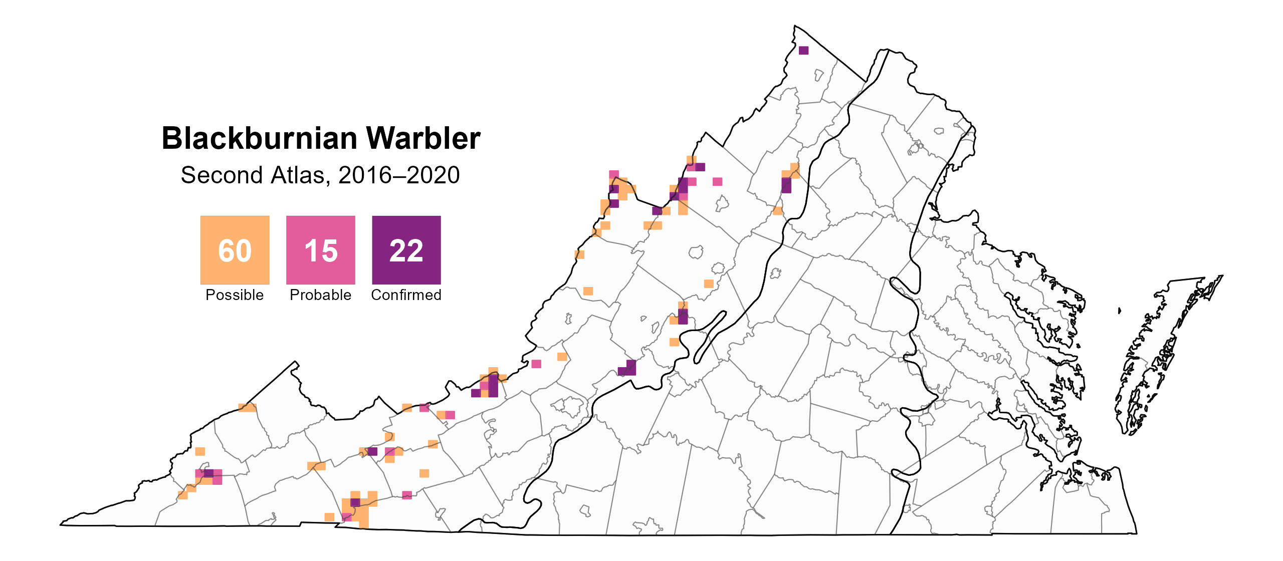
Figure 2: Blackburnian Warbler breeding observations from the Second Atlas (2016–2020). The colored boxes illustrate Atlas blocks (approximately 10 mi2 [26 km2] survey units) where the species was detected. The colors show the highest breeding category recorded in a block. The numbers within the colors in the legend correspond to the number of blocks with that breeding evidence category.
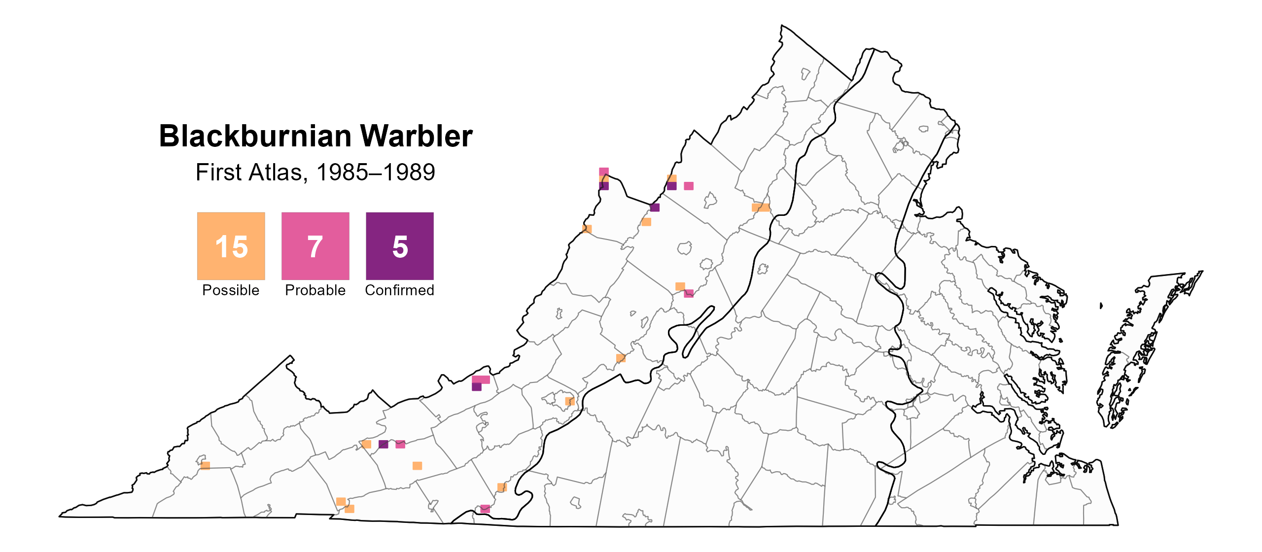
Figure 3: Blackburnian Warbler breeding observations from the First Atlas (1985–1989). The colored boxes illustrate Atlas blocks (approximately 10 mi2 [26 km2] survey units) where the species was detected. The colors show the highest breeding category recorded in a block. The numbers within the colors in the legend correspond to the number of blocks with that breeding evidence category.
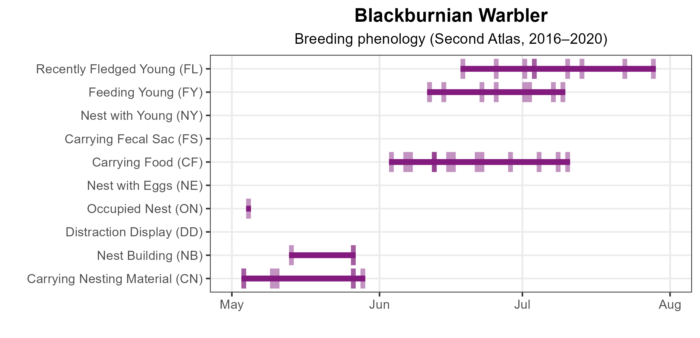
Figure 4: Blackburnian Warbler phenology: confirmed breeding codes. This graph shows a timeline of confirmed breeding behaviors. Tick marks represent individual observations of the behavior.
Population Status
Blackburnian Warbler relative abundance was estimated to be highest in the counties bordering West Virginia and along the Blue Ridge Mountains (Figure 5).
The total estimated Blackburnian Warbler population in the state is approximately 59,000 individuals (with a range between 28,000 and 128,000). Based on North American Breeding Bird Survey (BBS) data for the Atlantic Flyway region (data for Virginia do not produce credible population trends), the Blackburnian Warbler population showed a significant increase of 0.55% per year from 1966–2022 in the region, and between Atlas periods, it increased by a nonsignificant rate of 0.35% per year (Hostetler et al. 2023; Figure 6).
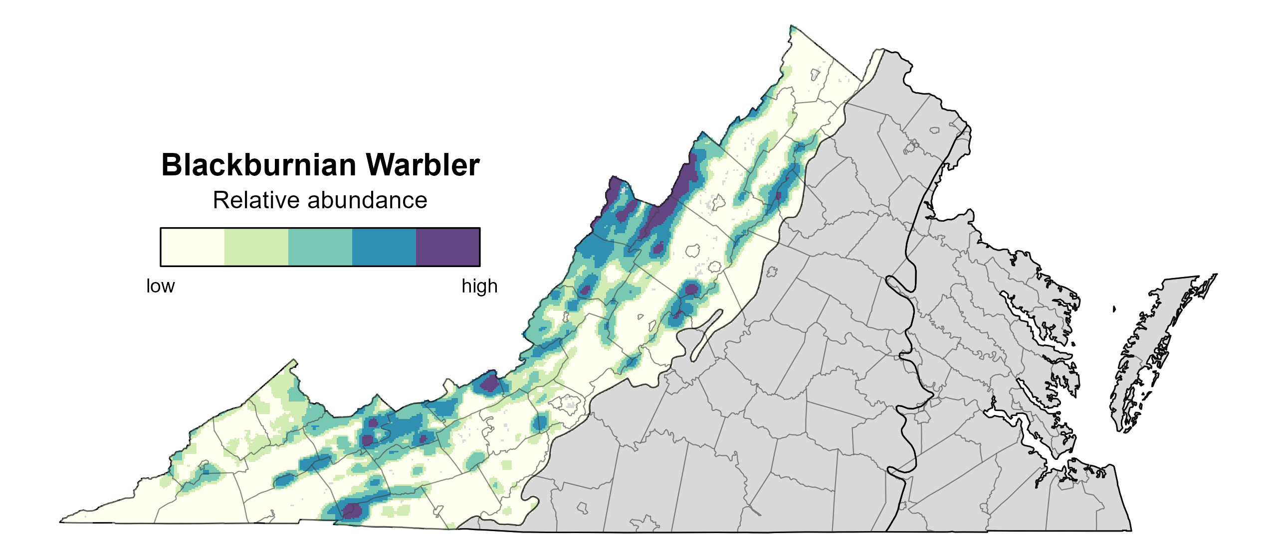
Figure 5: Blackburnian Warbler relative abundance (Second Atlas, 2016–2020). This map indicates the predicted abundance of this species at a 0.4 mi2 (1 km2) scale based on environmental (including habitat) factors. Abundance values are presented on a relative scale of low to high. Areas in gray are outside the species’ core range and were not modeled.
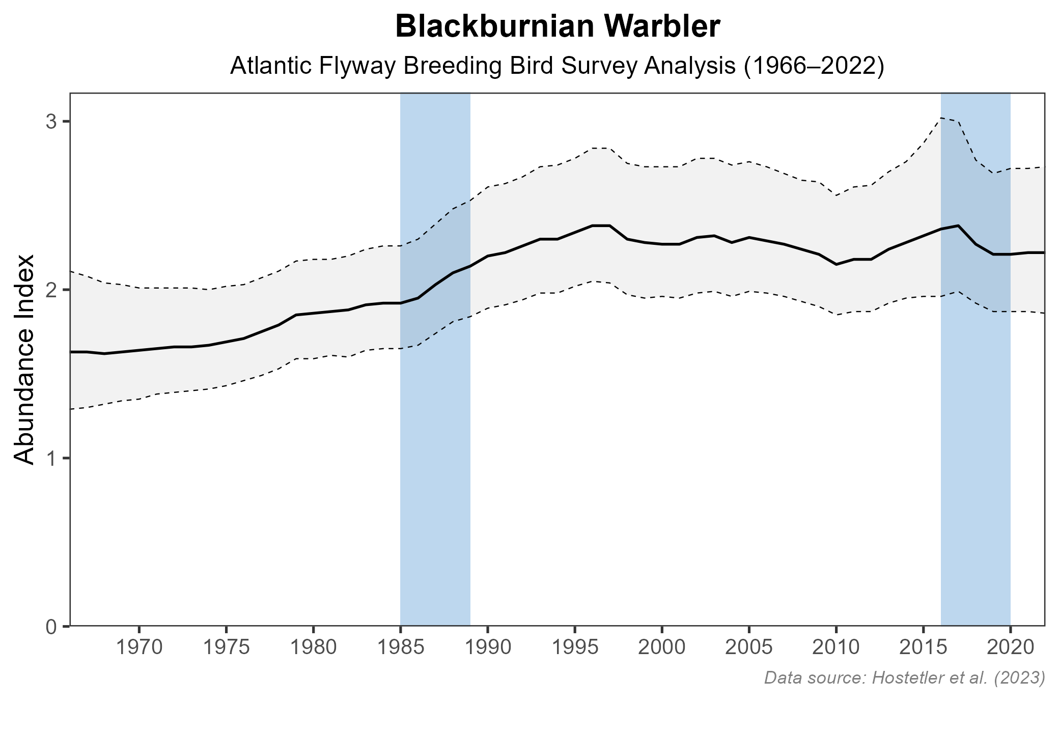
Figure 6: Blackburnian Warbler population trend for the Atlantic Flyway as estimated by the North American Breeding Bird Survey. The vertical axis shows species abundance; the horizontal axis shows the year. The solid line indicates the estimated population trend; there is a 97.5% probability that the true population trend falls between the dashed lines. The shaded bars indicate the First and Second Atlas periods.
Conservation
Although limited in Virginia, Blackburnian Warblers are stable, and throughout their range, they are common and widespread (Morse 2020). Thus, no species-specific conservation efforts are underway in the state. However, deforestation and reforestation efforts targeted at other species within its range would also benefit the Blackburnian Warbler.
Interactive Map
The interactive map contains up to six Atlas layers (probability of occurrence for the First and Second Atlases, change in probability of occurrence between Atlases, breeding evidence for the First and Second Atlases, and abundance for the Second Atlas) that can be viewed one at a time. To view an Atlas map layer, mouse over the layer box in the upper left. County lines and physiographic regional boundaries (Mountains and Valleys, Piedmont, and Coastal Plain) can be turned on and off by checking or unchecking the box below the layer box. Within the map window, users can hover on a block to see its value for each layer and pan and zoom to see roads, towns, and other features of interest that are visible beneath a selected layer.
View Interactive Map in Full Screen
References
Cornell Lab of Ornithology (2025). All About Birds. Cornell Lab of Ornithology, Ithaca, NY, USA.
Fleming, G.P., K.D. Patterson, and K. Taverna (2021). The natural communities of Virginia: a classification of ecological community groups and community types. Third approximation. Version 3.3. Virginia Department of Conservation and Recreation, Division of Natural Heritage, Richmond, VA, USA. www.dcr.virginia.gov/natural-heritage/natural-communities.
Hostetler, J. A., J. R. Sauer, J. E. Hines, D. Ziolkowski, and M. Lutmerding (2023). The North American breeding bird survey, analysis results 1966–2022. U.S. Geological Survey, Laurel, MD, USA. https://doi.org/10.5066/P9SC7T11.
Morse, D. H. (2020). Blackburnian Warbler (Setophaga fusca), version 1.0. In Birds of the World (A. F. Poole, Editor). Cornell Lab of Ornithology, Ithaca, NY, USA. https://doi.org/10.2173/bow.bkbwar.01.
Rottenborn, S. C., and E. S. Brinkley (Editors) (2007). Virginia’s birdlife: an annotated checklist. 4th edition. Virginia Society of Ornithology.