Introduction
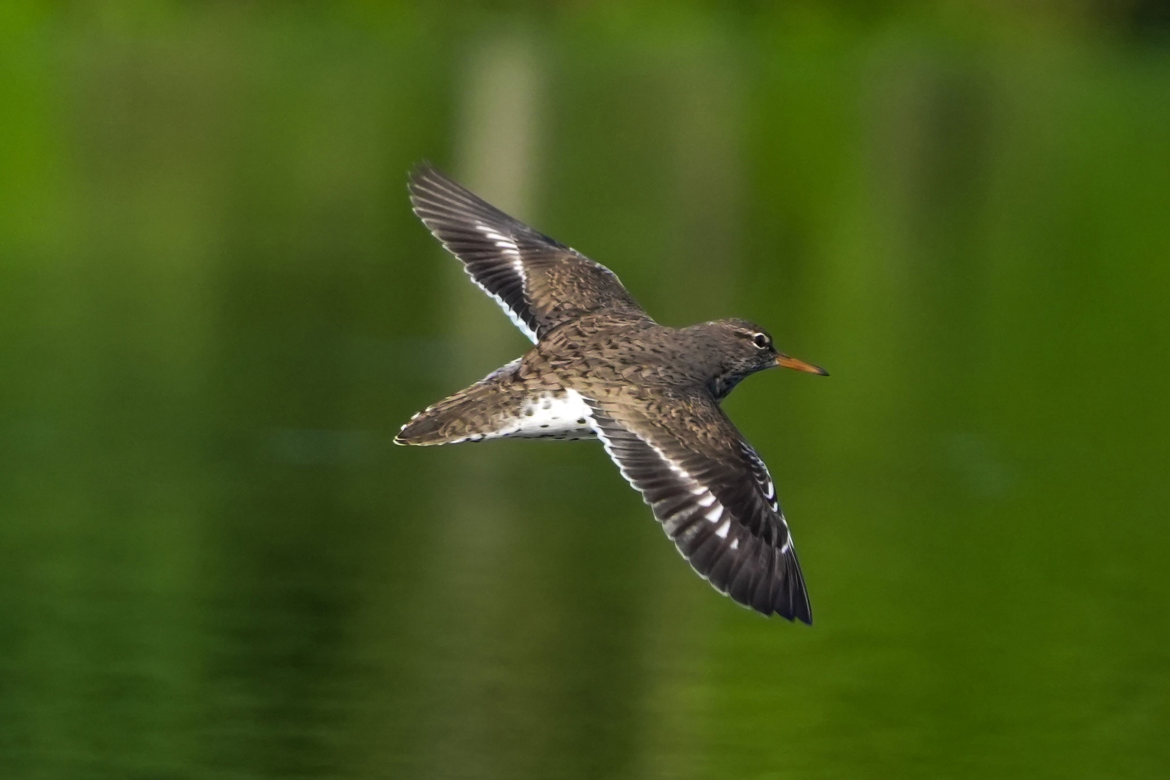
Sandpipers can be hard to identify, but the Spotted Sandpiper makes things a little easier. They are the most widely distributed sandpiper in North America and have a habit of bobbing their tails constantly while foraging, making them easier to identify than similar looking sandpipers that walk without bobbing. Spotted Sandpipers are found near many types of water, including creeks, rivers, and coastal shorelines (Reed et al. 2020). In Virginia, Spotted Sandpipers are common in inland riparian forest areas and along the coast (Harding 2009).
Breeding Distribution
During the Second Breeding Bird Atlas, there were too few breeding observations to develop occupancy models for the Spotted Sandpiper. Please see the Breeding Evidence section for more information on its breeding distribution.
Breeding Evidence
Spotted Sandpipers were confirmed breeders in just one block and one county (Prince Edward) and found to be probable breeders in four additional counties (Figure 1). A general lack of breeding records is testament to the difficulty in observing Spotted Sandpiper behaviors and finding nests, which are typically placed on the ground beneath broadleaf plants. As such, there were very few confirmed and probable breeders during the First Atlas as well (Figure 2).
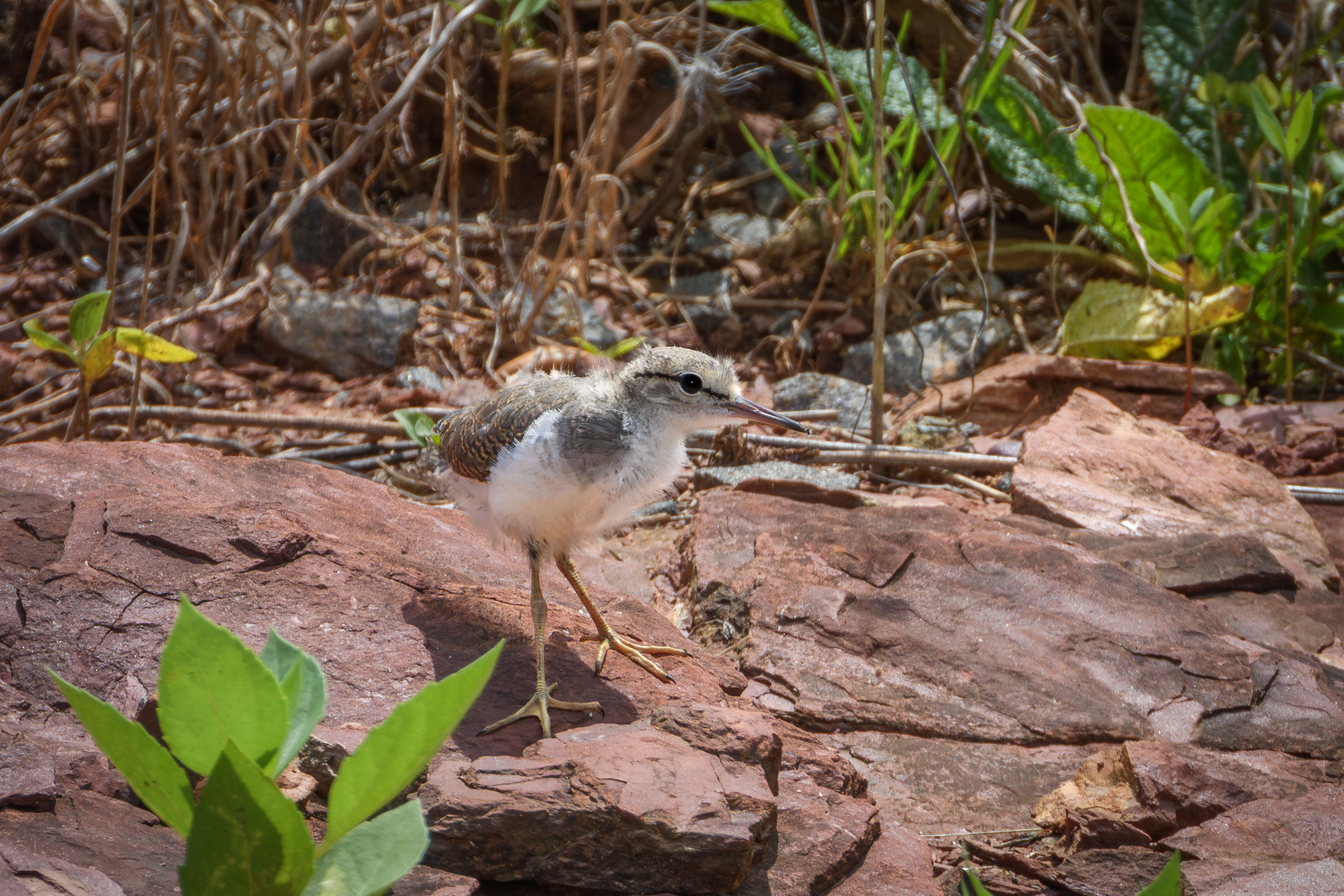
The only Spotted Sandpiper pair confirmed breeding during the Second Atlas was documented based on an observation of recently fledged young on July 25 (Figure 3).
For more general information on the breeding habits of this species, please refer to All About Birds.
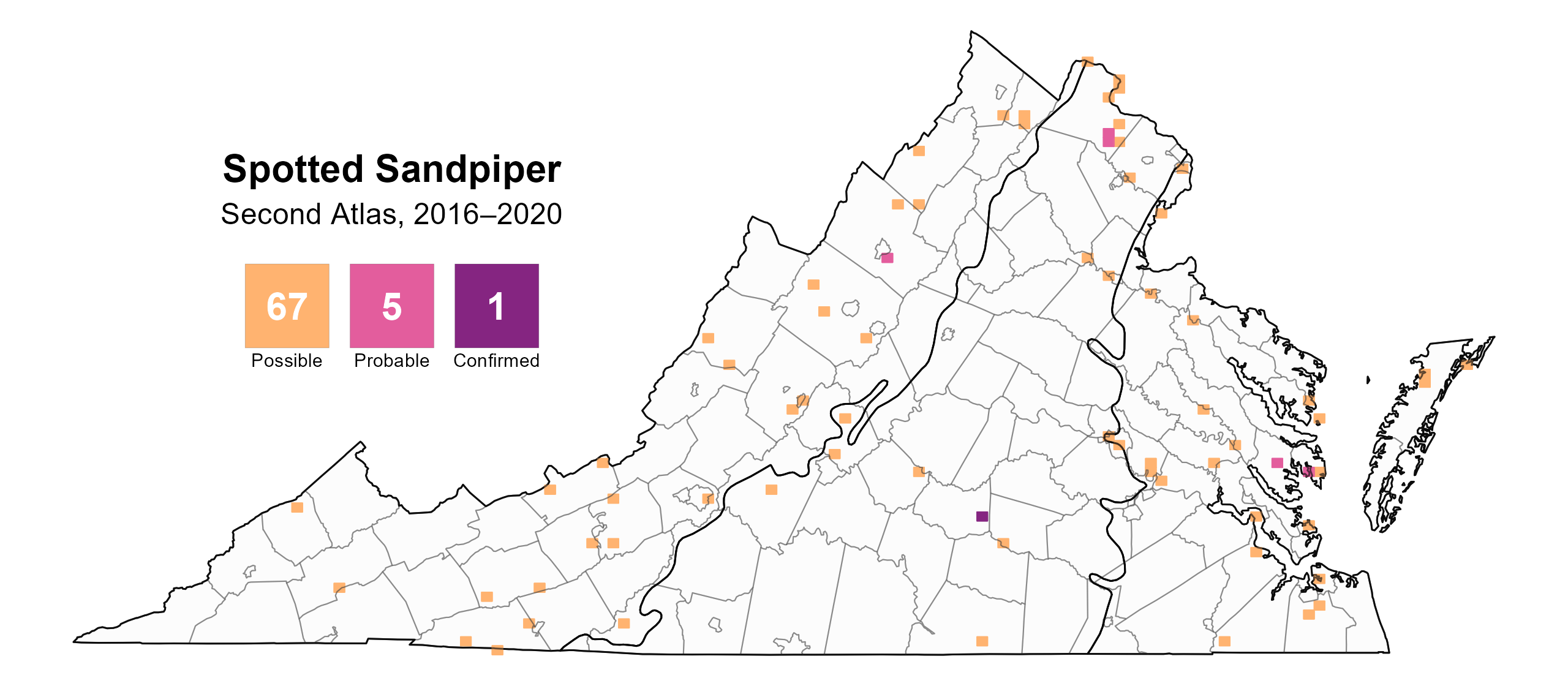
Figure 1: Spotted Sandpiper breeding observations from the Second Atlas (2016–2020). The colored boxes illustrate Atlas blocks (approximately 10 mi2 [26 km2] survey units) where the species was detected. The colors show the highest breeding category recorded in a block. The numbers within the colors in the legend correspond to the number of blocks with that breeding evidence category.
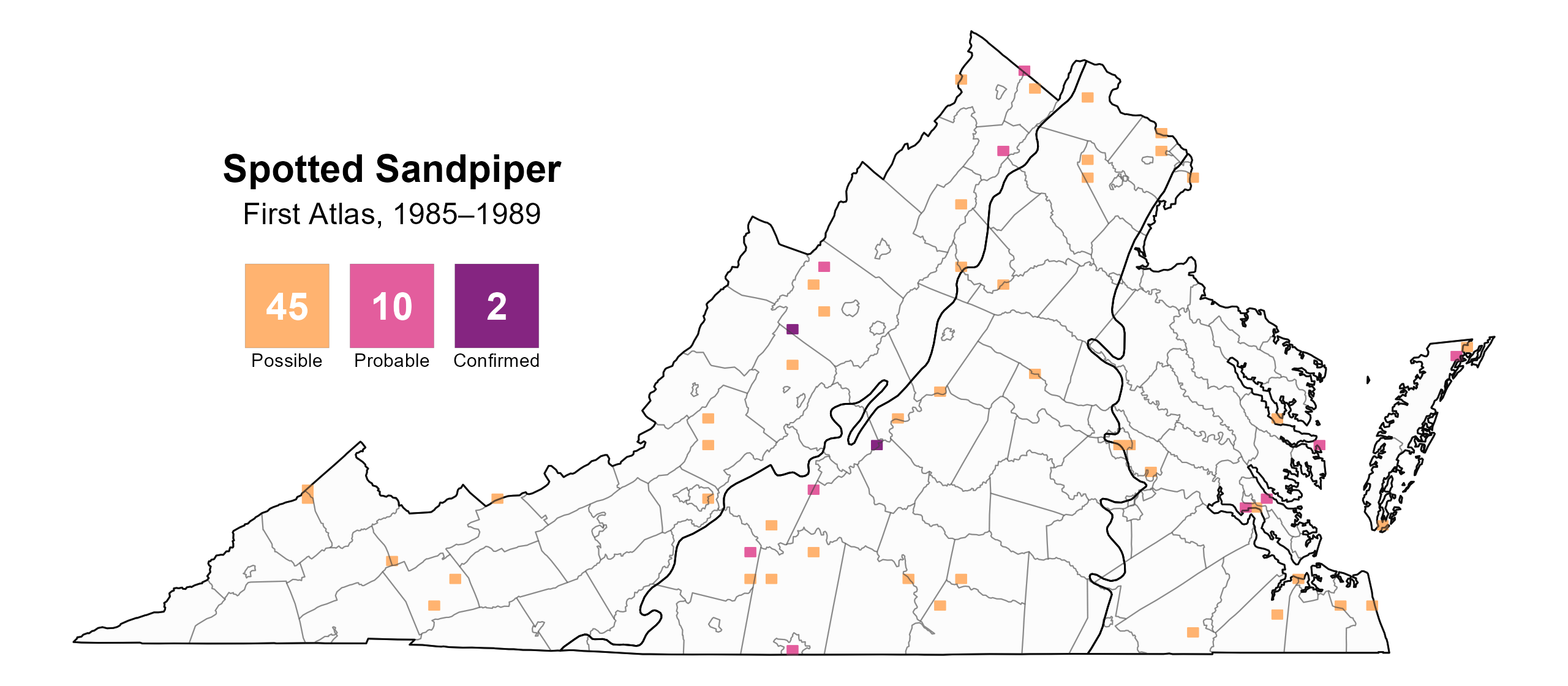
Figure 2: Spotted Sandpiper breeding observations from the First Atlas (1985–1989). The colored boxes illustrate Atlas blocks (approximately 10 mi2 [26 km2] survey units) where the species was detected. The colors show the highest breeding category recorded in a block. The numbers within the colors in the legend correspond to the number of blocks with that breeding evidence category.

Figure 3: Spotted Sandpiper phenology: confirmed breeding codes. This graph shows a timeline of confirmed breeding behaviors. Tick marks represent individual observations of the behavior.
Population Status
The abundance of Spotted Sandpipers could not be modeled from Atlas point count surveys because the species is not reliably detected using that survey methodology. Additionally, given that Spotted Sandpipers also are not regularly observed during North American Breeding Bird Surveys (BBS), BBS population trends at the state and regional level are not credible. The BBS trend for the Atlantic Flyway estimated a significant annual decline of 3.22% from 1966–2022 (Hostetler et al. 2023). Although this trend is credible, it is unknown whether it reflects the trajectory of the Virginia population.
Conservation
Although the Spotted Sandpiper is common and widespread throughout its range, the lack of a population trend does not allow it to be assessed as a potential Species of Greatest Conservation Need. Because of this, the 2025 Virginia Wildlife Action Plan identifies this species as an Assessment Priority Species (VDWR 2025). This rank indicates that this data gap needs to be filled to properly determine the conservation status of Spotted Sandpiper within the state.
Interactive Map
The interactive map contains up to six Atlas layers (probability of occurrence for the First and Second Atlases, change in probability of occurrence between Atlases, breeding evidence for the First and Second Atlases, and abundance for the Second Atlas) that can be viewed one at a time. To view an Atlas map layer, mouse over the layer box in the upper left. County lines and physiographic regional boundaries (Mountains and Valleys, Piedmont, and Coastal Plain) can be turned on and off by checking or unchecking the box below the layer box. Within the map window, users can hover on a block to see its value for each layer and pan and zoom to see roads, towns, and other features of interest that are visible beneath a selected layer.
View Interactive Map in Full Screen
References
Harding, S. (2009). The 2008 VSO foray–breeding birds of riparian areas. The Raven:79.
Hostetler, J. A., J. R. Sauer, J. E. Hines, D. Ziolkowski, and M. Lutmerding (2023). The North American breeding bird survey, analysis results 1966–2022. U.S. Geological Survey, Laurel, MD, USA. https://doi.org/10.5066/P9SC7T11.
Reed, J. M., L. W. Oring, and E. M. Gray (2020). Spotted Sandpiper (Actitis macularius), version 1.0. In Birds of the World (A. F. Poole, Editor). Cornell Lab of Ornithology, Ithaca, NY, USA. https://doi.org/10.2173/bow.sposan.01.
Virginia Department of Wildlife Resources (VDWR). 2025. Virginia wildlife action plan. Virginia Department of Wildlife Resources, Henrico, VA, USA. 506 pp.