Introduction
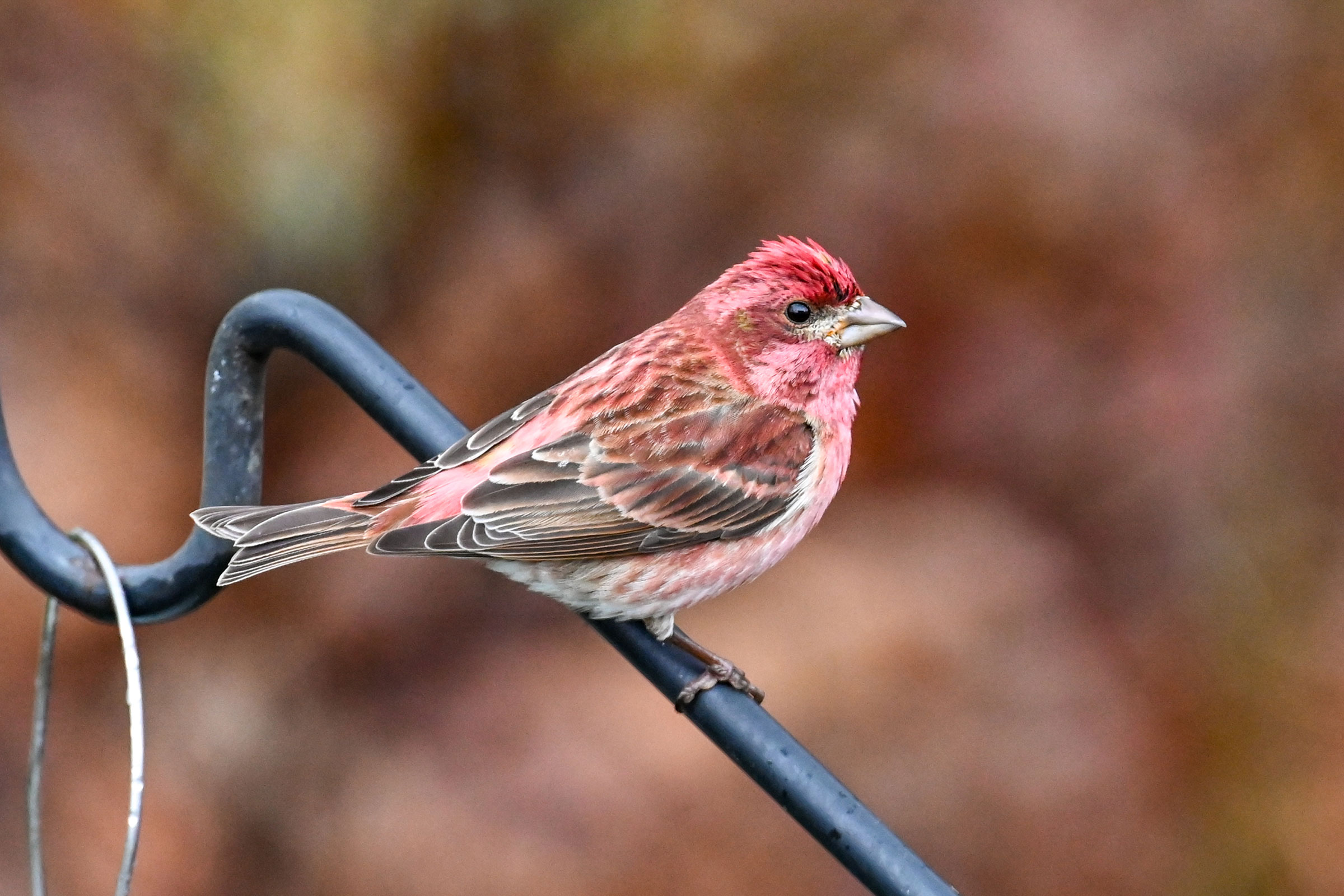
In eastern North America, Purple Finches breed primarily from central West Virginia north through New England and into Canada. They are casual breeders in the mountainous portions of western Virginia, generally in coniferous or mixed forests. House Finches (Haemorhous mexicanus) and Purple Finches are sometimes confused. To differentiate the two, look for the Purple Finch’s larger bill, prominent superciliary (eye) line, and much deeper red/purple color (Wootton 2020).
Breeding Distribution
Limitations imposed by the data prevented the development of distribution models for the Purple Finch. For more information on its distribution in Virginia, please see the Breeding Evidence section.
Breeding Evidence
Purple Finches were confirmed breeders in one block in a forest with red spruce (Picea rubens) in Highland County (Locust Springs, George Washington National Forest), and they were also found to be probable breeders in a second location in that county (Figure 1). The Purple Finch has been reported as a summer resident in the Mount Rogers Area (Rottenborn and Brinkley 2007) and was documented there as a probable breeder during the First Atlas (Figure 2).
Although it does not appear on the Second Atlas breeding evidence map, the species is known to persist on Mount Rogers as it was detected there during high-elevation bird surveys in 2006 (Lessig 2007). More recently, two singing males were reported in the area in July 2017, but this record could not be assigned to a specific block due to locational uncertainty. No confirmed breeders were recorded during the First Atlas (Figure 2).
Breeding was confirmed through the observation of a single female carrying nest material on June 8. For more general information on the breeding habits of this species, please refer to All About Birds.

Figure 1: Purple Finch breeding observations from the Second Atlas (2016–2020). The colored boxes illustrate Atlas blocks (approximately 10 mi2 [26 km2] survey units) where the species was detected. The colors show the highest breeding category recorded in a block. The numbers within the colors in the legend correspond to the number of blocks with that breeding evidence category.
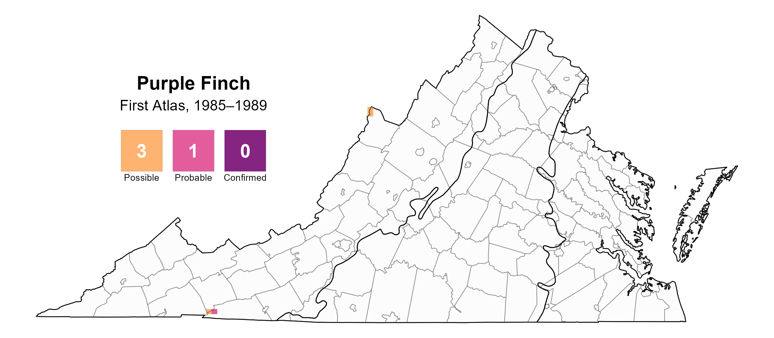
Figure 2: Purple Finch breeding observations from the First Atlas (1985–1989). The colored boxes illustrate Atlas blocks (approximately 10 mi2 [26 km2] survey units) where the species was detected. The colors show the highest breeding category recorded in a block. The numbers within the colors in the legend correspond to the number of blocks with that breeding evidence category.

Figure 3: Purple Finch phenology: confirmed breeding codes. This graph shows a timeline of confirmed breeding behaviors. Tick marks represent individual observations of the behavior.
Population Status
Given the lack of detections during the point count surveys, an abundance model for the Purple Finch could not be developed. Similarly, data from the North American Breeding Bird Survey (BBS) were insufficient in determining reliable population trend estimates for the Purple Finch within Virginia. However, at the Atlantic Flyway scale, BBS data showed that this species declined by a significant 0.76% annually from 1966–2022 and between Atlases by a nonsignificant 0.14% per year from 1987–2018 (Hostetler et al. 2023; Figure 4).
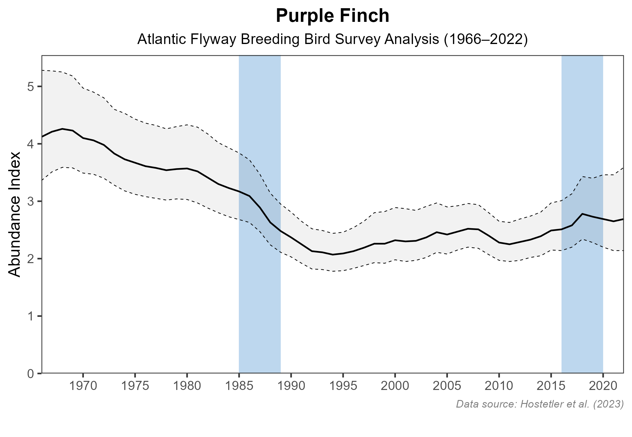
Figure 4: Purple Finch population trend for the Atlantic Flyway as estimated by the North American Breeding Bird Survey. The vertical axis shows species abundance; the horizontal axis shows the year. The solid line indicates the estimated population trend; there is a 97.5% probability that the true population trend falls between the dashed lines. The shaded bars indicate the First and Second Atlas periods.
Conservation
Although Purple Finches are not common or widespread breeders in Virginia, they are not considered a species of conservation concern. However, they have declined in the Atlantic Flyway region. Although the specific reason for the decline is unknown, negative interactions with House Finches during the breeding season may be a factor (Wooton 1987).
Interactive Map
The interactive map contains up to six Atlas layers (probability of occurrence for the First and Second Atlases, change in probability of occurrence between Atlases, breeding evidence for the First and Second Atlases, and abundance for the Second Atlas) that can be viewed one at a time. To view an Atlas map layer, mouse over the layer box in the upper left. County lines and physiographic regional boundaries (Mountains and Valleys, Piedmont, and Coastal Plain) can be turned on and off by checking or unchecking the box below the layer box. Within the map window, users can hover on a block to see its value for each layer and pan and zoom to see roads, towns, and other features of interest that are visible beneath a selected layer.
View Interactive Map in Full Screen
References
Hostetler, J. A., J. R. Sauer, J. E. Hines, D. Ziolkowski, and M. Lutmerding (2023). The North American breeding bird survey, analysis results 1966–2022. U.S. Geological Survey, Laurel, MD, USA. https://doi.org/10.5066/P9SC7T11.
Wootton, J. T. (1987). Interspecific competition between introduced House Finch populations and two associated passerine species. Oecologia 71:325–331. https://doi.org/10.1007/BF00378703.
Wootton, J. T. (2020). Purple Finch (Haemorhous purpureus), version 1.0. In Birds of the World (A. F. Poole and F. B. Gill, Editors). Cornell Lab of Ornithology, Ithaca, NY, USA. https://doi.org/10.2173/bow.purfin.01.