Introduction
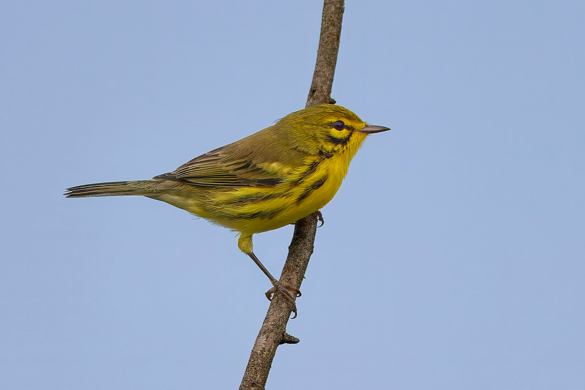
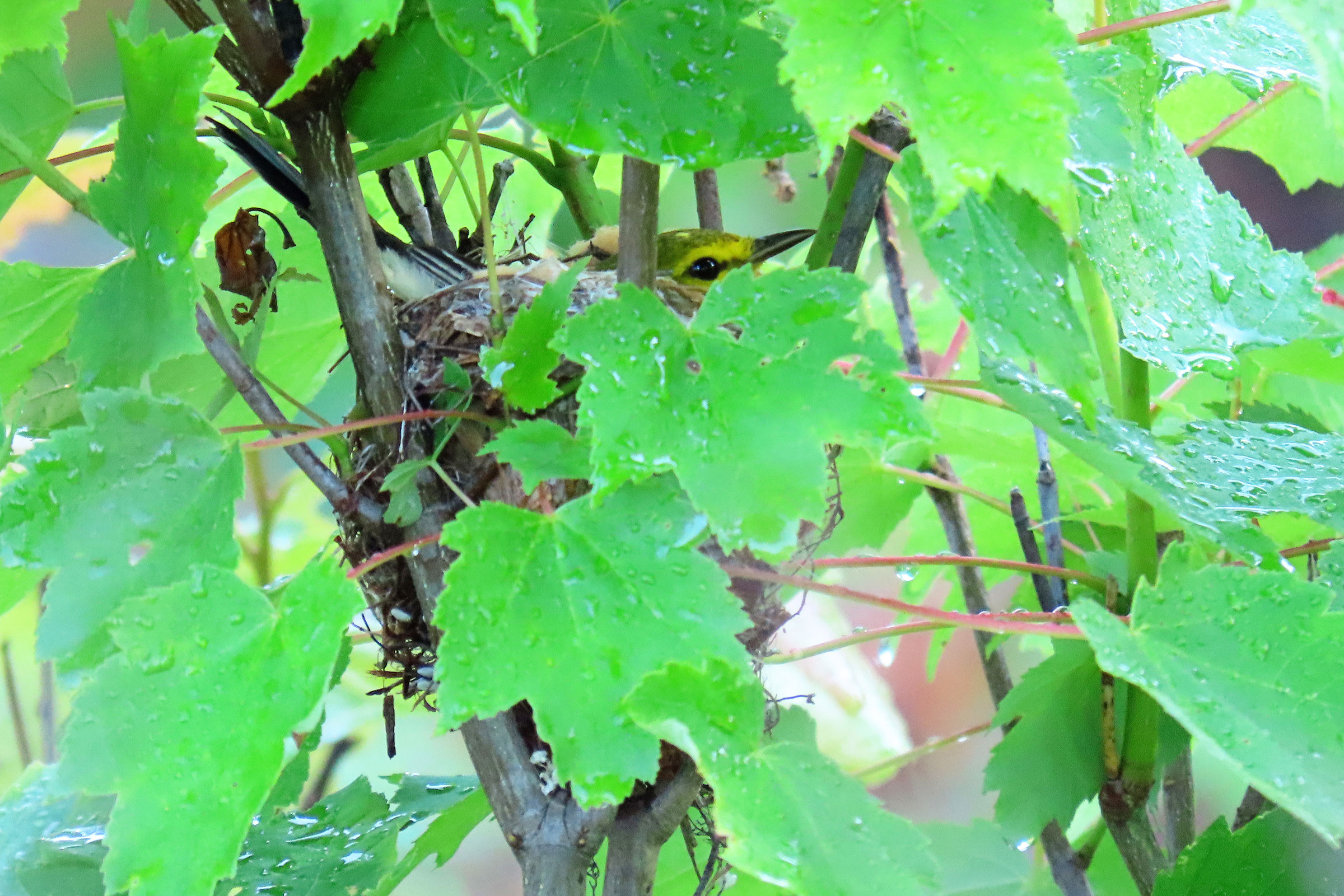
Do not let the name fool you. The Prairie Warbler is as much a bird of shrublands and young forest as it is of open grasslands. Building their nests three to six feet (one to two meters) high in tangled woody vegetation, Prairie Warblers use a variety of scrubby habitats, including pine barrens, scrub oak, abandoned agricultural fields, and regenerating forests. Prior to European settlement, Prairie Warblers used beaver meadows and forests that were recovering from fire or storms. Their populations likely increased in response to widespread timber harvesting during the last half of the 1800s and early 1900s, but they have declined in recent decades (Nolan et al. 2020).
Breeding Distribution
Prairie Warblers occur in all regions of the state, although they are most likely to occur in the central and southern Piedmont region and throughout the Coastal Plain region (Figure 1). They are less likely to inhabit areas in the Mountains and Valleys region, but within that region, they are most likely to occur in the southwestern corner (Figure 1). Their distribution is strongly associated with the proportion of shrubland/grassland habitat and number of habitat types in a block. However, as the proportion of agricultural areas, developed areas, and forest cover increases in a block their likelihood of occurring decreases.
Between the First and Second Atlases (Figures 1 and 2), the Prairie Warbler’s likelihood of occurrence decreased throughout the Mountains and Valleys region and near urban areas, such as Hampton Roads, Northern Virginia, and Richmond. It remained mostly constant in the more rural areas of the Piedmont region (Figure 3). The decreases in probable occurrence near urban areas were presumably driven by habitat loss, and those in the more forested sections of the Mountains and Valleys region were likely caused by reforestation and succession, which render forest habitats unsuitable for Prairie Warblers.
View Environmental Associations
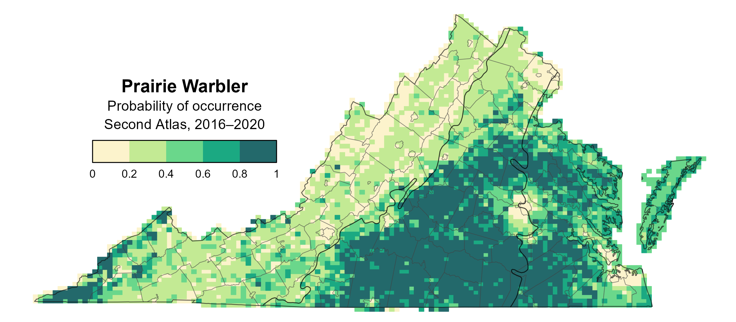
Figure 1: Prairie Warbler breeding distribution based on probability of occurrence (Second Atlas, 2016–2020). This map indicates the probability that this species will occur in an Atlas block (an approximately 10 mi2 [26 km2] survey unit) based on environmental (including habitat) factors and after adjusting for the probability of detection (variation in survey effort among blocks).
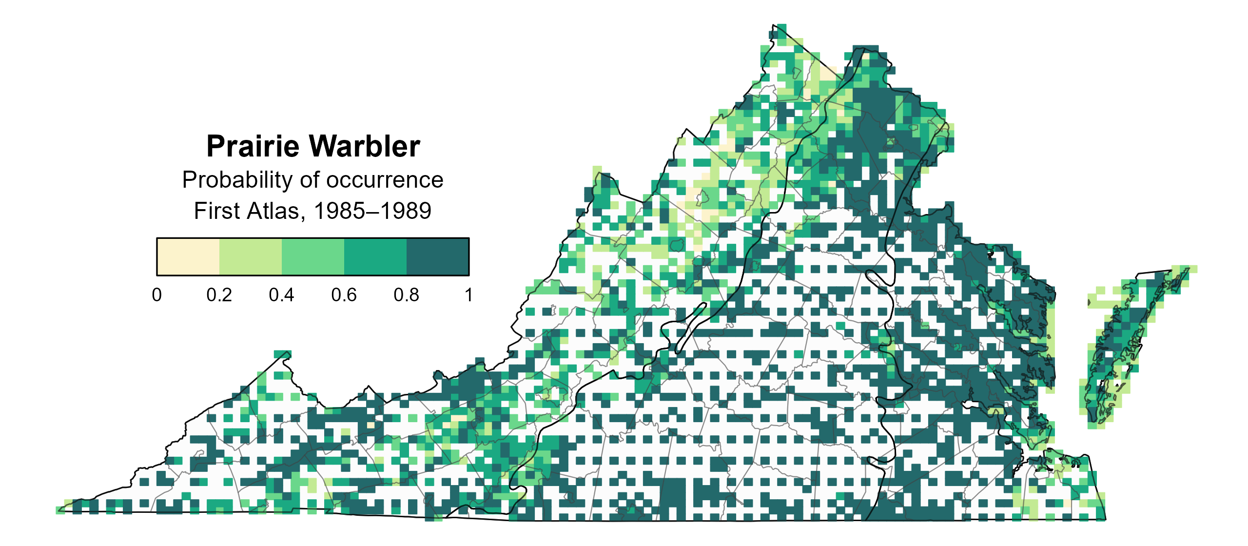
Figure 2: Prairie Warbler breeding distribution based on probability of occurrence (First Atlas, 1985–1989). This map indicates the probability that this species will occur in an Atlas block (an approximately 10 mi2 [26 km2] survey unit) based on environmental (including habitat) factors and after adjusting for the probability of detection (variation in survey effort among blocks). Blocks in white were not surveyed during the First Atlas and were not modeled.
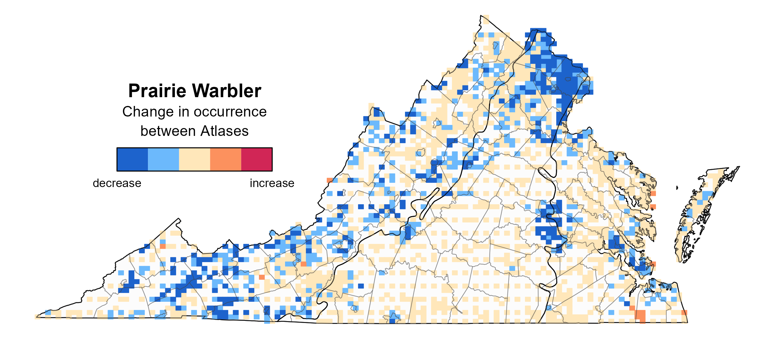
Figure 3: Prairie Warbler change in breeding distribution between Atlases (1985–1989 and 2016–2020) based on probability of occurrence. This map indicates the change in the probability that this species will occur in a block (an approximately 10 mi2 [26 km2] survey unit) between Atlas periods. Blocks with no change may have constant presence or constant absence. Blocks in white were not surveyed during the First Atlas and were not modeled.
Breeding Evidence
Prairie Warblers were confirmed breeders in 126 blocks and 52 counties and found to be probable breeders in an additional 36 counties (Figure 4). Breeding observations were evenly distributed over the Piedmont and Coastal Plain regions but were sporadic and much lower in the Mountains and Valleys region. Breeding observations were recorded in a similar pattern during the First Atlas as well (Figure 5).
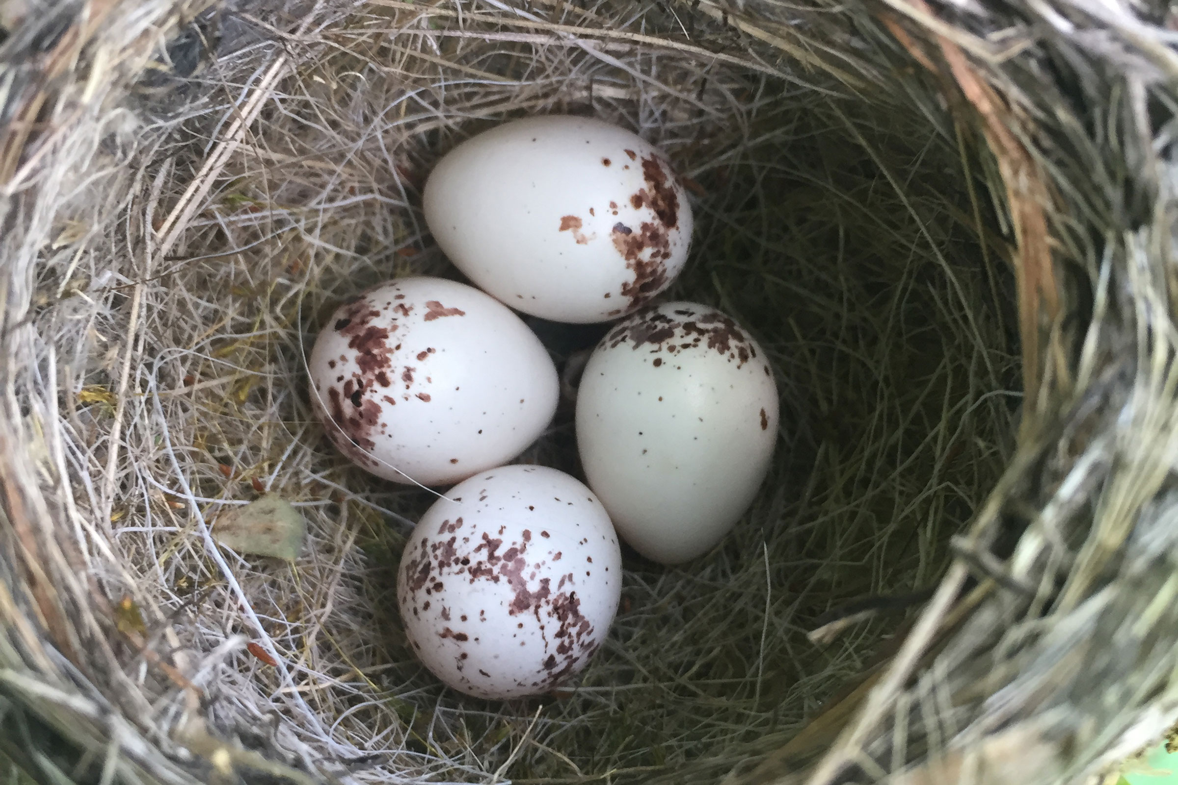
The earliest confirmed breeding behavior was recorded in early April when a nest with eggs was observed. However, most breeding behaviors were recorded from early May to early August. Breeding confirmations were mainly recorded based on observations of adults carrying food (May 16 – July 12), recently fledged young (May 29 – August 1), and adults feeding young (June 2 – July 19) (Figure 6).
For more general information on the breeding habits of this species, please refer to All About Birds.
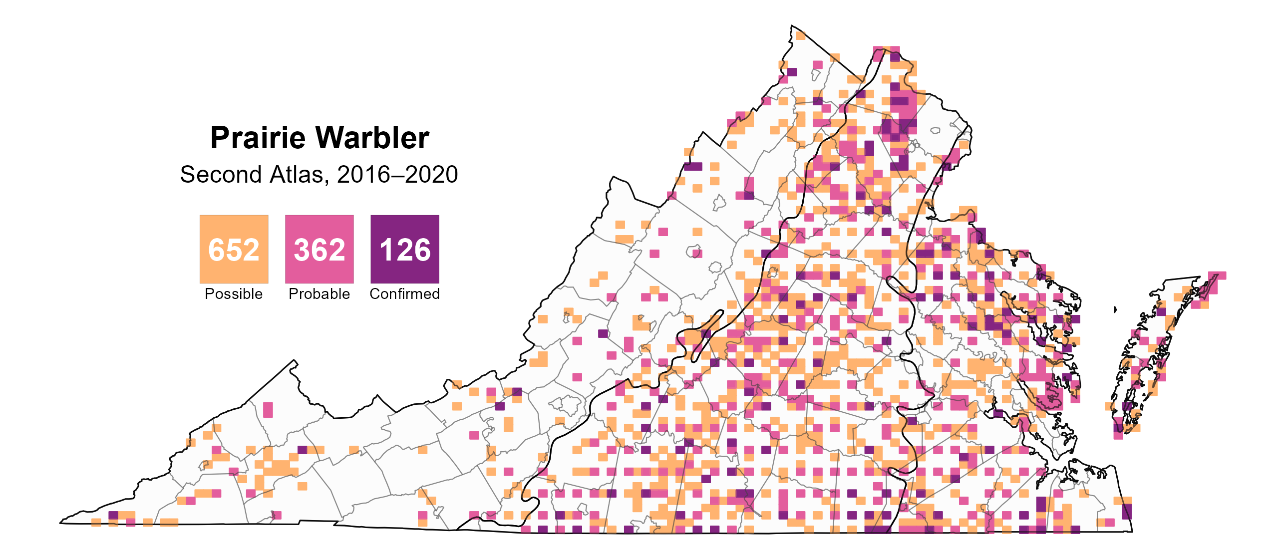
Figure 4: Prairie Warbler breeding observations from the Second Atlas (2016–2020). The colored boxes illustrate Atlas blocks (approximately 10 mi2 [26 km2] survey units) where the species was detected. The colors show the highest breeding category recorded in a block. The numbers within the colors in the legend correspond to the number of blocks with that breeding evidence category.
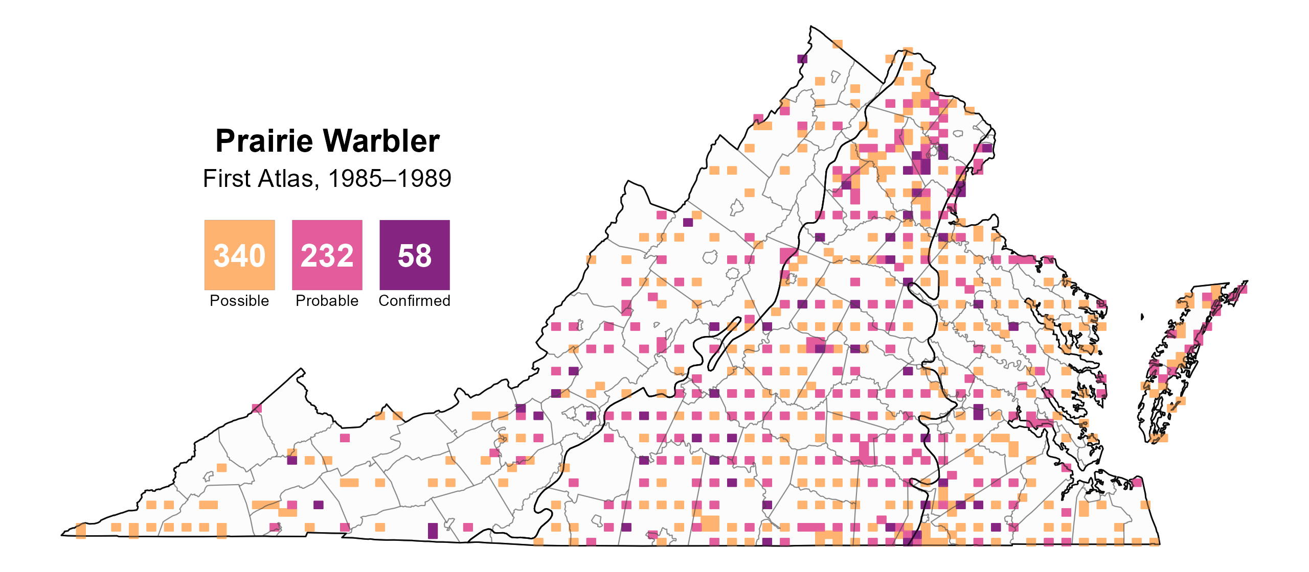
Figure 5: Prairie Warbler breeding observations from the First Atlas (1985–1989). The colored boxes illustrate Atlas blocks (approximately 10 mi2 [26 km2] survey units) where the species was detected. The colors show the highest breeding category recorded in a block. The numbers within the colors in the legend correspond to the number of blocks with that breeding evidence category.
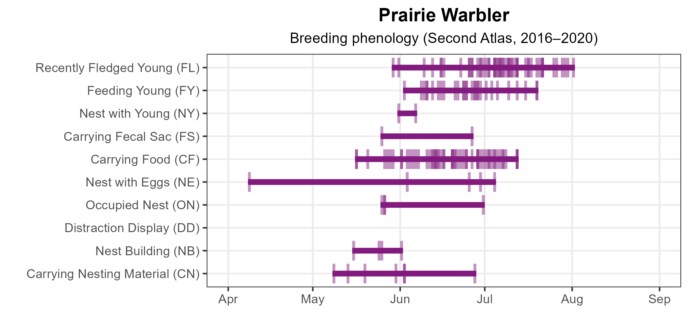
Figure 6: Prairie Warbler phenology: confirmed breeding codes. This graph shows a timeline of confirmed breeding behaviors. Tick marks represent individual observations of the behavior.
Population Status
Prairie Warbler relative abundance was estimated to be highest in the Piedmont and Coastal Plain regions (Figure 7). It was estimated to be lowest in and around urban areas and throughout the Mountains and Valleys region.
The total estimated Prairie Warbler population in the state is approximately 214,000 individuals (with a range between 158,000 and 297,000). Based on the North American Breeding Bird Survey (BBS), the Prairie Warbler population decreased by a significant 1.76% annually from 1966–2022 in Virginia, and between Atlases, its population decreased by a similar significant rate of 1.7% per year from 1987–2018 (Hostetler et al. 2023; Figure 8).
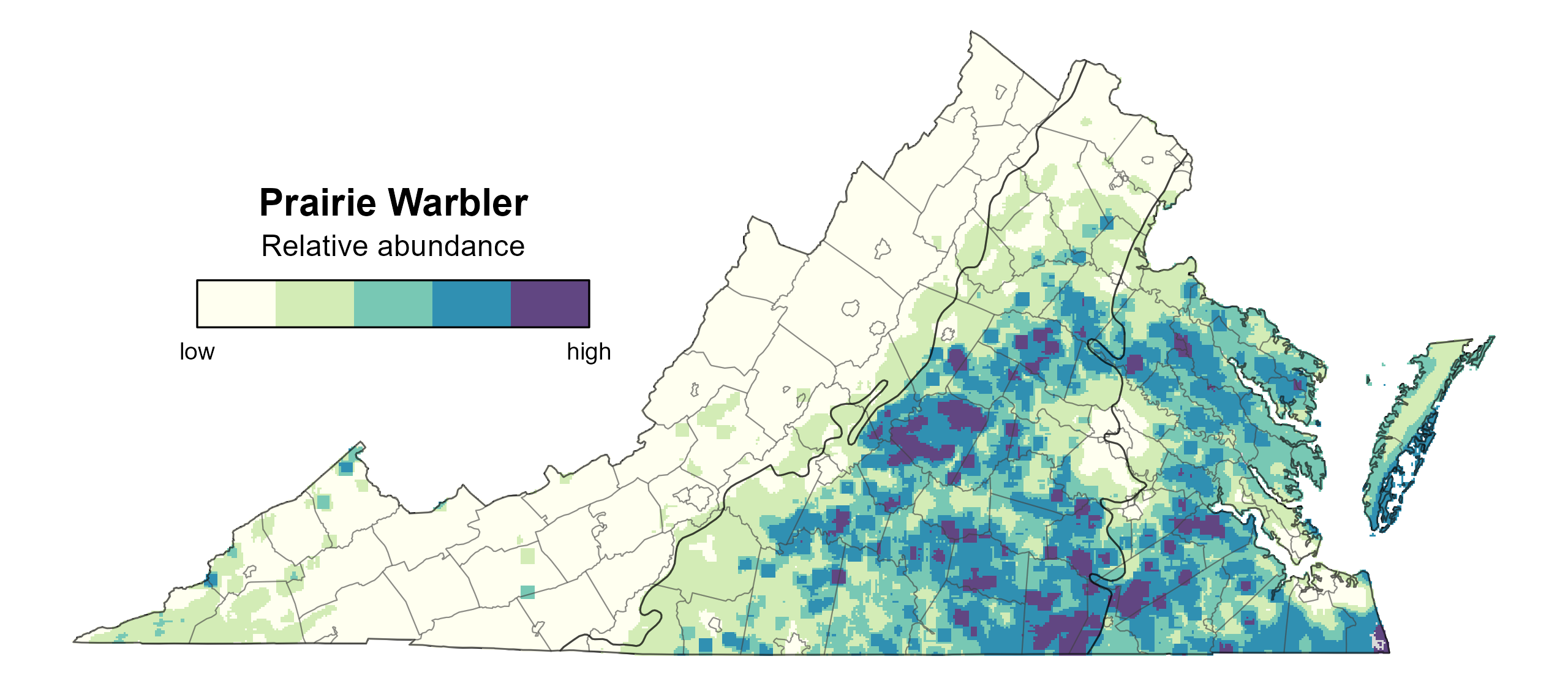
Figure 7: Prairie Warbler relative abundance (Second Atlas, 2016–2020). This map indicates the predicted abundance of this species at a 0.4 mi2 (1 km2) scale based on environmental (including habitat) factors. Abundance values are presented on a relative scale of low to high.
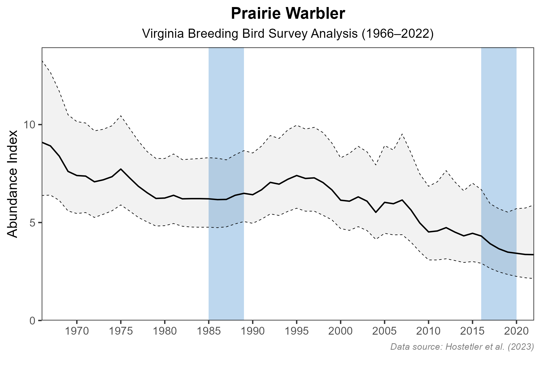
Figure 8: Prairie Warbler population trend for Virginia as estimated by the North American Breeding Bird Survey. The vertical axis shows species abundance; the horizontal axis shows the year. The solid line indicates the estimated population trend; there is a 97.5% probability that the true population trend falls between the dashed lines. The shaded bars indicate the First and Second Atlas periods.
Conservation
Prairie Warblers are declining throughout much of their range. Loss of breeding habitat is believed to be a primary contributor to the declining population. This habitat loss includes overall deforestation, owing to human development and agriculture, and a loss of early successional and young forest conditions on which nesting Prairie Warblers depend (Nolan et al. 2020). The 2025 Virginia Wildlife Action Plan includes the Prairie Warbler as a Tier IV Species of Greatest Conservation Need (Moderate Conservation Need), indicating that it has a declining population trend (VDWR 2025). While there are no specific conservation projects dedicated to only the Prairie Warbler in Virginia, conservation actions on behalf of other young forest and early successional species, such as the Golden-winged Warbler (Vermivora chrysoptera), often benefit Prairie Warblers (Roth et al. 2019).
Interactive Map
The interactive map contains up to six Atlas layers (probability of occurrence for the First and Second Atlases, change in probability of occurrence between Atlases, breeding evidence for the First and Second Atlases, and abundance for the Second Atlas) that can be viewed one at a time. To view an Atlas map layer, mouse over the layer box in the upper left. County lines and physiographic regional boundaries (Mountains and Valleys, Piedmont, and Coastal Plain) can be turned on and off by checking or unchecking the box below the layer box. Within the map window, users can hover on a block to see its value for each layer and pan and zoom to see roads, towns, and other features of interest that are visible beneath a selected layer.
View Interactive Map in Full Screen
References
Hostetler, J. A., J. R. Sauer, J. E. Hines, D. Ziolkowski, and M. Lutmerding (2023). The North American breeding bird survey, analysis results 1966–2022. U.S. Geological Survey, Laurel, MD, USA. https://doi.org/10.5066/P9SC7T11.
Nolan Jr, V., E. D. Ketterson, and C. A. Buerkle (2020). Prairie Warbler (Setophaga discolor), version 1.0. In Birds of the World (A. F. Poole, Editor). Cornell Lab of Ornithology, Ithaca, NY, USA. https://doi.org/10.2173/bow.prawar.01.
Roth, A.M., R.W. Rohrbaugh, T. Will, S. Barker Swarthout, and D.A. Buehler (Editors) (2019). Golden-winged Warbler status review and conservation plan, 2nd edition. www.gwwa.org.
Virginia Department of Wildlife Resources (VDWR) (2025). Virginia wildlife action plan. Virginia Department of Wildlife Resources, Henrico, VA, USA. 506 pp.