Introduction
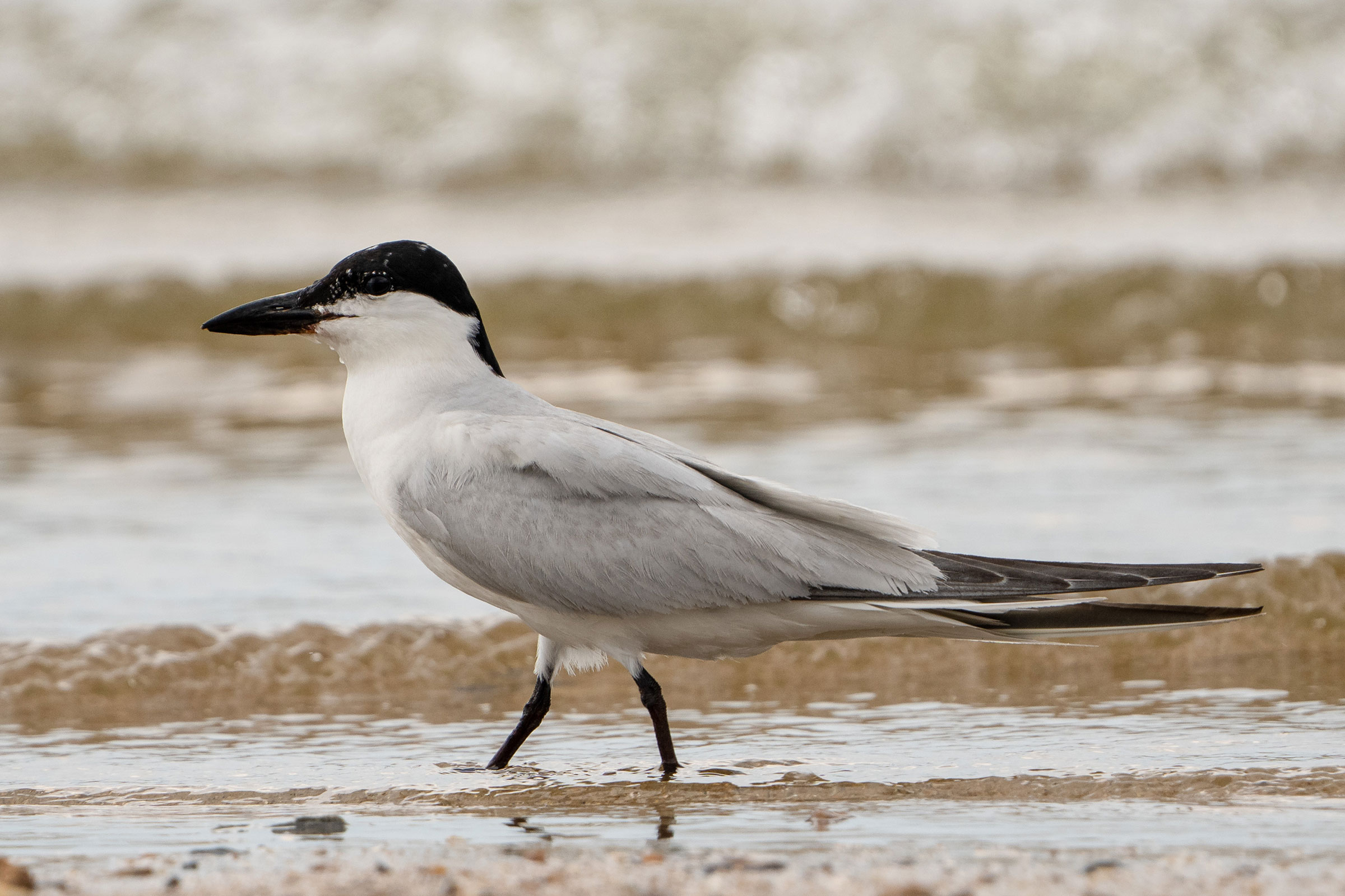
The Gull-billed Tern is a unique tern with a hefty beak, which gives it its name and is used to consume a much more varied diet than most terns. They nest in small-to-medium sized colonies on exposed shell or sand beaches. Much like the Least Tern (Sternula antillarum), the Gull-billed Tern was driven to near-extirpation in Virginia by the early 1900s from hunting pressure from the millinery industry (Bailey 1913). A slow recovery has given way to a decline since the 1970s (Wilson and Watts 2012).
Breeding Distribution
The Gull-billed Tern was well-covered during the Second Atlas by the 2018 Virginia Colonial Waterbird Survey, a coastal census conducted by the Center for Conservation Biology in collaboration with the Virginia Department of Wildlife Resources (VDWR) and The Nature Conservancy. The survey identifies nesting locations of this and other species that breed in colonies. Because the Gull-billed Tern only breeds within the survey area, there was no need to model its distribution. For information on where the species occurs in Virginia’s Coastal Plain, please see the Breeding Evidence section.
Breeding Evidence
Given the breeding biology of the species, the Gull-billed Tern is unlikely to have nested in blocks without confirmed breeding evidence (see Interpreting Species Accounts). Confirmation of breeding was based on records generated by the Virginia Colonial Waterbird Survey in 2018. Additional breeding confirmations were reported by Atlas volunteers in other years of the Second Atlas period.
Gull-billed Terns were confirmed breeders in 15 blocks (Figure 1). Most confirmations were along the Atlantic Coast of the Eastern Shore, particularly on the barrier islands in Accomack and Northampton Counties. Colonies containing Gull-billed Terns were also located on the Hampton Roads Bridge-Tunnel (HRBT) in Hampton and at Craney Island Disposal Area in Portsmouth. Confirmations were recorded from generally the same areas as those during the First Atlas, although the Craney and Hampton populations were not reported at that time (Figure 2).
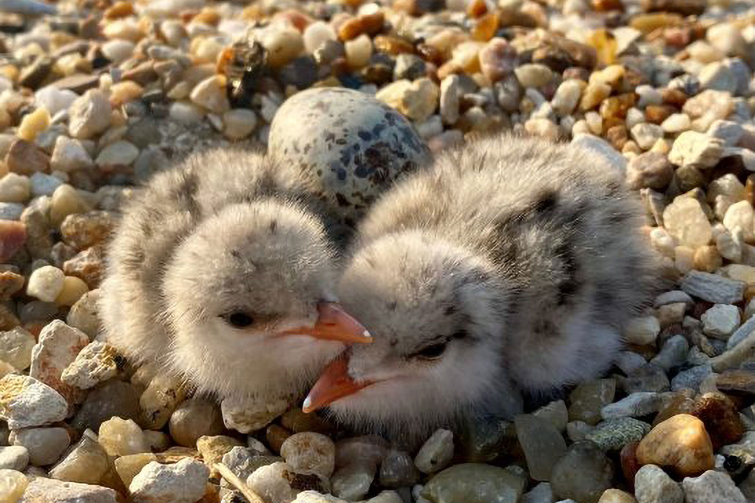
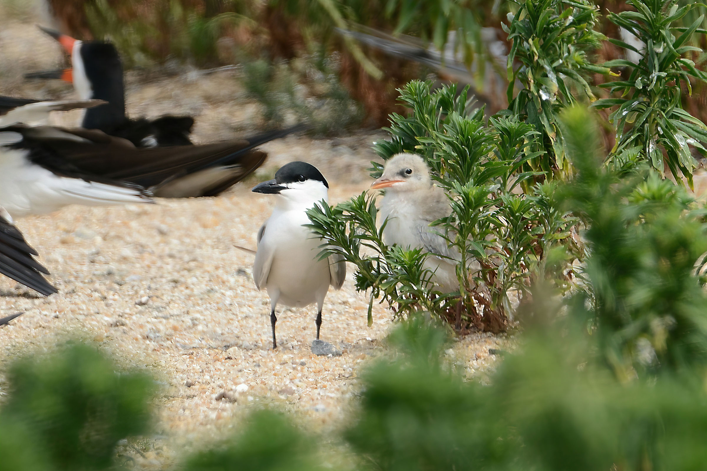
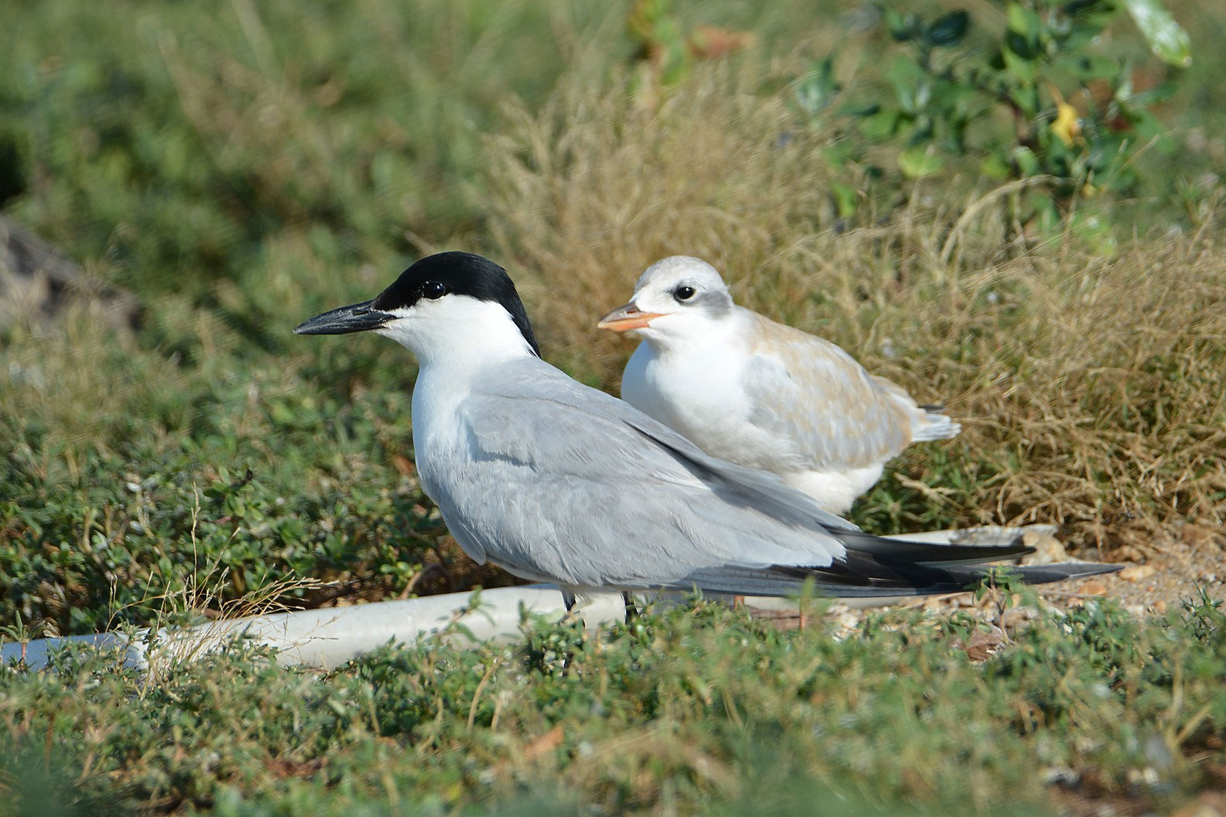
There were few observations of this rare species’ breeding behaviors. Birds were constructing their nest scrapes on May 8 and had eggs starting May 24 (Figure 3). Young were observed from June 12, with fledglings observed through August 15. For more general information on the breeding habits of the Gull-billed Tern, please refer to All About Birds.
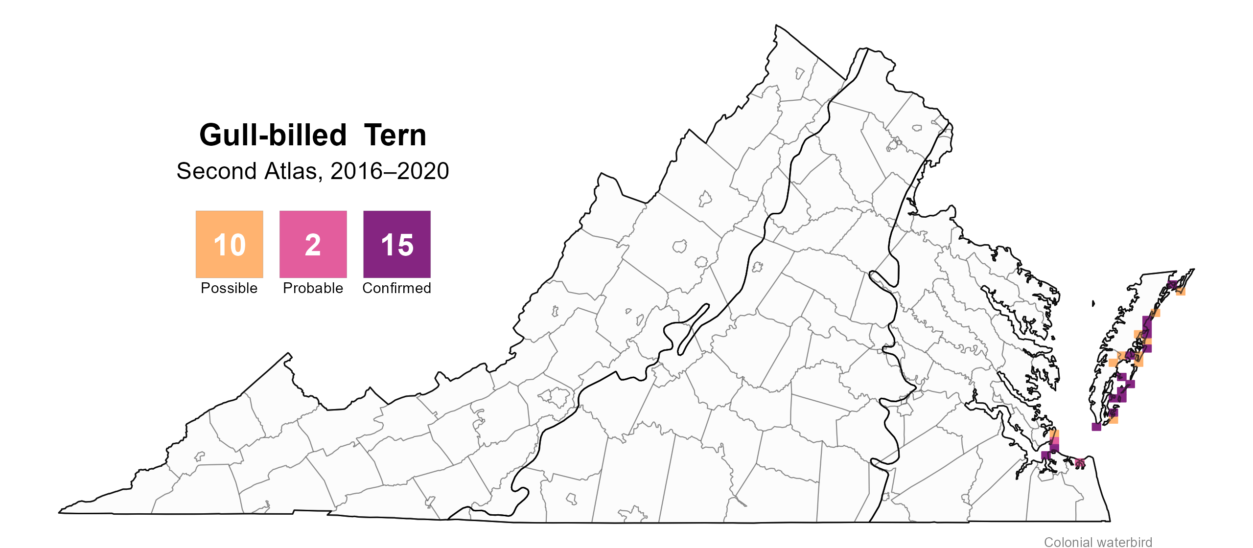
Figure 1: Gull-billed Tern breeding observations from the Second Atlas (2016–2020). The colored boxes illustrate Atlas blocks (approximately 10 mi2 [26 km2] survey units) where the species was detected. The colors show the highest breeding category recorded in a block. The numbers within the colors in the legend correspond to the number of blocks with that breeding evidence category. Nesting is unlikely outside of confirmed blocks.
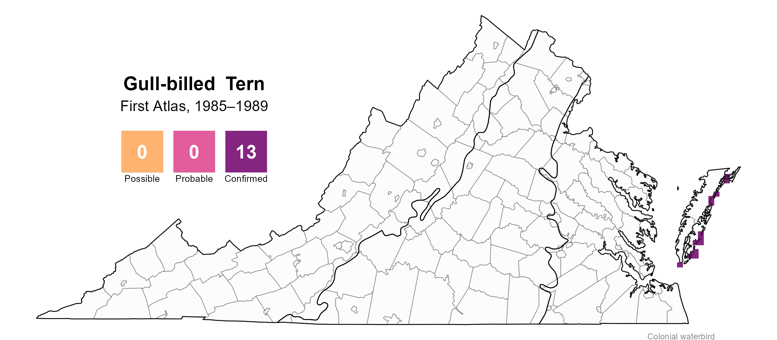
Figure 2: Gull-billed Tern breeding observations from the First Atlas (1985–1989). The colored boxes illustrate Atlas blocks (approximately 10 mi2 [26 km2] survey units) where the species was detected. The colors show the highest breeding category recorded in a block. The numbers within the colors in the legend correspond to the number of blocks with that breeding evidence category.

Figure 3: Gull-billed Tern phenology: confirmed breeding codes. This graph shows a timeline of confirmed breeding behaviors. Tick marks represent individual observations of the behavior.
Population Status
Because the Gull-billed Tern was not detected during Atlas point count surveys, an abundance model could not be developed. However, the distribution and size of Gull-billed Tern colonies derived from the 2018 Virginia Colonial Waterbird Survey are displayed on the CCB Mapping Portal.
The Virginia Colonial Waterbird Surveys recorded a decline in the number of breeding pairs from 606 in 1993 to 325 in 2023, representing a 46% decrease (Watts et al. 2019, 2024; Figure 4). However, these populations have increased from a low in 2013 thanks to strong colonies on Smith Island and Cedar Sandbar, and as of 2023, 94% of the breeding population nested on the seaside region of Cedar and Cobb Islands (Watts et al. 2019, 2024).
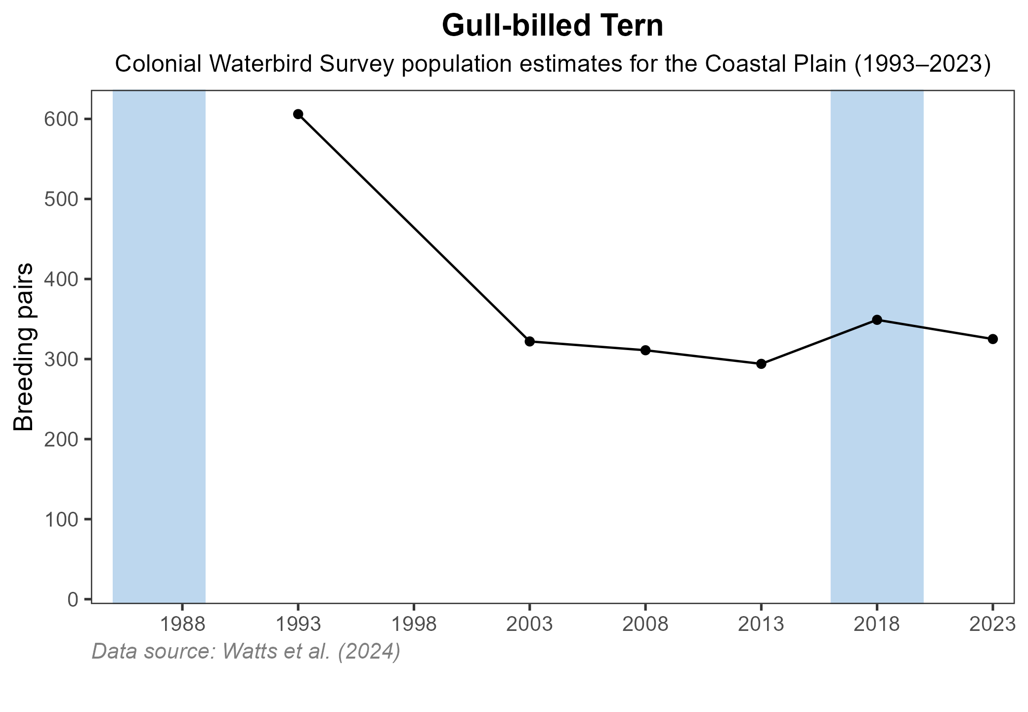
Figure 4: Gull-billed Tern population trend for Virginia’s Coastal Plain. This chart illustrates the number of breeding pairs as estimated by the Virginia Colonial Waterbird Survey (Watts et al. 2024). A data point is not included for 1998, as the Survey covered a smaller geographic area in that year. The vertical light blue bars represent the periods corresponding to the First Atlas (1985–1989) and Second Atlas (2016–2020).
Conservation
The Gull-billed Tern is classified as a Species of Greatest Conservation Need Tier I (Critical Conservation Need) in Virginia’s 2025 Wildlife Action Plan and is listed as a threatened at the state level, indicating it is at very high risk within the state (VDWR 2025). As a colonial-nesting species, its populations are vulnerable to disturbance and loss of nesting sites. Shore habitat can be lost to rising sea levels or human activity. Predation also is a major threat to this and other ground-nesting species (Hunt et al. 2019).
One seabird colony containing Gull-billed Terns was recently displaced when the Virginia Department of Transportation began a project to expand the HRBT. In 2020, the South Island HRBT expansion project paved over the former nesting site. The VDWR and partners were able to provide alternative habitat on the historic Fort Wool (also known as Rip Raps Island) and floating barges, which now provide replacement habitat for multiple nesting seabird species, including Gull-billed Tern (Sweeney et al. 2024). As with many other beach-nesting species, Gull-billed Terns can be protected by restricting disturbance and promoting public awareness around their nesting sites.
Interactive Map
The interactive map contains up to six Atlas layers (probability of occurrence for the First and Second Atlases, change in probability of occurrence between Atlases, breeding evidence for the First and Second Atlases, and abundance for the Second Atlas) that can be viewed one at a time. To view an Atlas map layer, mouse over the layer box in the upper left. County lines and physiographic regional boundaries (Mountains and Valleys, Piedmont, and Coastal Plain) can be turned on and off by checking or unchecking the box below the layer box. Within the map window, users can hover on a block to see its value for each layer and pan and zoom to see roads, towns, and other features of interest that are visible beneath a selected layer.
View Interactive Map in Full Screen
References
Bailey, H. H. (1913). The Birds of Virginia. J.P. Bell Company, Inc. Lynchburg, VA, USA.
Hunt, K. L, Karpanty, S. M., Davis, K. L., Wilke, A., Myers, N., Spiegel, C., Schulte, S., Catlin, D. H., Fraser, J. D. (2019). Guidance and best practices for coordinated predation management to benefit temperate breeding shorebirds in the Atlantic Flyway. U.S. Fish and Wildlife Service and National Fish and Wildlife Foundation. https://atlanticflywayshorebirds.org/documents/Guidance_BMP_coordinated_predator_mngt_FINAL.pdf.
Sweeney, C., K. Hunt, J. Fraser, and S. Karpanty (2024). Assessing avian response to the relocation of Virginia’s largest seabird colony, 2024 annual report. Virginia Polytechnic Institute and State University, Blacksburg, VA, USA.
Virginia Department of Wildlife Resources (VDWR). 2025. Virginia wildlife action plan. Virginia Department of Wildlife Resources, Henrico, VA, USA. 506 pp.
Watts, B. D., B. J. Paxton, R. B., and A. L Wilke (2019). Status and distribution of colonial waterbirds in coastal Virginia: 2018 breeding season. CCBTR-19-06. College of William and Mary and Virginia Commonwealth University. Williamsburg, VA, USA.
Watts, B. D., B. J. Paxton, R. B., and A. L Wilke (2024). Status and distribution of colonial waterbirds in coastal Virginia: 2023 breeding season. CCBTR-24-12. College of William and Mary and Virginia Commonwealth University. Williamsburg, VA, USA.