Introduction
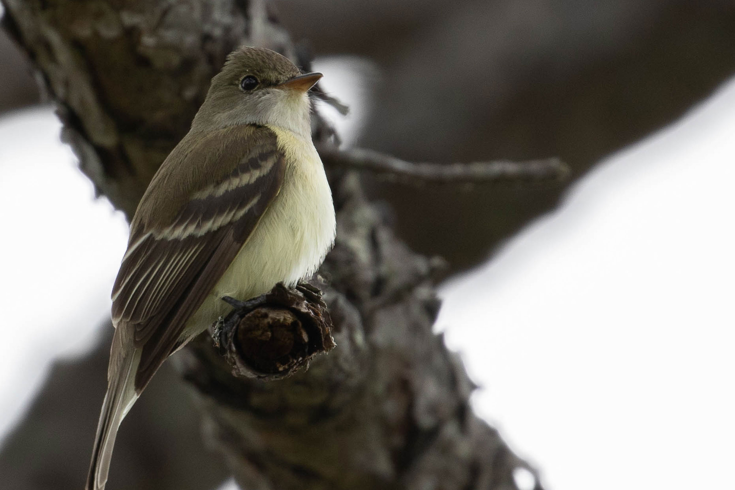
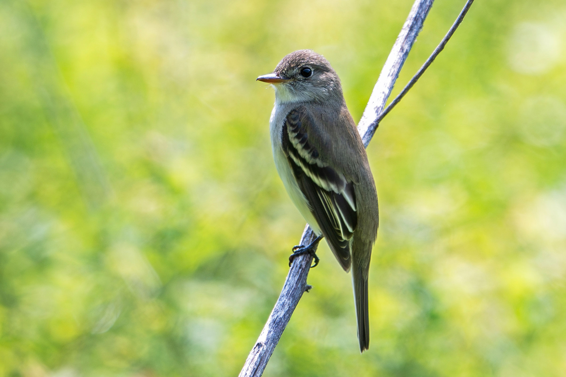
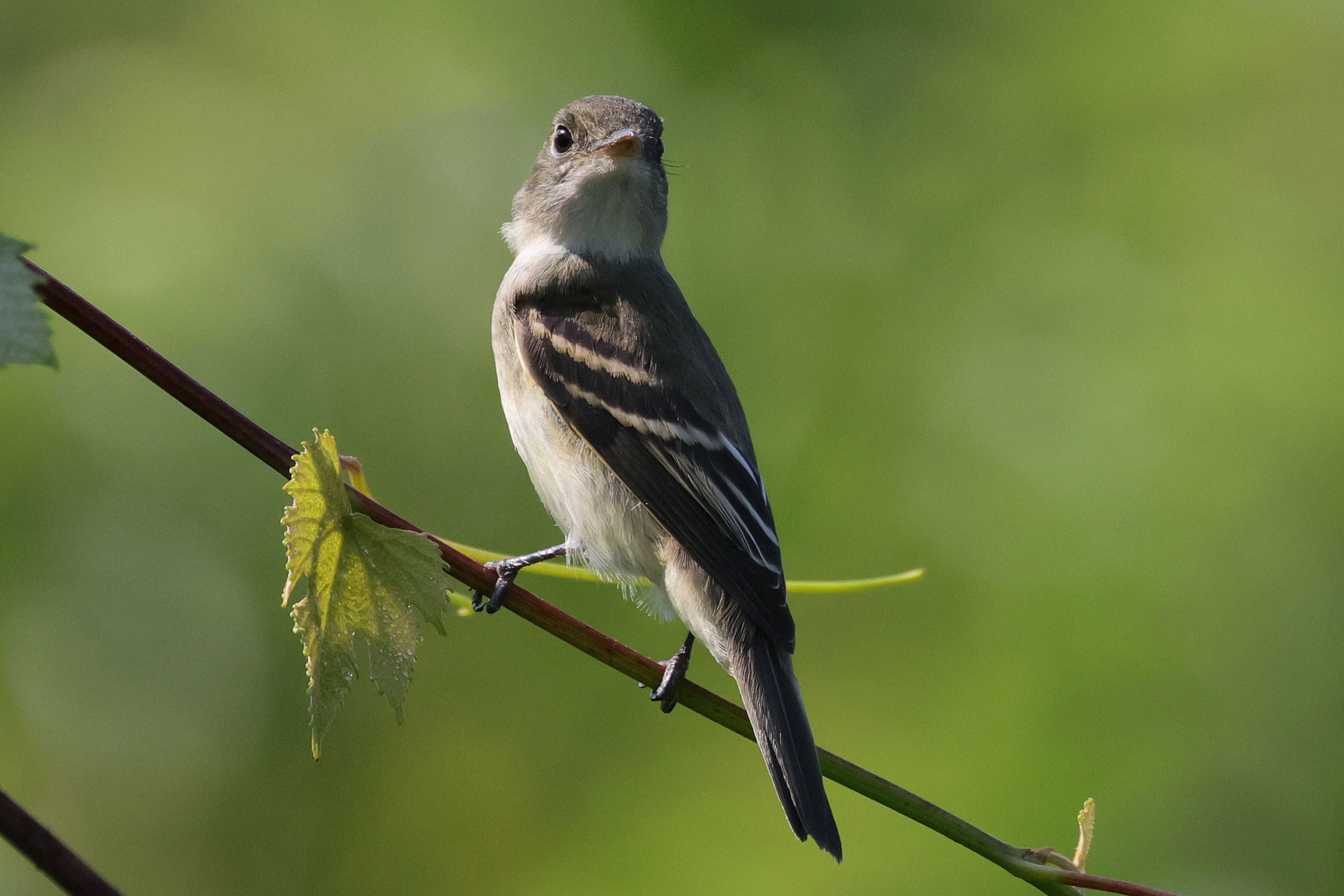
Alder Flycatchers (Empidonax alnorum) and Willow Flycatchers (E. traillii) can be very difficult, and in most cases impossible, to tell apart, even when side-by-side (Rottenborn and Brinkley 2007). The Alder Flycatcher does have a distinct song (fee-BEE-o) that can help distinguish it. However, much of what is known about the Alder Flycatcher is based on other flycatcher species (Lowther 2020). This species occurs in the Mountains and Valleys region of the state, breeding in boggy areas with nests placed low on branches in shrubs (Rottenborn and Brinkley 2007; Lowther 2020).
Breeding Distribution
During the Second Breeding Bird Atlas, there were too few breeding observations to develop occurrence models for the Alder Flycatcher. Please see the Breeding Evidence section for more information on its breeding distribution.
Breeding Evidence
In the Mountains and Valleys region, the Alder Flycatcher was identified as a probable breeder in Augusta, Highland, and Smyth Counties, and possible breeding records were obtained in Bath, Botetourt, and Grayson Counties (Figure 1). Notably, no confirmed breeding was documented during either Atlas period, which was likely due to the difficulty involved in accessing and thus confirming nests and other breeding behaviors (Figures 1 and 2).
For more general information on the breeding habits of this species, please refer to All About Birds.
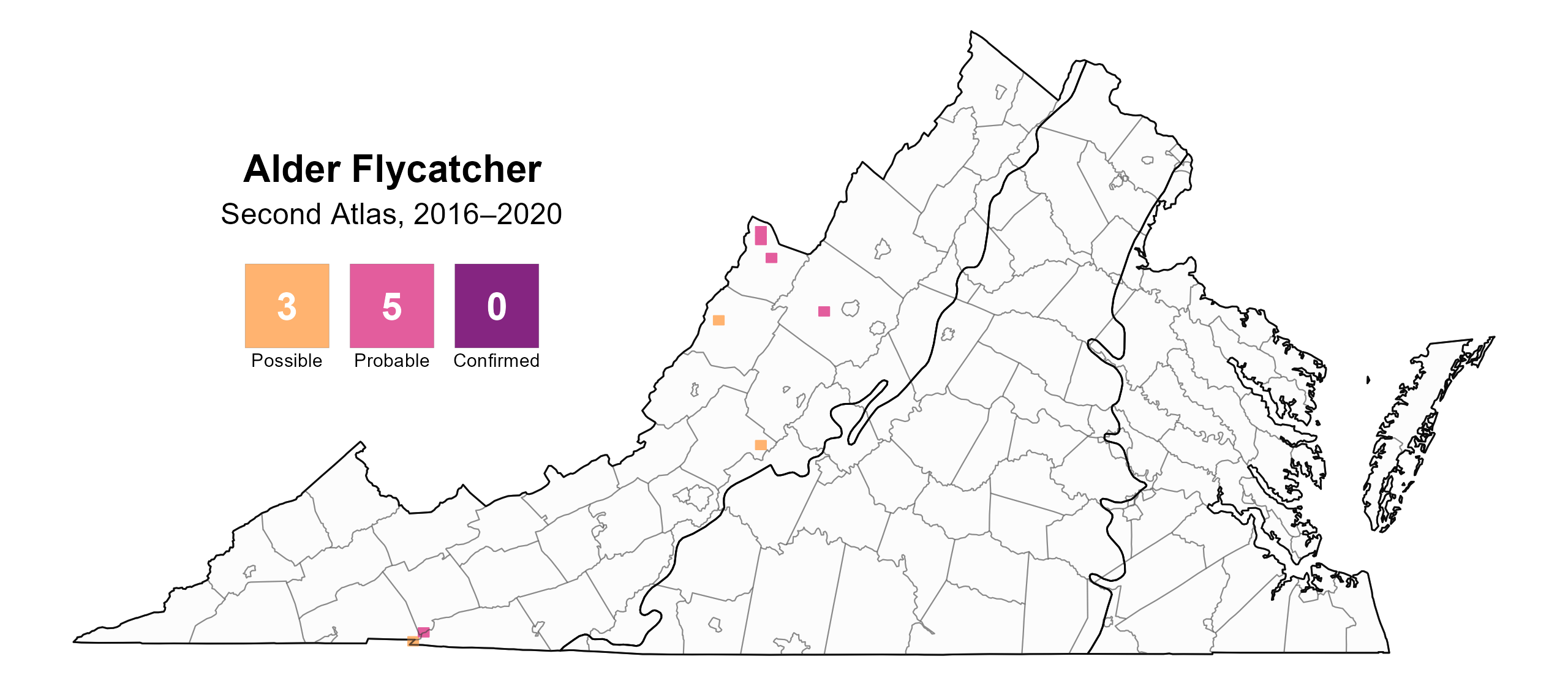
Figure 1: Alder Flycatcher breeding observations from the Second Atlas (2016–2020). The colored boxes illustrate Atlas blocks (approximately 10 mi2 [26 km2] survey units) where the species was detected. The colors show the highest level of breeding evidence observed. The numbers within the colors in the legend correspond to the number of blocks with that breeding evidence category.
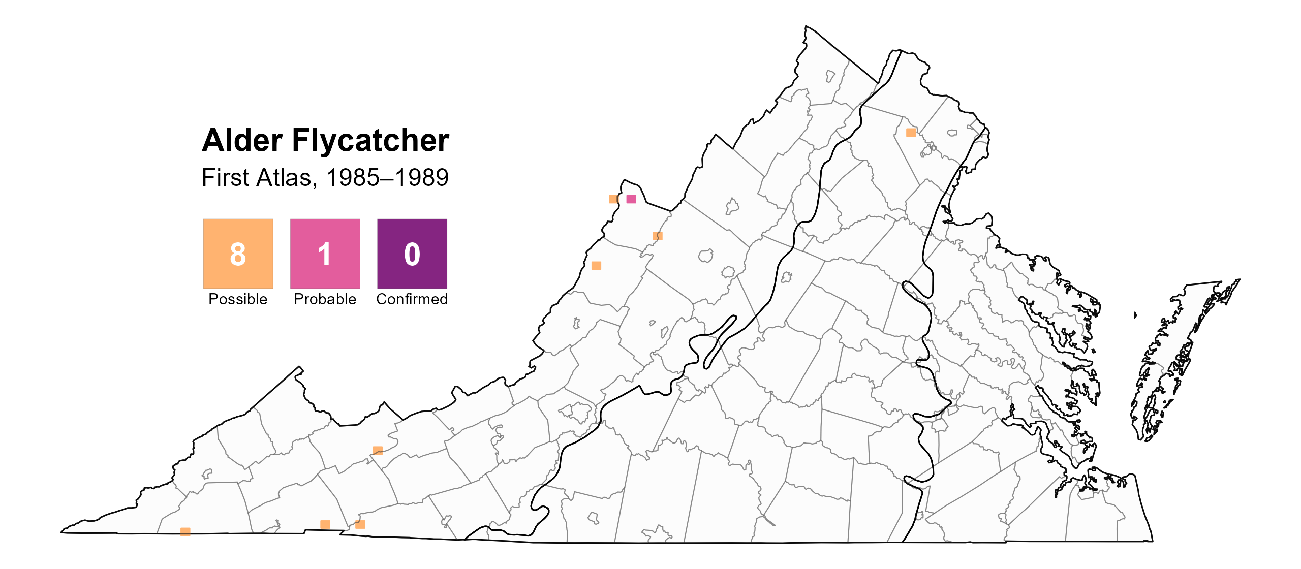
Figure 2: Alder Flycatcher breeding observations from the First Atlas (1985–1989). The colored boxes illustrate Atlas blocks (approximately 10 mi2 [26 km2] survey units) where the species was detected. The colors show the highest level of breeding evidence observed. The numbers within the colors in the legend correspond to the number of blocks with that breeding evidence category.
Population Status
A lack of detections in the point count data prevented the development of an abundance model for the Alder Flycatcher. The North American Breeding Bird Survey (BBS) combines population data for the Willow Flycatcher and Alder Flycatcher to determine their population trends at all scales. However, the BBS data for Virginia do not provide a credible trend at that scale. The population trend estimates for the Appalachian Mountains from 1966–2021 showed a significant increase of 0.53% annually, and between Atlases, for the Appalachian region, the data showed a significant decrease of 1.23% per year (Hostetler et al. 2023; Figure 7).
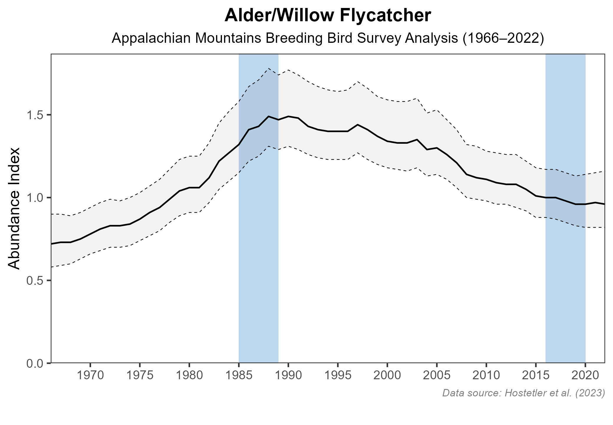
Figure 3: Alder Flycatcher population trend for the Appalachian Mountains as estimated by the North American Breeding Bird Survey. The vertical axis shows species abundance; the horizontal axis shows the year. The solid line indicates the estimated population trend; there is a 97.5% probability that the true population trendfalls between the dashed lines. The shaded bars indicate the First and Second Atlas periods.
Conservation
Regionally, Alder Flycatchers likely decreased between Atlas periods, and although they can be indicators of high-elevation wetland habitats and bogs, they are not a Species of Greatest Conservation Need. Additionally, no species-specific conservation projects are underway in Virginia. However, any efforts implemented to protect and enhance wetland habitats within its range will benefit this species.
Interactive Map
The interactive map contains up to six Atlas layers (probability of occurrence for the First and Second Atlases, change in probability of occurrence between Atlases, breeding evidence for the First and Second Atlases, and abundance for the Second Atlas) that can be viewed one at a time. To view an Atlas map layer, mouse over the layer box in the upper left. County lines and physiographic regional boundaries (Mountains and Valleys, Piedmont, and Coastal Plain) can be turned on and off by checking or unchecking the box below the layer box. Within the map window, users can hover on a block to see its value for each layer and pan and zoom to see roads, towns, and other features of interest that are visible beneath a selected layer.
View Interactive Map in Full Screen
References
Hostetler, J. A., J. R. Sauer, J. E. Hines, D. Ziolkowski, and M. Lutmerding (2023). The North American breeding bird survey, analysis results 1966–2022. U.S. Geological Survey, Laurel, MD, USA. https://doi.org/10.5066/P9SC7T11.
Lowther, P. E. (2020). Alder Flycatcher (Empidonax alnorum), version 1.0. In Birds of the World (A. F. Poole and F. B. Gill, Editors). Cornell Lab of Ornithology, Ithaca, NY, USA. https://doi.org/10.2173/bow.aldfly.01.
Rottenborn, S. C., and E. S. Brinkley (Editors) (2007). Virginia’s birdlife: An annotated checklist. 4th edition. Virginia Society of Ornithology.